Elevation: 7,724 ft
Prominence: 424
This peak is not in the book. Livingston Douglas provided a new route which is set out down the page. I added a new map showing the access and my route as well as a couple of photos. Updated July 2023
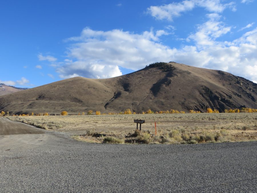
Peak 7724 is located southwest of Swensen Butte just off of Bartlett Point Road in the Big Lost River Valley. Peak 7724 is a relatively short climb with a rocky summit that provides great views of the valley, the Lost River Range and the White Knob Mountains. USGS Harry Canyon
Peak 7724 from Trail Creek Road. Photo – Steve Mandella.
Access
Travel southwest on Trail Creek Road from US-93 for 11.3 to The signed junction for Bartlett Point Road. Turn onto this good, maintained gravel road and follow it toward the mountains. The road soon crosses the Big Lost River and turns sharply to the left and climbs up onto the bench above the river. In a short distance look for an unsigned two track road (See map below). This road provides access to both the peak’s northeast and southeast ridges. A high-clearance 4WD vehicle may be necessary to drive from the northeast ridge to the southeast ridge, depending upon road conditions.
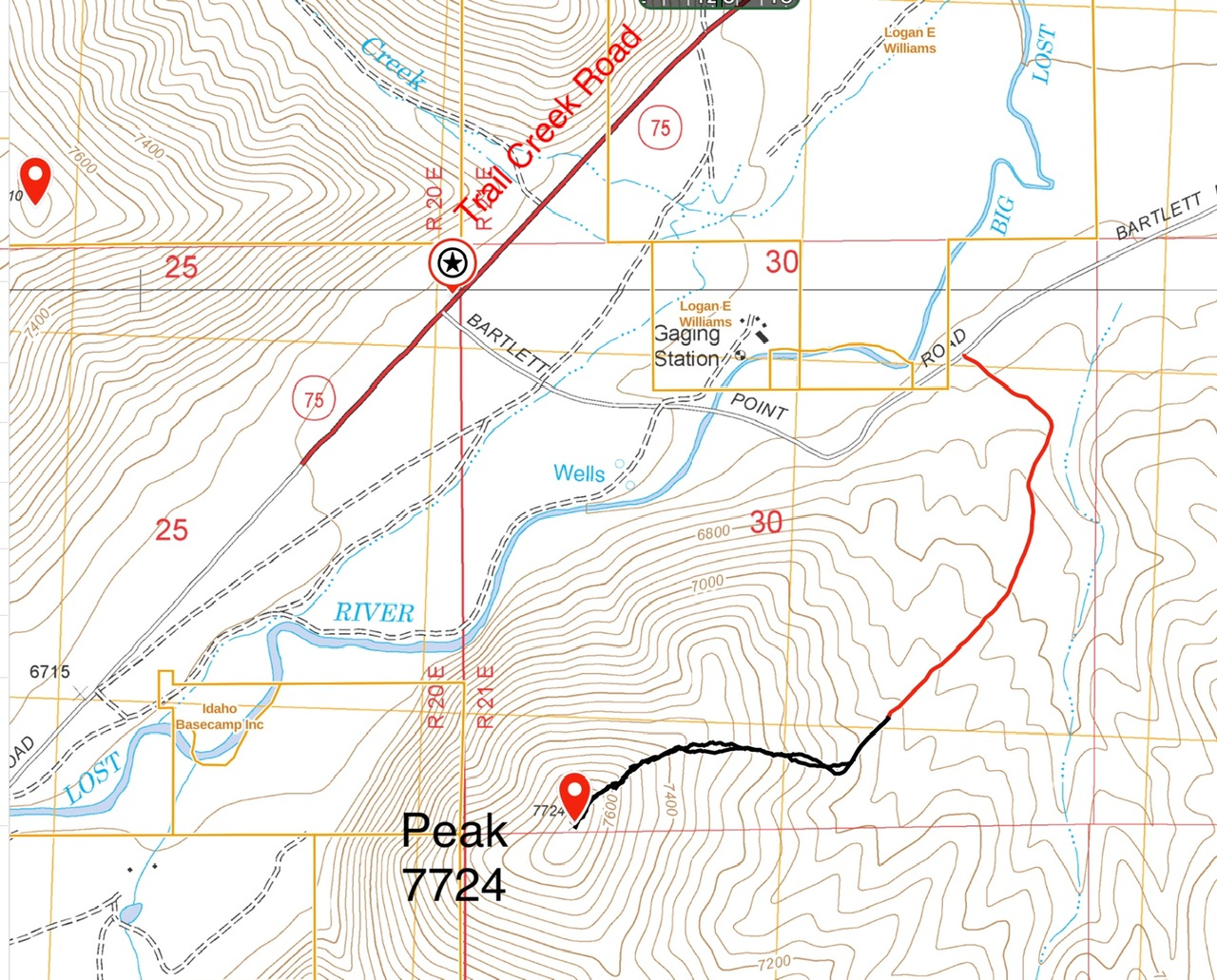
This map shows the 4WD access road (red) and my line of ascent. I drove the up the 4WD road for 0.8 miles to a broad parking spot. I then continued up the road a short distance before to the summit. My route was 1.3 miles round trip and gained 555 feet of elevation.
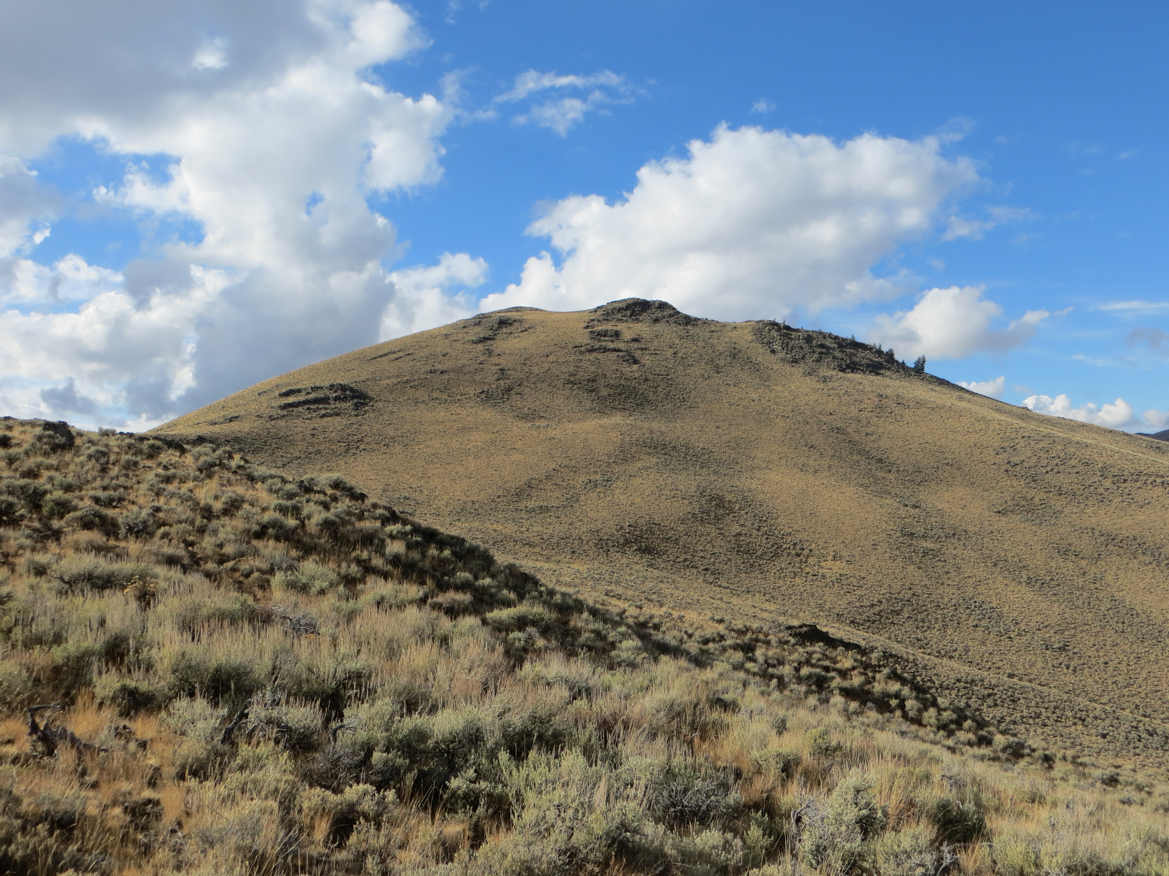
The summit of Peak 7724 as viewed from the southeast ridge. Steve Mandella Photo
Northeast Ridge/Southeast Ridge Loop, Class 2 by Margo Mandella
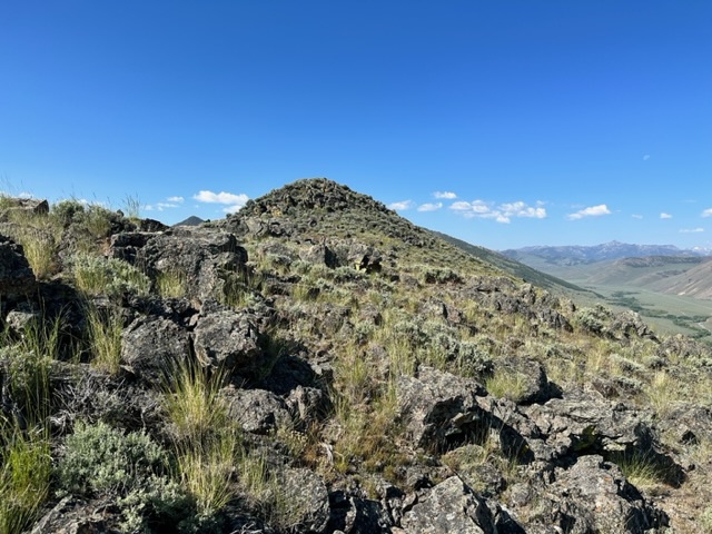
Both the northeast and southeast ridges are visible and straightforward from your parking location. You’ll find a very short steep section of climbing near the summit along the upper northeast ridge. In either direction, the small rocky summit is the only minimal scrambling on the route. The summit has a double cairn which undoubtedly has a local story behind it. Our trip stats: 1.6 miles with 739 feet of elevation gain round trip.

The twin summit cairns atop Peak 7724. Steve Mandella Photo.
Full Northeast Ridge, Class 2 by Livingston Douglas
Access
From US-93 north of Mackay, drive 11.3 miles west on Trail Creek Road to the [signed] left/south turn for Bartlett Road. Drive 0.8 miles on Bartlett Road and park alongside the road just after the road makes a sharp left/north turn. The elevation here is 6,670 feet. This is the toe of the northeast ridge.
The Climb
Leave Bartlett Road and climb steeply south up onto the northeast ridge. Follow the magnificent, open ridge to the summit. The terrain on the ridge is a mix of field grass and sagebrush. The summit hump is rocky and has two large cairns. The views down to Trail Creek Road and the Big Lost River are breathtaking.
The summit is the westernmost of three bumps.
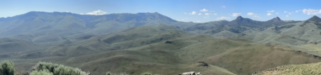
A panoramic show of the view south from the summit.
Additional Resources
Regions: EASTERN IDAHO->White Knob Mountains
Mountain Range: White Knob Mountains
Year Climbed: 2023
Longitude: -114.02679 Latitude: 43.98679