Elevation: 7,734 ft
Prominence: 564
This peak is not in the book. Published January 2023
Peak 7734 is the northernmost ranked summit in the Black Pine Mountains and is on the main Black Pine Ridge Crest that runs from north to south. It is most easily reached from Mill Fork Road on its east side. This is the first leg of a 2-peak journey that includes Peak 7734 and Bird Benchmark (7,580 feet). This adventure covers 9.0 miles with 3,375 feet of elevation gain round trip. USGS Sandrock Canyon
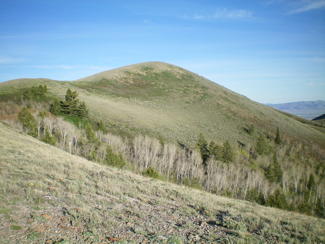
Peak 7734 as viewed from high on the east ridge. The summit hump is not yet in view. Livingston Douglas Photo
Access
From Exit 254 (Sweetzer Road) on I-84, drive south on [signed] Sweetzer Road for 1.3 miles to an unsigned 3-way junction. Go straight here onto a narrow 2-track road. This is Sweetzer Canyon Road/FSR-584. Reset your odometer here. At 2.2 miles, go right onto [unsigned] Mill Fork Road. At 2.6 miles, reach the [signed] Sawtooth National Forest boundary. At 3.6 miles, reach a “T” junction and the end of Mill Fork Road. Park here (6,010 feet).
East Ridge, Class 2
The Climb
From the junction, hike briefly northwest up a 2-track road that leads up to the crest of the east ridge and a nearby, rust-colored water tanker. This tanker sits on a knoll at the base of the east ridge of Peak 7734. It is a useful navigational tool on the descent of the weaving, up-and-down east ridge from the Black Pine ridge crest. Make a note of it. Leave the road and follow the ridge crest southwest up to Point 6980. There is a short section of thick, tall veg early on but there are old cattle/game trails to help navigate through this mess.
Once above this thick patch, the ridge terrain is easy, short scrub and it is just a steady grind along the weaving, undulating ridge southwest then west then southwest up to the main Black Pine ridge crest. You reach the ridge crest at a ridge corner (7,560+). A short ridge scramble west on an old 2-track road leads up to the gentle, cairned summit of Peak 7734. There is a small cairn on top. The summit offers a magnificent view of the highest Black Pine peaks to the south and of Bird Benchmark to the northwest.
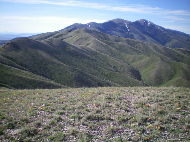
Peak 7734 (in mid-ground in distance) as viewed from the summit of Bird Benchmark. Notice the undulating connecting ridge (to the left) and the highest Black Pine Mountains in the far distance. Livingston Douglas Photo
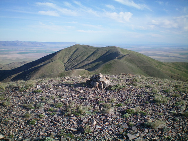
The summit of Peak 7734 with Bird Benchmark in the distance. Livingston Douglas Photo
Northwest Ridge, Class 2
The Descent
From the summit, descend northwest on steep 2-track jeep road of very loose scree to reach a minor saddle. Continue northwest over a minor ridge hump then drop northwest to the 7,300-foot connecting saddle with Bird Benchmark. The ridge terrain is easy, short scrub on a broken rock base. It goes quickly. This concludes the first leg of today’s 2-peak adventure. Bird Benchmark is up next.
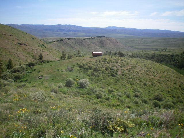
The infamous water tanker on a knoll near the base of the east ridge. It is a critical navigational tool to finding your way back to your vehicle, which is hidden on a jeep road in a narrow valley below, not visible from higher up. Livingston Douglas Photo
Additional Resources
Regions: Black Pine Mountains->SOUTHERN IDAHO
Mountain Range: Black Pine Mountains
Longitude: -113.14401 Latitude: 42.18669