Elevation: 7,864 ft
Prominence: 284
This peak is not in the book. Published November 2021
Peak 7864 is located on a ridgeline on the north side of Alder Creek. Public access begins at the Challis National Forest boundary on Alder Creek Road. USGS Big Blind Canyon
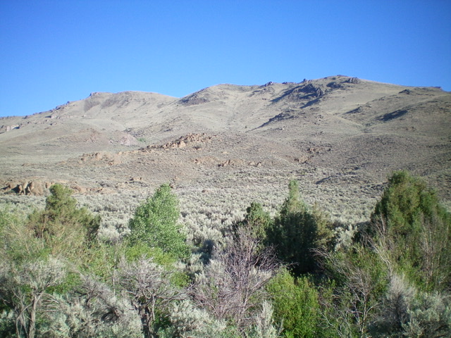
Peak 7864 as viewed from Alder Creek Road (start of hike). The summit is the hump well left of center. Alder Creek is in the foreground, amongst the trees. Livingston Douglas Photo
Access
This is the first leg of a 2-peak adventure that includes Peak 7864 and Peak 7350. This journey covers 5.5 miles with 2,100 feet of elevation gain round trip.
From the junction of Main Street and US-93 in Mackay, drive 2.4 miles south on US-93 to a signed junction with Houston Road. Turn right/south onto Houston Road and drive 2.0 miles to an unsigned junction with Alder Creek Road. Turn right/south onto Alder Creek Road and drive 1.6 miles to an unsigned junction at a private ranch and a sharp right/southwest turn in the road. Reset your odometer here. From the unsigned junction, drive southwest on Alder Creek Road. At 2.9 miles, reach the Challis National Forest boundary. At 3.0 miles, reach a fence corner and a parking pullout at the base of an old jeep road (now closed to motor vehicles). Park here (6,350 feet).
Southeast Shoulder, Class 2
The Climb
The southeast shoulder of Peak 7864 is readily visible from Alder Creek Road. Make a visual note of it before you begin this climb. From the fence corner on the north side of Alder Creek Road, descend 15 vertical feet on the left/west side of the fence row to cross Alder Creek at a wide, shallow point. Once across the creek, bushwhack north then northwest through a short patch of tall sagebrush. Cross a stiff, tall cattle fence early on.
Continue angling left/northwest through average sagebrush and cross a dry gully to reach the base of the [obvious] southeast shoulder. Scramble northwest up the crest of the shoulder on a combination of sagebrush and boulders/talus. As you near the summit ridge, contour left/northwest to intercept a ridge saddle between the true summit and the [lower] east summit. From the saddle, scramble west to the small, rocky summit. The summit has a decent cairn and a USGS benchmark in a nearby boulder.
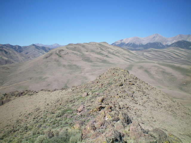
Peak 7864 (mid-ground) as viewed from the northeast. Livingston Douglas Photo
Looking down the east ridge from the summit. Peak 7350 is the hump left of center. Livingston Douglas Photo
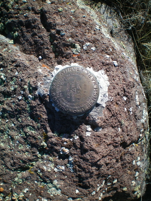
The USGS benchmark atop Peak 7864. Livingston Douglas Photo
Northeast Ridge, Class 2
The Descent
From the summit, follow the ridgeline east in reasonable scrub with a few rocky outcrops/bands to navigate). At 7,660 feet, descend left-ish/northeast to a minor saddle. From the saddle, scramble northeast for about 100 vertical feet on easy scrub to the top of Point 7283. From Point 7283, descend east to a final, confusing saddle area. The 7,020-foot saddle connects Peak 7864 and Peak 7350 and concludes the first leg of today’s 2-peak journey. Peak 7350 is up next.
Additional Resources
Regions: EASTERN IDAHO->White Knob Mountains
Mountain Range: White Knob Mountains
Longitude: -113.61779 Latitude: 43.83749