Elevation: 7,933 ft
Prominence: 553
This peak is not in the book. Published November 2022
Peak 7933 is located along ID-75 north of Ketchum and sits above Oregon Gulch. Its northeast ridge is easily reached from the Oregon Gulch trailhead and makes for a magnificent ridge scramble. Peak 7933 is often climbed with its nearby neighbor Peak 7583 which is just across Oregon Gulch. USGS Amber Lakes
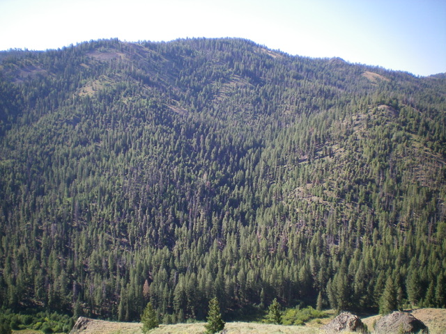
Peak 7933 and its north aspects as viewed from just above Oregon Gulch. Livingston Douglas Photo
Access
The Oregon Gulch trailhead is probably the only unsigned, hard-to-find trailhead along ID-75. It is located on an unsigned spur road on the west side of ID-75 exactly 0.5 miles south of the [well-signed] turnoff for the SNRA headquarters/visitor center and 30 feet north of [signed] Old Ranch Way (which is actually a private driveway). Drive 0.1 miles up the spur road to the large trailhead parking area, complete with a bathroom, a horse rail, and two trailheads (Saddle Trail and Oregon Gulch Trail). The trailhead is at 6,230 feet. GPS coordinates: 43⁰46’43”N, 114⁰25’03”W.
Northeast Ridge, Class 2
The Climb
Please note that the USGS map fails to show the Saddle Trail/FST-326 that is shown on the Sawtooth National Forest map. From the trailhead parking area, hike up the [signed] Saddle Trail/FST-326 (an ATV trail) which heads south and crosses the northeast ridge of Peak 7933. It mitigates the need for a difficult bushwhack through thick forest low on the northeast ridge so tolerate the switchbacks and enjoy the easy but steep climb up FST-326. When the trail crosses the northeast ridge in an open area to head south to who-knows-where, leave the trail and follow the ridge crest southwest.
Scramble southwest then west up the mostly-forested ridge (with some open patches of scrub and forest/scrub edges) over Point 7131. From Point 7131, head southwest up the ridge (with some wiggles and undulations) to reach the open summit of Peak 7933 with pine trees nearby. Surprisingly, the forested sections of the northeast ridge have several hidden areas of ridge rock/outcrops and underlying scree. The summit has a modest cairn.
North Face/North Gully, Class 2
The Descent
From the summit, the objective is to descend north (preferably on a shoulder) to reach Oregon Gulch and then climb Peak 7583 from there. However, the terrain on the north side of Peak 7933 is thickly forested and provides minimal, if any, visibility. That makes it difficult to find the correct shoulder and to avoid getting into one of the gullies on the north face, as I found out. I will describe how my descent evolved but, hopefully, you can navigate a better route than I did.
From the summit, descend west briefly to a false summit hump (in open terrain) then descend right/north on a hidden ridge and follow it down to a flattish ridge area. Head left-ish/northwest down a shoulder then face to end up in a deep gully just east of Point 7072. This gully is a mess of blowdown and is slow, so move to its right/east side and try to reach a ridge (which I never quite did). The sidehilling is brutal, so return to the gully where the bushwhack has gotten easier. Bas through a merciless patch of creekside willows to cross [small] Oregon Gulch Creek and reach the Oregon Gulch Trail. This is the low point of the traverse between Peak 7933 and Peak 7583 and concludes the first leg of today’s 2-peak adventure. Peak 7583 is up next.
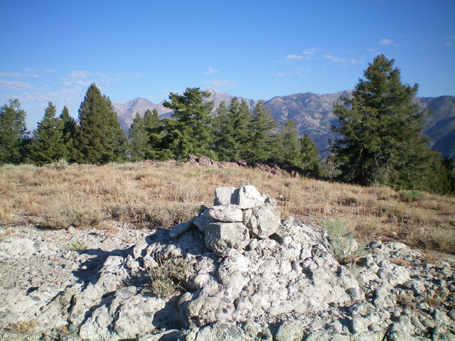
The summit cairn atop Peak 7933. Livingston Douglas Photo
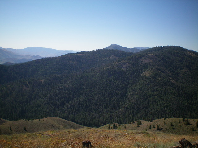
Peak 7933 (in mid-ground) and its long northeast ridge (my ascent route) as viewed from the north. The summit is at far right. The northeast ridge is the skyline leading up to it from the left. Livingston Douglas Photo
Additional Resources
Regions: Smoky Mountains->WESTERN IDAHO
Mountain Range: Smoky Mountains
Longitude: -114.44601 Latitude: 43.76309