Elevation: 7,978 ft
Prominence: 558
This peak is not in the book. Published August 2019
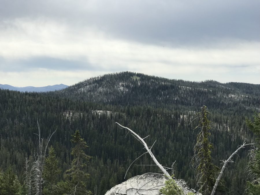
Peak 7978 is located north of Big Creek Summit and Warm Lake Highway. Like many Lick Creek Range peaks, the actual summit is formed by a granite boulder which makes the final ascent difficult. USGS Gold Fork Rock
Six Bit Peak as viewed from the west.
Access
There are two ways to access this peak. The first is from Warm Lake Highway [(C)(1) on Page 138] at Big Creek Summit. A road leads north from the pass and quickly becomes FST-4150. Follow this trail north past Peak 7789 to Six Bit Peak’s South Ridge. Use the link below to read John Platt’s trip report for this route.
The second access route is via FS-411 and FS-411A which lead to the Gold Fork Lookout Site. The road is accessed from Warm Lake Highway [(C)(1) on Page 138]. From ID-55 follow Warm Lake Highway east for roughly 11.0 miles to the signed junction for the Gold Fork Lookout. Turn left onto FS-411 and follow its twisted path north. The farther you go, the more the road deteriorates. The road turns hard left just off the highway and then right. There are “No Trespassing” signs but they do not apply to the road. Once you start heading uphill, there are no confusing junctions. A 4WD vehicle is a necessity. Expect brush to scrape your sides and be prepared for downed trees. Despite these issues, it appears that the road see moderate use. At roughly 8.0 miles, you reach the turn for the trailhead for FST-4150. See the map.
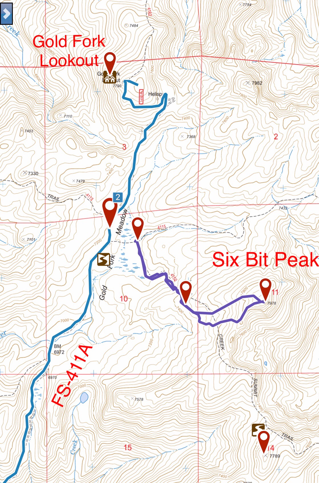
FST-4150 actually starts as a rough road which leads to a junction where FST-4150 and FST-4115 split. This map also shows my GPS track for Six Bit Peak.
West Slopes, Class 2 with Class 4 Summit Boulder
From the point where FST-4115 and FST-4150 split, follow FST-4150 south through a narrow meadow and then into a larger meadow. The tread disappears in this meadow but the trail is routed just as shown on the map. Follow the meadow’s left/north side until you find blazes on the trees where the trail reenters the forest. From this point, the trail is hard to follow. Look for occasional blazes and cairns. The trail completely disappears due west of the summit. Turn east and climb the West Slopes to the summit.
The high point is a large granite boulder. This boulder is not easily ascended and I suspect no one will ever stand on top of it. The boulder has a large crack. The crack is not easy to ascend but is amenable to jamming in your boots and arms to get high enough to a point where you can either get you hand on top or mantle up on top. The crack is not easy and getting down is even harder.
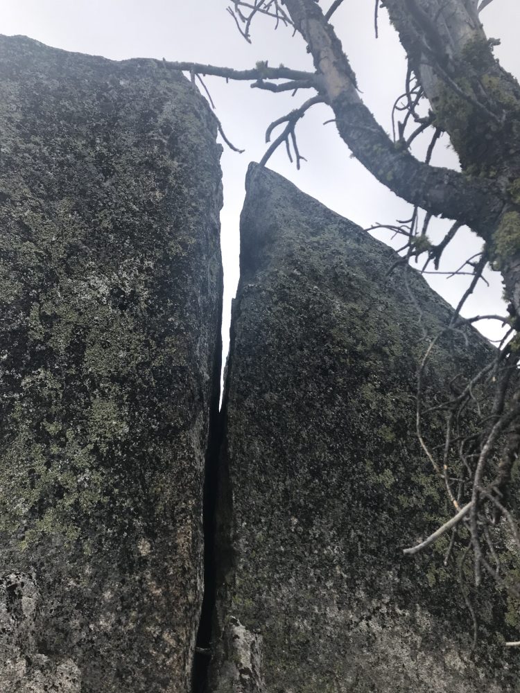
The jam crack on the summit block.
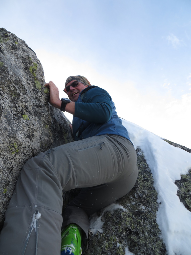
John Platt climbing the jam crack in the Winter of 2017.
Additional Resources
Mountain Range: Western Salmon River Mountains
Year Climbed: 2019
Longitude: -115.81689 Latitude: 44.65029