Elevation: 7,980 ft
Prominence: 440
This peak is not in the book. Published January 2023
Peak 7980 is a semi-open hump that separates Davis Canyon from Dry Canyon in the Bear River Range. It is most easily reached from the St. Charles Canyon Road/FSR-412 to its south and FST-314 which leads north up to its west face. However, Peak 7980 can also be climbed in combination with Peak 8002 to its north from Dry Canyon Road/FSR-410. USGS Saint Charles
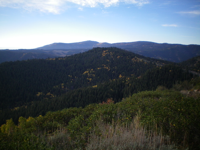
Peak 7980 (forested hump in mid-ground) as viewed from the north. Livingston Douglas Photo
Access
Same as for Peak 8002. This is the second leg of a 2-peak adventure that includes Peak 8002 and Peak 7980.
Map Errors
The USGS topo map shows Dry Canyon Road/FSR-410 as an improved road all the way up the canyon to a major fork (Stewart Fork and Water Fork) and a junction with FSR-1152 (an ATV trail). It most certainly is NOT. The USGS topo map also shows FSR-1152 as a decent road but it is now an ATV trail. The USGS topo map shows a 4WD road heading up Limekiln Fork but that old road no longer exists. There are not even any remnants of an old road in Limekiln Fork, only a cattle trail in its lower reaches.
Northwest Ridge, Class 2
The Climb
From the road junction of FSR-410 and FST-1152 (7,420 feet), which is the connecting “saddle” between Peak 8002 and Peak 7980, follow FST-1152 for about ¾ mile as it weaves its way southwest then east then south past Point 7747 to reach the semi-open terrain on the west side of Peak 7980. Leave the ATV trail and scramble east up an easy slope of field grass and scattered mountain mahogany to reach the northwest ridge. The crest of the northwest ridge is rocky early on and is clogged with mountain mahogany. Stay right/south of the ridge crest the entire way up to the [lower] north summit of Peak 7980.
From the forested north summit, bushwhack south to a minor saddle (30-foot drop). From the saddle, bushwhack south up through dense pine forest with some large blowdown and thick underbrush to reach the small, semi-open summit of Peak 7980. Given the tiny final contour line/circle area, the peak is probably only about 7,960 feet in elevation. There is a small benchmark in a ground boulder nearby. Is this Dry Benchmark? I’m not sure. This summit area is definitely the high point of Peak 7980. The highest point is a large boulder amongst the pine trees so I built a modest cairn on top of it.
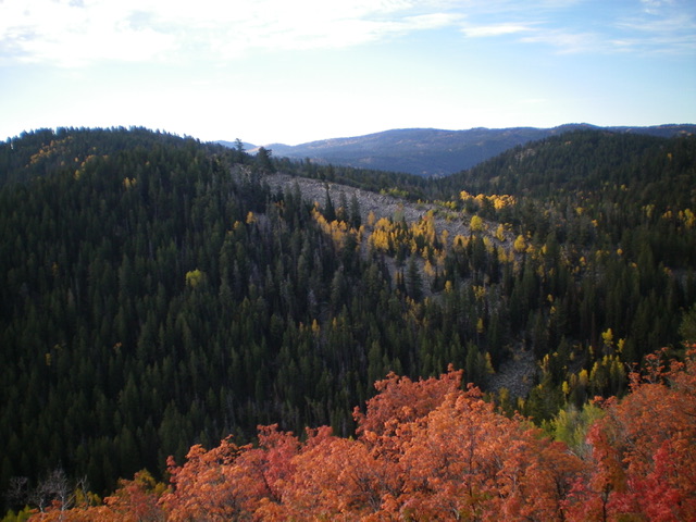
Peak 7980 (summit is at far upper left) and its northwest ridge (descending diagonally downward to the right), my ascent route. Livingston Douglas Photo
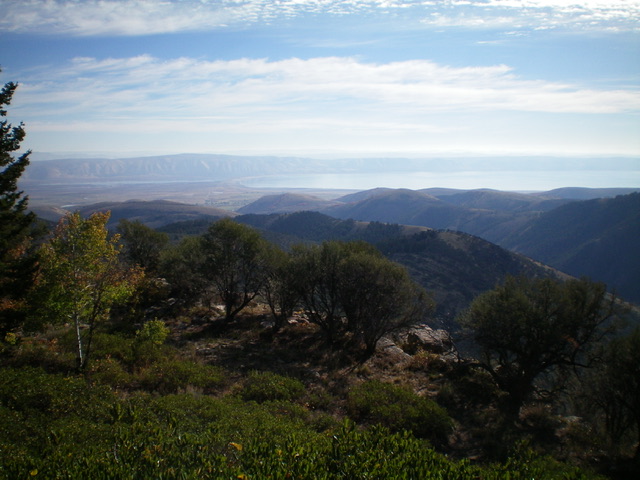
Summit view from atop Peak 7980. Bear Lake is in the distance. Livingston Douglas Photo
North Face/Limekiln Fork, Class 2
The Descent
From the summit, descend north over the [lower] north summit. From there, bash northward down through a mercilessly-thick pine forest with copious blowdown and lots of underbrush. Some sections of the forest go quickly but not enough. Upon reaching the Limekiln Fork drainage, find the remnants of an old trail that is very overgrown with blowdown across it and, in some areas, is nonexistent. Follow the trail northeast down the dry gulch to find a nice wood-framed cattle cistern in semi-open terrain of grass/scrub. Follow a cattle trail north to the mouth of Limekiln Fork and its junction with FSR-410. Hike east down FSR-410 for 2-1/2 miles back to the parking pullout near the Cache National Forest boundary.
Additional Resources
Regions: Bear River Range->SOUTHERN IDAHO
Mountain Range: Bear River Range
Longitude: -111.4929 Latitude: 42.1196