Elevation: 8,024 ft
Prominence: 404
This peak is not in the book. Published January 2023
Peak 8024 is a ridgeline summit that separates Pine Creek from Camel Hollow in the Gannett Hills. It is most easily climbed from nearby FSR-595/Camel Hollow Road. USGS Elk Valley
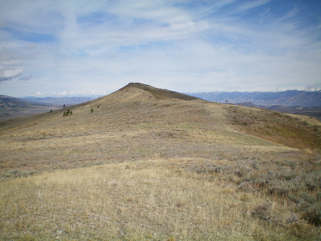
Peak 8024 (ridgeline in mid-ground) as viewed from the southeast. Livingston Douglas Photo
Access
Same as for Peak 8060. This is the second leg of a 2-peak adventure that includes Peak 8060 and Peak 8024.
Map Errors
The Caribou-Targhee National Forest map shows trailheads for Camel Hollow and Deer Creek which don’t exist. The USGS topo map shows a jeep road in the Pine Creek drainage but it is only a foot trail. The USGS topo map also shows a trail junction in the meadow near Pine Creek with a trail (FST-573) heading northwest up to Peak 8024. There is no such trail junction though FST-573 does still exist on the south ridge of Peak 8024.
South Ridge, Class 2
The Climb
From the trail junction at the east end of the meadow, follow FSR-595 briefly then bushwhack northwest across scrub, marsh, and a short patch of easy aspens/pines to reach the remnants of an old 2-track. Briefly follow this 2-track left/west to reach the good foot trail (at least initially) on the south ridge of Peak 8024. This is FST-573. Follow FST-573 north up the ridge crest (or scramble in the open, easy scrub on the crest) to reach Point 7968 then continue north to Peak 8024. The trail is sometimes faint or nonexistent. There is a bit of a rock-and-scrub scramble to the summit. Peak 8024 had a torn-down summit cairn so I built a nice cairn on the high point.
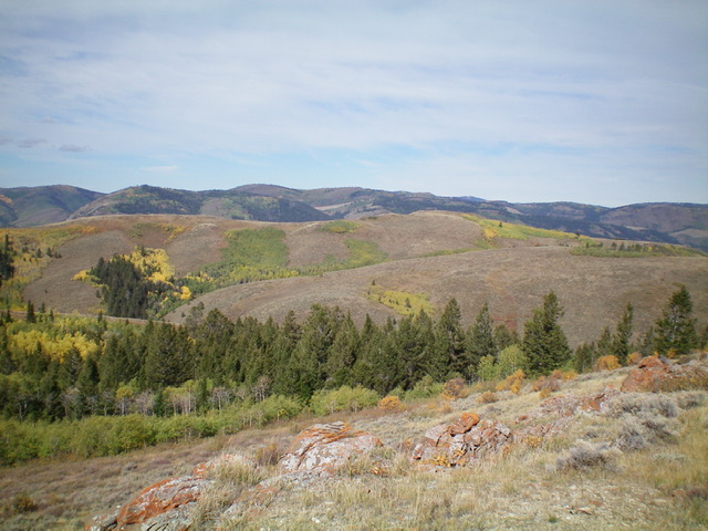
The summit hump of Peak 8024 as viewed from Point 7968 to its south. Livingston Douglas Photo
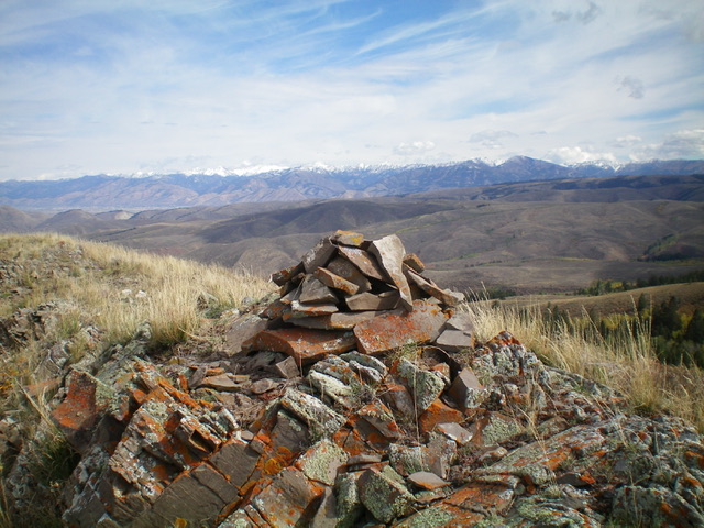
The large cairn atop Peak 8024 with the snow-dusted Tetons in the distance. Livingston Douglas Photo
West Ridge, Class 2
The Descent
From the summit, return south to Point 7968 then descend the open scrub of the west ridge. The ridge is rounded and ill-defined initially but is generally easy and has cattle trails in the areas of thicker sagebrush. Cruise west down this magnificent open ridge all the way to its end in a prominent dry gully, where the ridge bends left/southwest and drops to Camel Hollow and FSR-595. This part of the ridge is fairly steep, tedious scrub (mostly sagebrush) with underlying loose scree, so it is a bit slow. Near the bottom of the ridge is a patch of aspens so skirt right/west along the edge of them to find an open scrub path through them or continue west to the open, easy gully and skirt the aspens entirely to reach the ATV trail/road.
Once on FSR-595, follow it down to the fording of Crow Creek. Leave the road here and bushwhack (easy) through the gapped willows and scrub to reach the creek at a sharp right/north bend just below Crow Creek Road. Ford the creek in fairly shallow water (mid-calf at most) and scramble up a short scrub slope to reach the road. Walk south along Crow Creek Road for ¼ mile back to the bridge crossing and the road junction where your parked vehicle awaits.
Additional Resources
Regions: Gannett Hills->SOUTHERN IDAHO
Mountain Range: Gannett Hills
Longitude: -111.1048 Latitude: 42.5853