Elevation: 8,082 ft
Prominence: 302
This peak is not in the book. Margo Mandella and Livingston Douglas provided the alternative and harder routes found down the page. Updated November 2019
Peak 8082 is located a mile south of Peak 8150 on the ridge that parallels US-93 from Arco to Moore. You can climb Peak 8082 from almost any direction but the easiest route follows the ridge south from Peak 8150. USGS Arco North
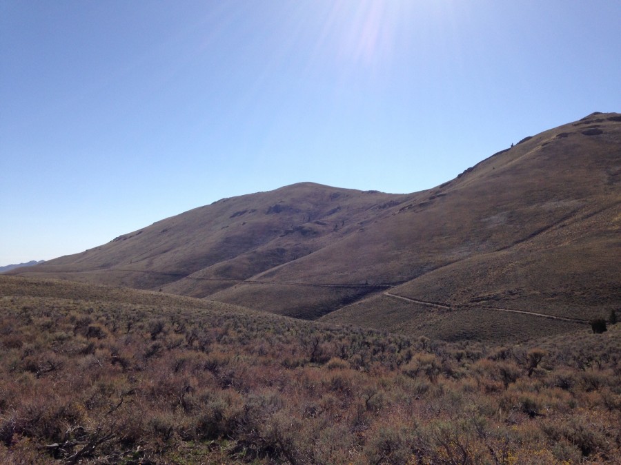
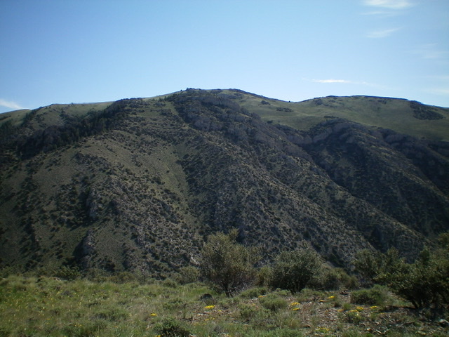
Peak 8082 as viewed from near Beaverland Pass.
Access
Same as for Peak 8150
North Ridge, Class 2
Follow the connecting ridge south from the summit of Peak 8150. There are no obstacles along the way.
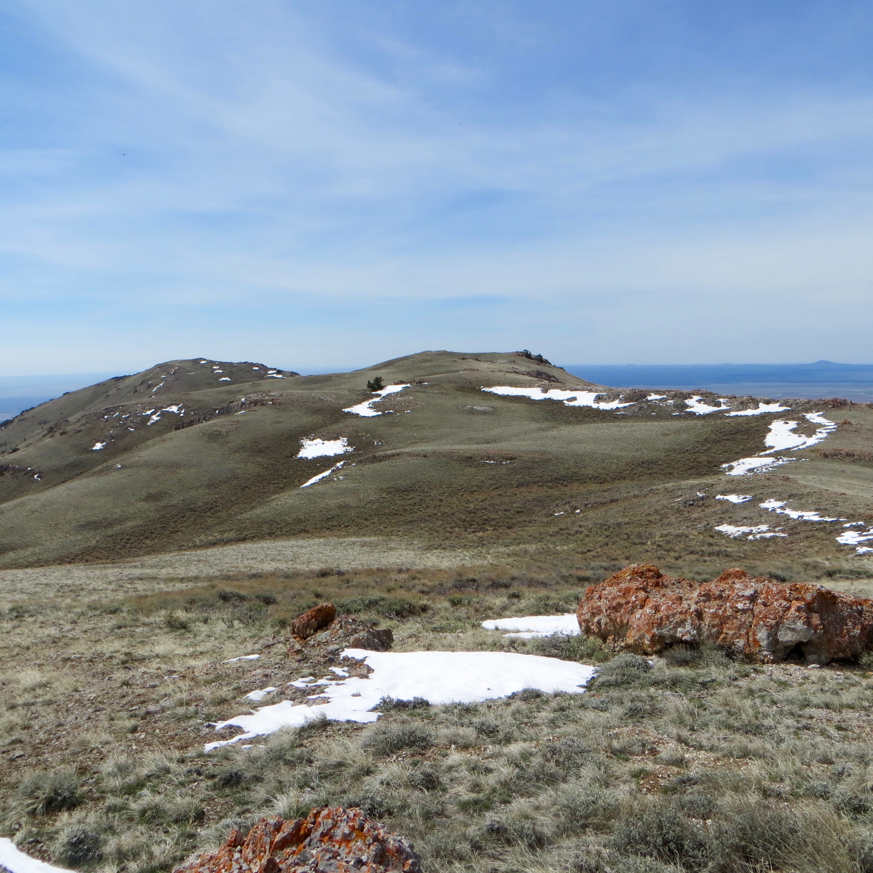
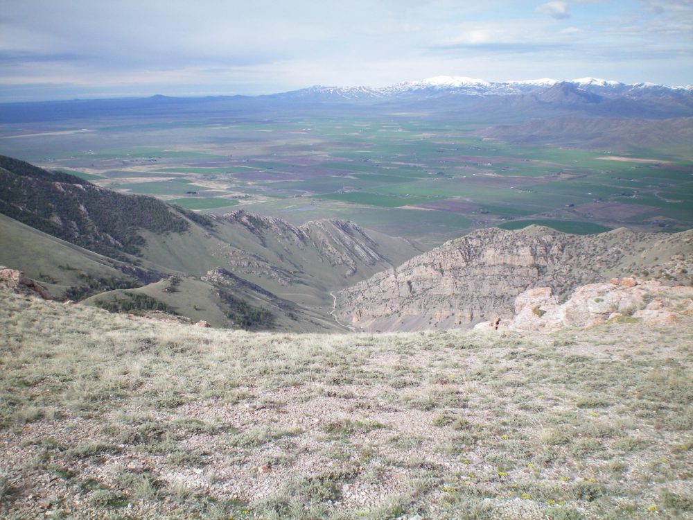
On the summit ridge, looking at the summit of Peak 8082. Steve Mandella Photo
East Slopes, Class 2
Steve and Margo Mandella climbed these peaks in May 2018. They approached the peak from the south via Arco Pass Road [(B)(18) on Page 293]. Because of a heavy rain event earlier that year, the roads were severely washed out in places and they were not able to drive all the way to Beaverland Pass with their high-clearance 4WD vehicle. Thus, they accessed the peak from Beaverland Pass Road on the northeast side between the two mountains. See their track below for their loop route. Their trip stats for the loop route: 4.93 miles and 1,906 feet of elevation gain.
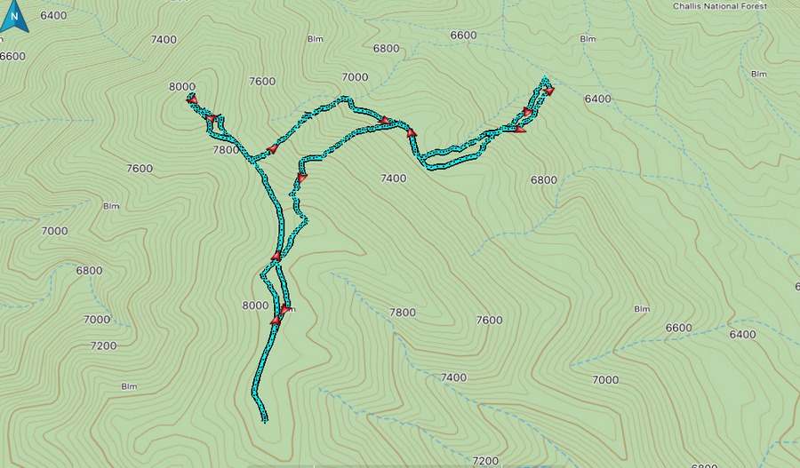
Steve and Margo Mandella’s track for Peak 8082 and Peak 8150.
North Ridge Loop Route, Class 2 by Livingston Douglas
Access
Same as for the west ridge route of Peak 8150. This is part of the ridge traverse from Peak 8150 to the north.
The Climb
From the 7,780-foot connecting saddle with Peak 8150, scramble southeast then south along the ridge crest to the summit of Peak 8082. The terrain here is easy open scrub with a talus/scree base. The summit of Peak 8082 is characterized by open scrub with protruding talus mixed in. No summit cairn or evidence of previous ascent.
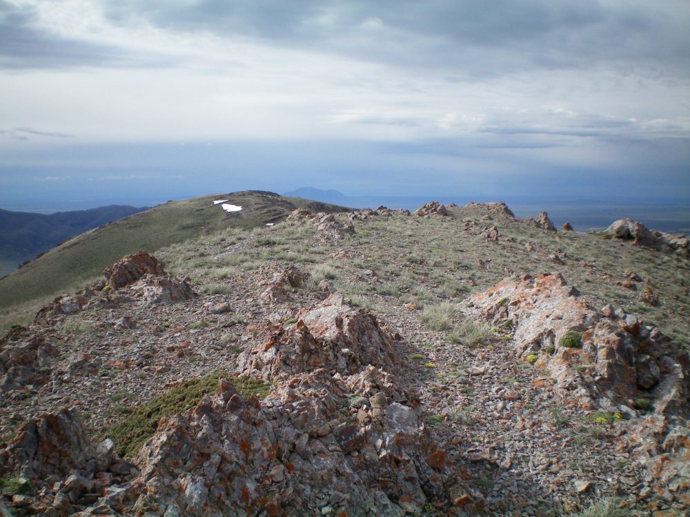
The summit rocks of Peak 8082, looking south toward Point 8070. Livingston Douglas Photo
Southwest Face, Class 2
Access
Same as for the north ridge. This is the final leg of a loop route that begins and ends on King Mountain Road at the base of the west ridge of Peak 8150.
The Descent
From the summit, descend south on the angled face, cross a high gully, and continue south to reach a shoulder heading right/west. This high traverse across the southwest face is on relatively stable tundra, albeit angled and a bit tedious. Once on the shoulder, follow it down easy field grass as it curls right/west down to a minor saddle. You will find a decent elk trail on the shoulder as you near the saddle. The saddle has an old 2-track jeep road crossing it and heading northwest then west down to the base of the southwest face in a massive gulch that comes up from the mouth of the canyon.
Hike down the steep, 2-track road to reach a better jeep road in the center of the large gulch at the base of the southwest face. Follow this jeep road southwest then west as it descends all the way to King Mountain Road. Walk north along King Mountain Road to return to your parked vehicle at the side road at the base of the west ridge of Peak 8150. Please be advised that a direct descent down the southwest face of Peak 8082 is not advised because the face is riddled with serious cliffs high on the face, in the 7,400-foot to 7,600-foot area.
Looking down at the massive southwest gully from the summit of Peak 8082. The drop is over 2,000 vertical feet. Livingston Douglas Photo
The rugged west face of Peak 8082 as viewed from the summit of Peak 7226. Livingston Douglas Photo
Additional Resources
Regions: EASTERN IDAHO->Lost River Range
Mountain Range: Lost River Range
Year Climbed: 2014
Longitude: -113.29289 Latitude: 43.71969