Elevation: 8,100 ft
Prominence: 309
This peak is not in the book. Livingston Douglas revised this page, adding additional detail to the route that I followed. He also provided some new photos. Updated November 2023
Peak 8100 is located west of the main Smoky Mountains crest between the West Fork and East Fork of Willow Creek. This peak is usually snow-free by mid-May. See the Trouble Peak page for detailed hiking directions. USGS Dollarhide Mountain
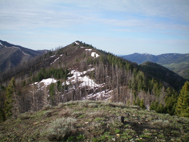
Peak 8100 as viewed from the north. The north ridge was my descent route. Livingston Douglas Photo
Access
This is the first leg of a 2-peak adventure that includes Peak 8100 and nearby Peak 8595/Trouble Peak. This journey covers 8.5 miles with 3,180 feet of elevation gain round trip. It has a few minor variations when compared to the Lopez route so it is of similar length. However, the elevation gain is over 500 feet more than the Lopez route so I believe that Tom’s elevation gain figure is a bit understated.
Map Errors
The entire West Fork Trail (shown on the USGS topo map as a road) is not shown on the Sawtooth National Forest Map.
West Face/South Ridge, Class 2
The Climb
From the West Fork Trailhead at the gated road closure (which is located at a fork in the Willow Creek drainage), follow the unmaintained foot trail (no longer a road) northwest then north as it heads up the West Fork of Willow Creek for about 1.3 miles to just before a sharp left/west bend in the trail. Leave the trail here and bushwhack east across the West Fork. The West Fork Trail is on an old roadbed that is sometimes visible but at other times is pretty much gone. There is blowdown across the trail in a few spots.
Climb steeply east up through a dense pine forest with lots of lateral and diagonal game trails to help get through the thick understory in the forest. Higher up, climb up a rocky rib (and talus slopes) to reach the open, easy ridgeline in an elongated saddle area north of Point 7655. Follow the ridge north-northeast up through short scrub (often with a game trail to help) to reach the open summit of Peak 8100. The summit had no cairn so I built a modest one. This route ascends more directly east to the south ridge and pops out a bit farther north on the ridge than the Lopez route.
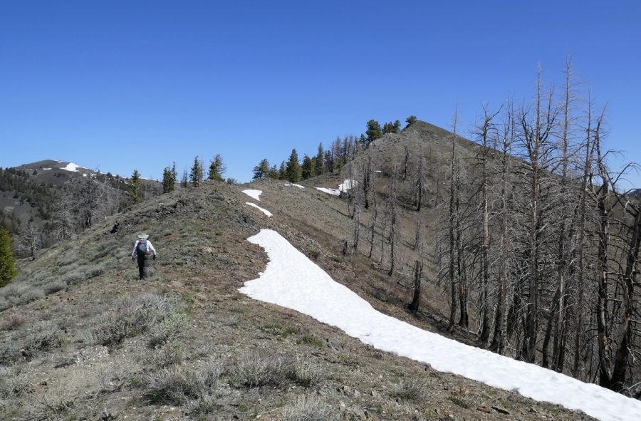
Peak 8100 (ridgeline in mid-ground) as viewed from the west. The south ridge is right of center and descends diagonally from the summit hump, which is in dead center. Livingston Douglas Photo
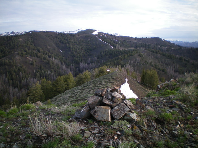
The newly-built summit cairn atop Peak 8100 with Peak 8595/Trouble Peak in the distance (just left of center). Livingston Douglas Photo
North Ridge, Class 2
The Descent
From the summit, descend the ridge northward in easy scrub to reach Saddle 7791, the low point in the ridge traverse to Peak 8595/Trouble Peak. This concludes the first leg of today’s 2-peak adventure. Peak 8595/Trouble Peak is up next.
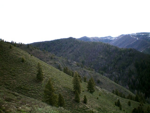
Hiking the trail-less east side ridge is mostly across easy, open slopes.
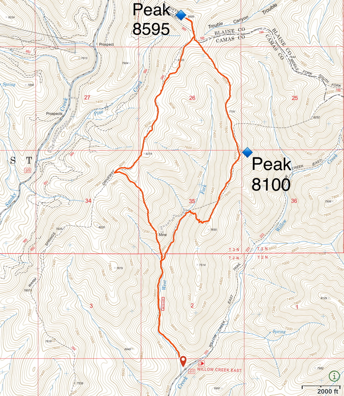
My GPS track for Willow Creek Ridges Route for both Peak 8100 and Peak 8595/Trouble Peak.
Additional Resources
Regions: Smoky Mountains->WESTERN IDAHO
Mountain Range: Smoky Mountains
Longitude: -114.62759 Latitude: 43.55749