Elevation: 8,121 ft
Prominence: 301
This peak is not in the book. LOJ and Peakbagger list the elevation as 8,118 feet based on a spot elevation on the Grave Peak USGS quadrangle. The high point is 50 feet to the north of the spot elevation. Like many peaks in the Idaho batholith, granite boulders and columns often are the high point, not where the spot elevation is shown. In this case, it is a boulder which is at least three feet higher than the spot elevation. Published July 2021
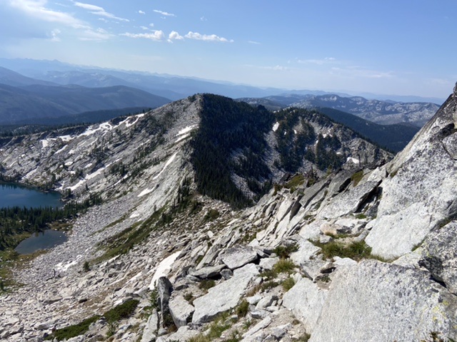
Peak 8121 is located on Friday Ridge, south of Grave Peak. Friday Ridge is the highest ridgeline in a large section of the Selway-Bitterroot Wilderness. The ridge extends south from Tom Beal Park high above the Lochsa River south for many miles. This granite peak is fin-shaped. It is steep, cliffy, and heavily forested on its west side. The east aspect is mostly composed of granite slabs, steep meadows, and a few trees. USGS Grave Peak
Peak 8121 (Friday Ridge) as viewed from Grave Peak.
Access
Access this peak from Wind Lakes to the west or the Kooskooskia Meadows Trailhead to the east. Use the access section for Grave Peak to reach Friday Pass, the starting point for this short climb.
South Ridge, Class 2
Leave the Grave Peak Lookout Trail at the point where it crosses Friday Ridge. From this saddle, drop down to the east, losing about 25 feet of elevation to avoid a section of large granite blocks. Turn the corner and angle up toward the summit as shown on the map below. It is 0.2 miles with 200 feet of elevation gain from the trail to the summit.
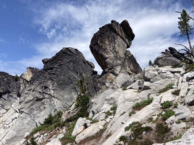
The peak’s south ridge is studded with granite towers.
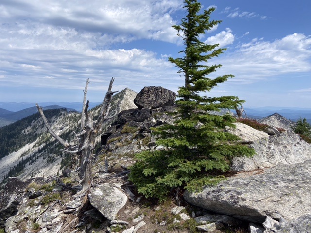
This boulder is the high point. Grave Peak is in the background.
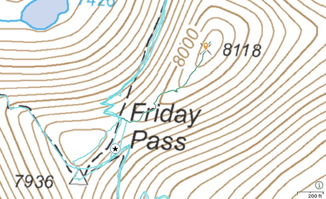
My GPS track. We did cross over to the west side of the ridge at one point.
Additional Resources
Mountain Range: Central Clearwater Peaks
Year Climbed: 2021
Longitude: -114.72819 Latitude: 46.38601