Elevation: 8,146 ft
Prominence: 326
This peak is not in the book. Published November 2020
Peak 8146 is located in the northwest corner of Copper Basin. It is the final peak of a four-peak adventure that includes Peak 8664, Peak 9533, Peak 8763, and Peak 8146. Peak 8763 is located on the east side of the Fox Creek drainage, directly above the mouth of the Fox Creek drainage and the top of the Fox Creek Road. USGS Big Black Dome
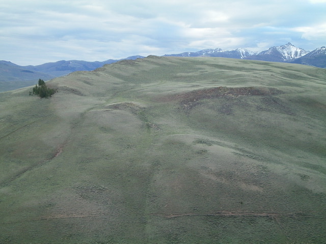
Peak 8146 as viewed from the northwest. Livingston Douglas Photo
Access
Same as for Peak 8644. This is the final leg of a four-peak journey covering ridges on both sides of Fox Creek.
South Ridge, Class 2
The Climb
From the dried pond bed in the 7,820-foot connecting saddle between Peak 8763 and Peak 8146, scramble east up STEEP scrub (not fun) to reach the south ridge. Follow an old 2-track road (not shown on maps) on the ridge crest all the way to the summit. There is a small cairn on the high point. The summit area is quite flat and is covered with sagebrush.
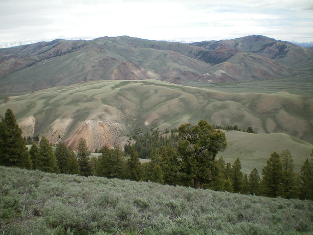
Peak 8146 (center, mid-ground) as viewed from the southwest. Livingston Douglas Photo
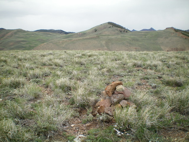
The small summit cairn atop the sagebrush hump that is Peak 8146. Peak 8664 is in dead-center behind the cairn. Livingston Douglas Photo
Northwest Face, Class 2
The Descent
From the summit, follow the 2-track road (not shown on maps) northwest then north toward the mouth of the Fox Creek drainage and the top of Fox Creek Road. The old road turns right/northeast to descend to Copper Basin Road at a cattle guard located 0.3 miles east of the turnoff for Fox Creek Road. [Note: This old 2-track and the cattle fence is an easy way to tackle Peak 8146 from Copper Basin Road if you plan to climb only Peak 8146.]
Leave the old 2-track road at an opportune time and descend northwest directly to Fox Creek. You must cross a wickedly high, taut cattle fence to get to the creek, so look for a gate to cross it unless you happen to be 10 feet tall with LONG legs. Descend a short distance downstream alongside Fox Creek to where the willows end then head west through sagebrush and other brush to cross Fox Creek and reach Fox Creek Road. Walk a short distance up the road to your vehicle.
Additional Resources
Regions: EASTERN IDAHO->Pioneer Mountains
Mountain Range: Pioneer Mountains
Longitude: -113.91919 Latitude: 43.85959