Elevation: 9,533 ft
Prominence: 353
This peak is not in the book. Published November 2020
Peak 9533 is located in the northwest corner of Copper Basin. It is the second peak in a four-peak adventure that includes Peak 8664, Peak 9533, Peak 8763, and Peak 8146. Peak 9533 sits a ways up the west side of Fox Creek. A weaving, undulating two-mile ridge connects Peak 8664 to Peak 9533. This one takes some work to get to. USGS Big Black Dome
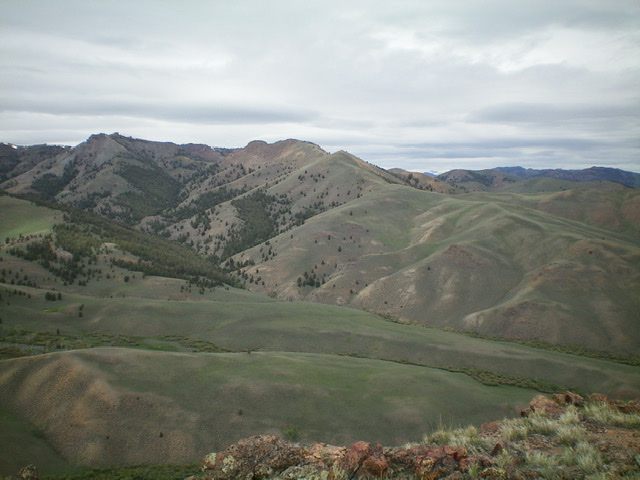
Peak 9533 and its LONG east ridge (from lower right diagonally up to the center of the photo). The summit is in dead center, just behind the gentle hump. Livingston Douglas Photo
Access
Same as for Peak 8644. This is the second leg of a four-peak journey covering ridges on both sides of Fox Creek.
Northeast Spur/East Ridge, Class 2
The Climb
From the 8,220-foot connecting saddle with Peak 8664, follow the ridge southwest to Point 8731 on easy, open scrub. The ridge turns right/west here and heads steeply up to Point 9256, a gentle hump with a cairn atop it. From Point 9256, descend 60 vertical feet to a minor saddle then scramble up through a patch of bristlecone pines to reach the final, rocky climb to the summit of Peak 9533 on Class 2 shale. The summit is a ridge crest point and, thankfully, is NOT the ugly rock tower to its southwest (Point 9520+). The summit area is a rocky perch with a modest cairn.
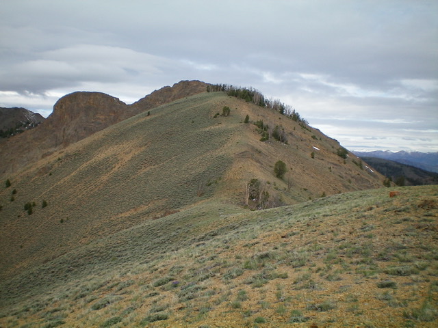
The upper east ridge of Peak 9533. The summit is the rocky outcrop in dead center, just behind the gentle forested hump. Livingston Douglas Photo
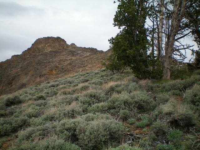
The rocky finish up the east ridge of Peak 9533, with bristlecone pines on the ridge crest to the right. You can skirt them on the left side. Livingston Douglas Photo
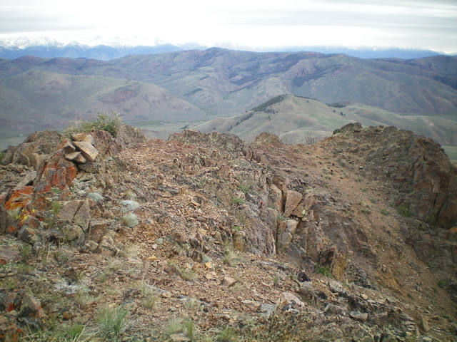
The summit area of Peak 9533 and the rocky upper east ridge. The summit cairn is left of center. Livingston Douglas Photo
FULL East Ridge, Class 2
The Descent
From the summit, descend the east ridge back to Point 8731. Continue east down the ridge to Point 8246 on easy scrub. From Point 8246, descend a short distance to a flat ridge area at 8120+ (akin to a saddle) and descend southeast through somewhat thick sagebrush to reach a good, willow-free crossing of the West Fork of Fox Creek. Cross the West Fork then scramble 20 vertical feet over a shoulder that separates the West Fork from the South Fork. Drop slightly to cross the South Fork of Fox Creek. You are now at the low point of the traverse between Peak 9533 and Peak 8763. This point is just above the convergence of the West Fork and South Fork of Fox Creek. You are now sitting at the base of the northwest face of Peak 8763. This concludes the second leg of today’s four-peak journey. Peak 8763 is up next.
Additional Resources
Regions: EASTERN IDAHO->Pioneer Mountains
Mountain Range: Pioneer Mountains
Longitude: -113.97669 Latitude: 43.85869