Elevation: 8,191 ft
Prominence: 771
This peak is not in the book. Published January 2023
Peak 8191 is located northeast of Swan Valley, Idaho. It towers over nearby Burnt Canyon. This is the second leg of a 3-peak adventure that includes Ross Peak, Peak 8191, and Peak 7843. This journey covers 10.2 miles with 3,325 feet of elevation gain round trip. USGS Swan Valley
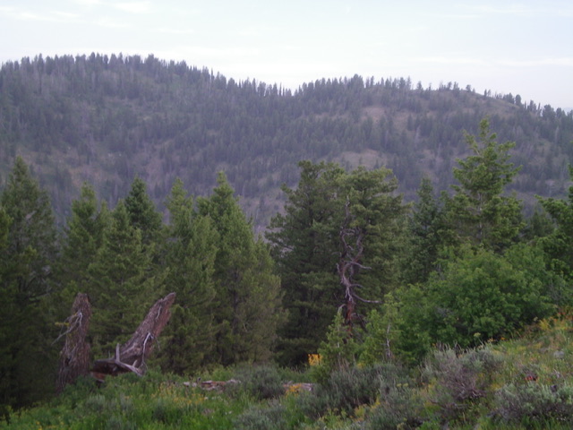
Peak 8191 (summit hump is left of center) and its east ridge (skyline) as viewed from Ross Peak to its south-southeast. Livingston Douglas Photo
Access
Same as for Ross Peak. This is the second leg of a 3-peak journey.
East Ridge, Class 2
The Climb
From the ridge junction on the north side of Ross Peak, continue up the forested east ridge of Peak 8191 to the semi-open, ridgeline summit of Peak 8191. The high point is a dead pine tree. There is a small summit cairn. The east ridge has its ups and downs and is semi-open but is tedious due to large downed trees to navigate through. The veg is manageable.
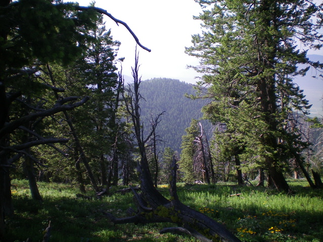
The semi-forested summit of Peak 8191 with Ross Peak in the distance. Livingston Douglas Photo
West Ridge/North Spur, Class 2
The Descent
From the summit, descend the semi-open ridge west then down through a thicker pine forest to reach an open saddle of scrub/veg. From the saddle, continue west up a semi-open ridge with more veg and large blowdown to reach the [open] west summit hump. From here, you can see Peak 7843 and its critical [open] connecting saddle. The next objective is to descend to that saddle. From the west summit, bushwhack north on the semi-open forested ridgeline to a ridge junction. Go right-ish/northeast here and follow a flattish ridge section to a point where the ridge turns left-ish/north. The semi-open terrain ends here and a difficult bushwhack north down a rounded, forested ridge (more of a face) begins.
This is a steep descent through thick pine forest with loose scree/gravel, dense veg, and lots of blowdown. Once down it, you reach a flattish, semi-open ridge section that is much easier. Continue heading north and look for a descent route in the forest to cross the head of an obvious gully (to the right) to reach the visible, open scrub saddle at the base of the southwest spur of the south ridge of Peak 7843. From the flattish ridge section, descend right-ish/northeast to the saddle in a forest bushwhack that is manageable. This is the 7,480-foot connecting saddle with Peak 7843 and concludes the second leg of today’s 3-peak journey. Peak 7843 is up next.
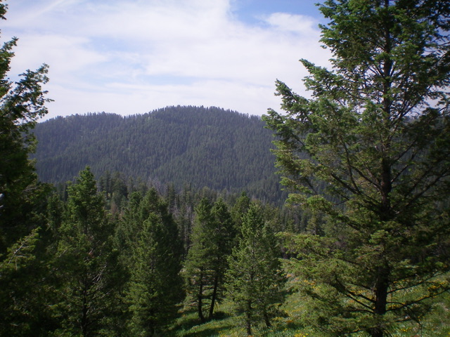
Peak 8191 (left of center) as viewed from Peak 7843 to its north. Livingston Douglas Photo
Additional Resources
Mountain Range: Big Hole and Snake River Mountains
Longitude: -111.2805 Latitude: 43.4957