Elevation: 8,290 ft
Prominence: 830
This peak is not in the book. Published November 2023
Peak 8290 sits at the head of Sheep Canyon in the White Knob Mountains. It is overshadowed by its rugged neighbor to the west, Peak 8585. Peak 8290 is a relatively straightforward scramble via either its west ridge or its north ridge, both of which are accessed via Sheep Canyon Road and ATV trails in Sheep Canyon. USGS Big Blind Canyon
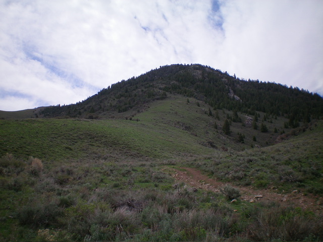
Peak 8290 as viewed from the base of its west ridge (my ascent route). The summit is the hump left of center. Livingston Douglas Photo
Access
Same as for Peak 8585. This is the second leg of a 2-peak adventure that includes Peak 8585 and Peak 8290. It begins at the base of Sheep Creek Road and covers 8.0 miles with 3,150 feet of elevation gain round trip.
Map Errors
3700N is incorrectly shown as “Dove Road” on the USGS topo map and is labeled as a 4WD road when it is actually a well-graded county road and does NOT require 4WD. The USGS map fails to show the ATV trail that continues south all the way to the 7,460-foot connecting saddle between Peak 8585 and Peak 8290. The National Forest map shows the ATV trail ending at this saddle when, in fact, it continues southward down a wide gully and probably goes to Marsh Canyon Road. Both the USGS and National Forest maps fail to show a critical ATV trail junction at about 6,900 feet where another good ATV trail heads west.
West Ridge, Class 2
The Climb
From the 7,460-foot connecting saddle with Peak 8585, scramble southeast up easy grass/scrub and broken rock. The ridge steepens as you gain elevation. Stay just left/north of pine trees to reach the upper, flattish section of the west ridge. From here, bushwhack east then northeast up the ridge, which is now a mix of mountain mahogany and underlying scrub/gravel. Reach a false summit then continue on to the official summit in easy scrub. I rebuilt the summit cairn.
Noticing another summit hump to the northeast, I descended 20 feet to a sagebrush saddle then continued quickly to that high point. It measures of equal height to the official summit but the northeast summit has triangulation posts laying on the ground so perhaps it should actually be the official summit. Considering such, I built a summit cairn atop the northeast summit hump and stuck a triangulation post in it. Perhaps the 8,290-foot map measurement took place on this summit and the USGS map misplaces the 8,290-foot marker.
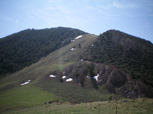
Peak 8290 and its north ridge (my descent route) in dead center as viewed from its base. Livingston Douglas Photo

The rebuilt summit cairn atop the official summit of Peak 8290. Livingston Douglas Photo
North Ridge, Class 2+
The Descent
From the northeast summit hump, descend across a high snowfield to enter a thick pine forest (which includes mountain mahogany in some areas). Descend northward with no visibility. There is a surprising amount of ridge rock/outcrops to navigate through. The ridge wiggles a bit but generally goes quickly. Downclimbing the ridge outcrops is a bit tedious (Class 2+). Lower down, the ridge opens up and is an easy descent on open scrub/sagebrush to the obvious ATV trail to the left/west of the ridge crest. Once on the ATV trail, follow it down to Sheep Canyon Road and then follow the road northeast back to the base of the road and your parked vehicle.
Additional Resources
Regions: EASTERN IDAHO->White Knob Mountains
Mountain Range: White Knob Mountains
Longitude: -113.5170 Latitude: 43.7921