Elevation: 8,297 ft
Prominence: 437
This peak is not in the book. Livingston Douglas added this page to the database. He originally climbed this peak via a long hiking traverse from Broken Wagon Peak. I have added a shorter route which is set out below. Updated July 2023
Peak 8297 South is one of two summits of exactly equal, measured heights. This is highly unusual, particularly given that the summits are over 1-1/2 miles apart via a twisting, turning, up-and-down ridge traverse. Thankfully, the terrain here is open scrub and goes relatively quickly. You must do each summit in order to bag this peak. The ridge traverse takes just under 40 minutes each way. The south summit alone is NOT ENOUGH. You must also do Peak 8297 North. Since the peaks are of equal height, you can claim TWO summits if you do the work. USGS Antelope Flat
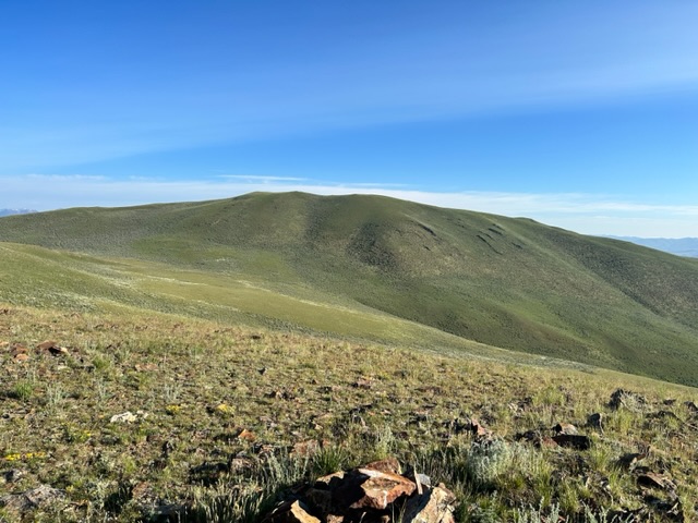
The newly-built summit cairn atop Peak 8297 North with Peak 8297 South in the background. Peak 8297 South is the scrub hill in the dead center of the photo with the high point just right of center. Livingston Douglas Photo
East Spur/South Face, Class 2
Access
Same as for the east ridge of Peak 8288/Broken Wagon Peak. This route is the next leg in a ridge traverse from Peak 8288 to Peak 8297 South to Peak 8297 North.
The Climb
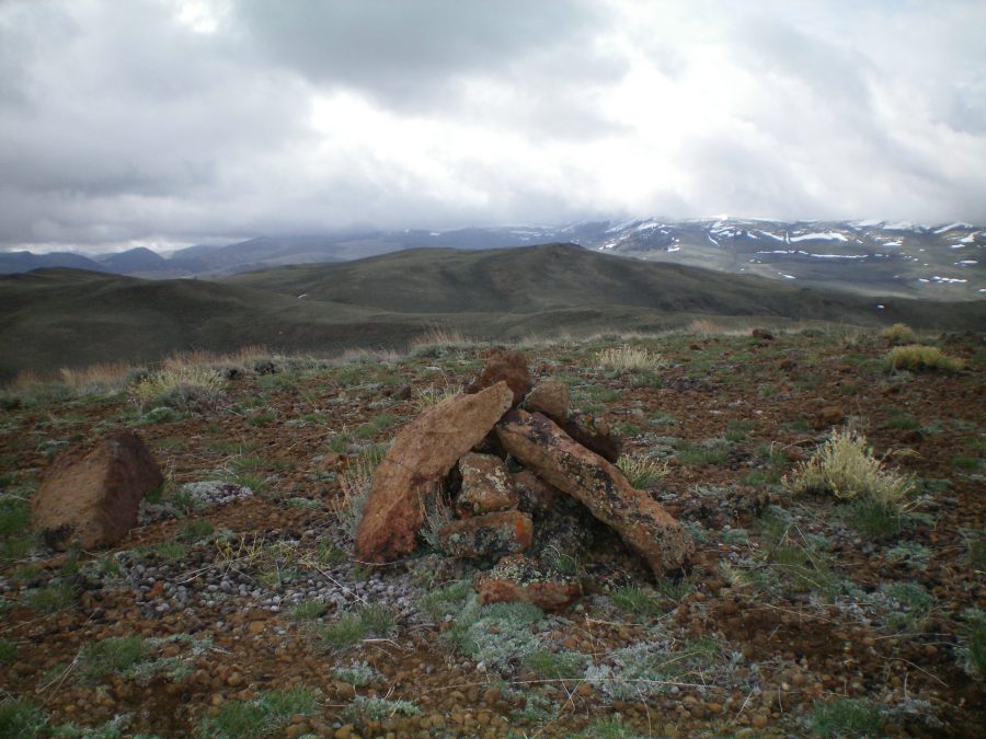
From the second 7,740-foot saddle southwest of Peak 8288, follow a jeep road southwest up to 7,800 feet. Leave the road here to contour north around the head of a drainage. Elk trails help here. Once on the other side of the drainage, climb up an easy, open scrub slope to reach the well-cairned Point 8088. This cairn is five feet tall and can be seen from a long distance.
From Point 8088, descend the easy open ridge west then northwest to a cattle meadow that sits directly below (and south of) Peak 8297 South and at the head of a massive drainage to the east. Follow one of two obvious cattle/elk trails northward up onto the summit ridge. Scramble a little farther north to reach the cairned high point of Peak 8297 South. From here, you have an outstanding view of both Peak 8288 (to the east) and the circuitous connecting ridge to Peak 8297 North.
Northeast Face, Class 2
Access
Same as for the east spur/south face. This is part of a ridge traverse from Peak 8297 South to Peak 8297 North and back.
The Descent
From the summit of Peak 8297 South, bushwhack northeast down through thick sagebrush (weaving required) to a wide saddle. This is the base of the northeast face.
South Face/South Gully, Class 2
Access
Same as for the east spur/south face. This is the final leg of a loop route that begins and ends near the base of Broken Wagon Road close to US-93.
The Descent
From the summit of Peak 8297 South, descend the scrub on the south face down to a saddle at the head of a large drainage to the east and a gully to the southwest. Descend southwest down the sagebrush of a dry gully, using elk trails, to quickly reach Broken Wagon Creek Road. Follow the road four miles east to return to the parking area and your vehicle. There is an early 200-foot ascent up a hill required in this final road hike.
South Face from Broken Wagon Creek and Corral Basin Creek Saddle by Tom Lopez
Access
The Broken Wagon Road leaves US-93 32.0 miles north of Mackay, Idaho and 22.0 miles south of Challis, Idaho. This narrow road is suitable for high clearance vehicles until it enters into Section 35 where there is a junction in a wide flat area which is private property. There is public access across this property. From this point the road steepens and deteriorates and a 4WD is required. After 3.8 miles and gaining 1,150 feet of elevation the road ends at the saddle dividing Broken Wagon Creek and Corral Basin Creek. Note that the road down into Corral Basin Creek is closed because the basin is a Wilderness Study Area.
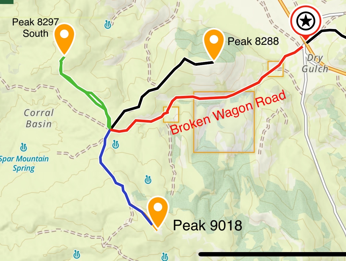
This map shows the three peaks accessible from the Broken Wagon Creek/Corral Basin Creek Saddle.
South Face, Class 2
From the Broken Wagon Creek and Corral Basin Creek saddle cross over the cattle guard and make a gradual climbing traverse along side the ridge that leads toward the peak. This is open country with a few patches of thick sagebrush. Aim for the 8,000 foot contour. Once on the ridge continue northwest until you can drop down into the saddle at the base of the peak’s south face. On the left side of the face and old, overgrown two track is visible. Follow this track through the thick sagebrush to the ridge top west of the summit. Turn east and hike to the top. Round trip is 3.3 miles with 884 feet of elevation gain.
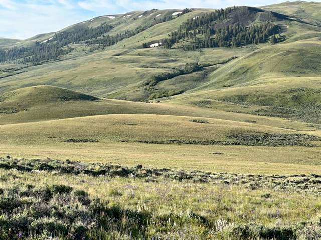
Peak 8297 South viewed from the south.
Looking back to theBroken Wagon Creek and Corral Basin Creek saddle from the 8,000 foot contour.
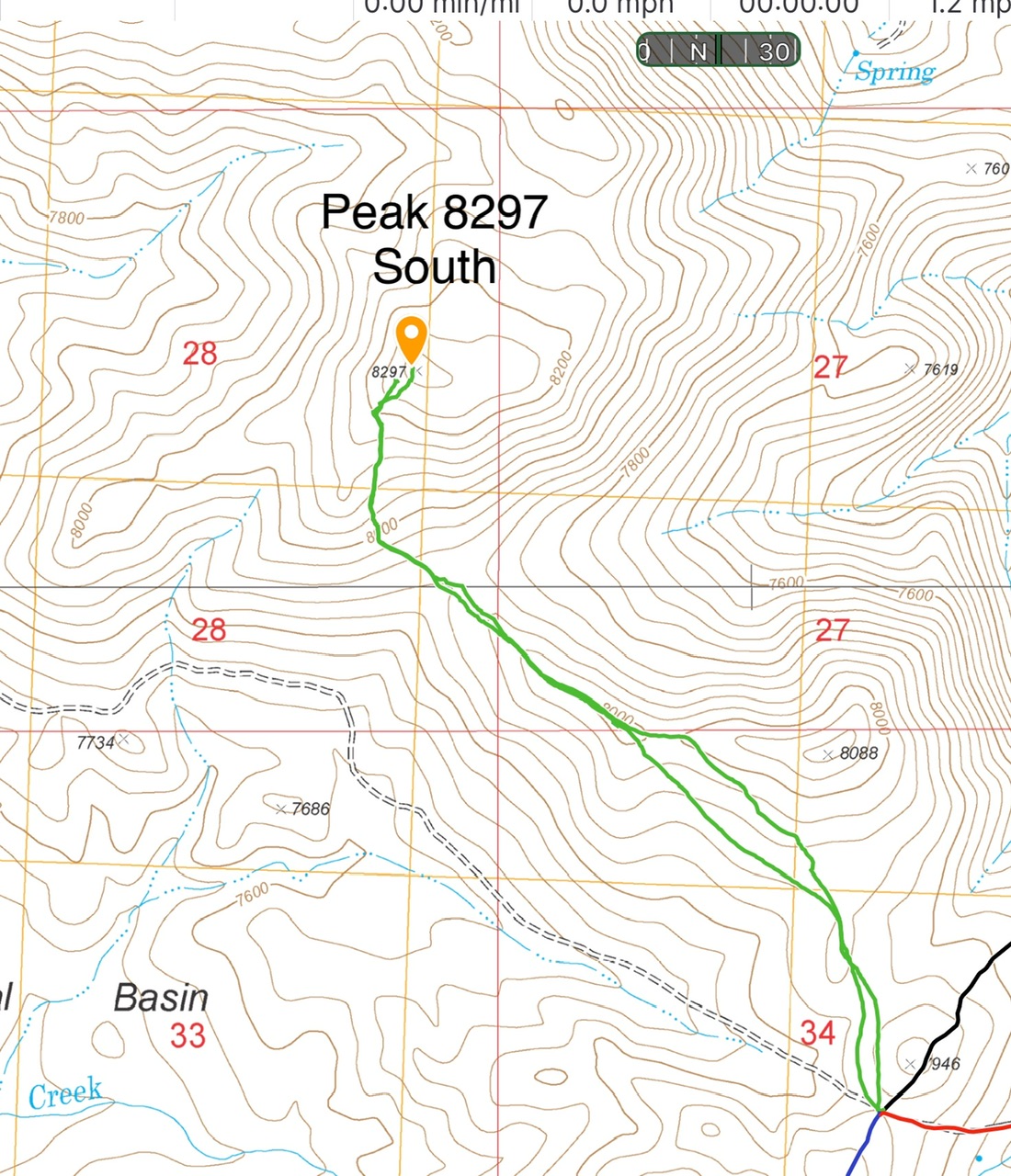
My GPS track.
Additional Resources
Regions: Boulder Mountains->EASTERN IDAHO
Mountain Range: Boulder Mountains
Year Climbed: 2023
Longitude: -114.09439 Latitude: 44.25509