Elevation: 8,301 ft
Prominence: 921
This peak is not in the book. Published December 2019
Peak 8301 is one of two ranked summits located on a massive ridge that separates Martin Canyon from Slaughterhouse Creek. Vue Benchmark (8,468 feet) is only 167 feet higher. Peak 8301 has a LONG southwest ridge and a shorter southeast ridge, both of which are suitable for early-season climbs when the snow is lingering on the higher peaks of the Pioneer and Boulder Mountains. There are no trails or roads on Peak 8301. You must DO THE WORK to get this one done. USGS Baugh Creek SW
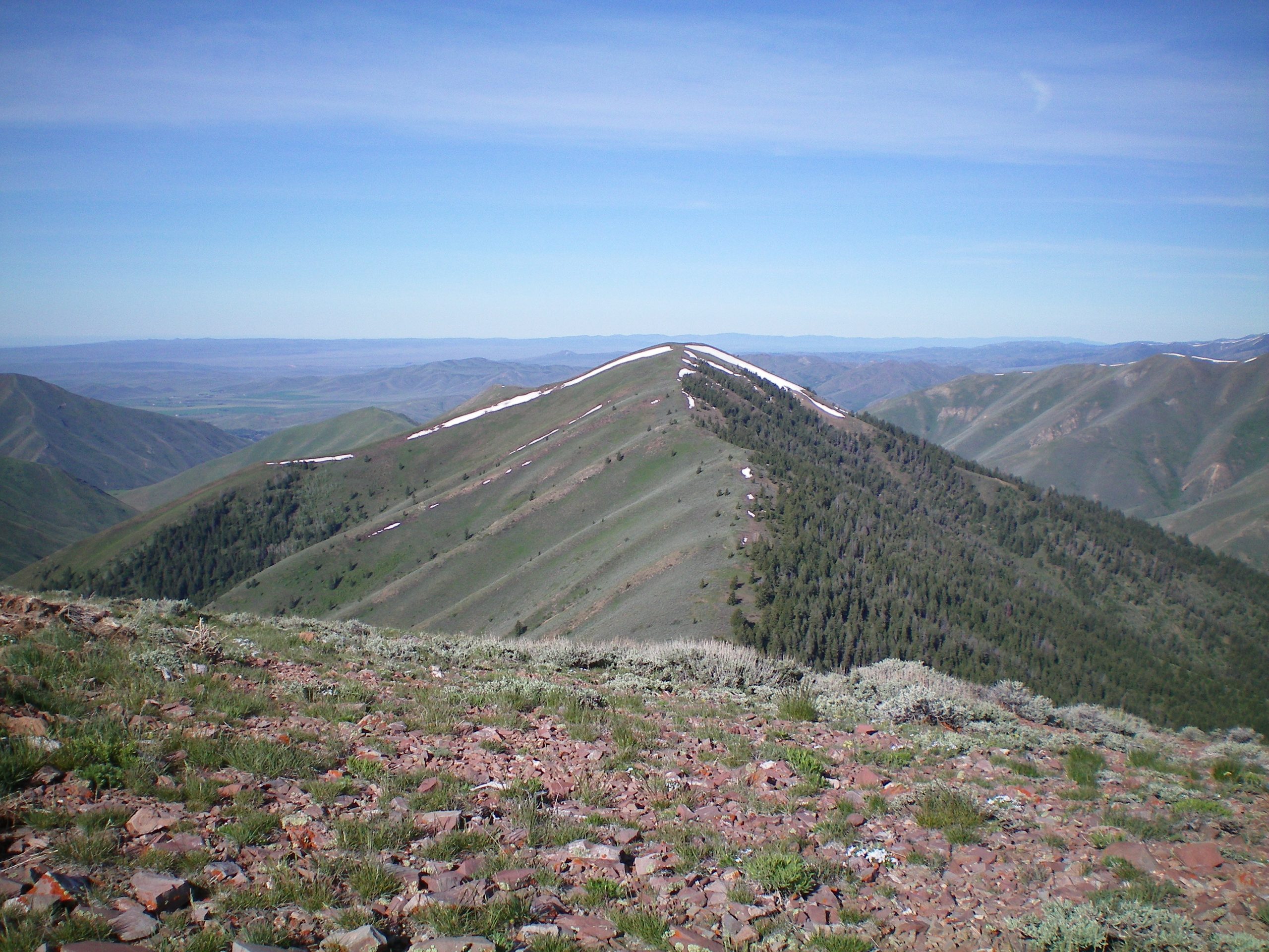
Peak 8301 and its northeast ridge (center of photo) and southeast ridge (descending leftward from the summit with a snow line on its north edge), as viewed from the summit of Vue Benchmark. Livingston Douglas Photo
Southeast Ridge, Class 2
Access
From the junction of ID-75 and Pine Street in Bellevue, drive east on Pine Street (which becomes Muldoon Canyon Road). At 2.5 miles, turn left/north onto [unsigned] Martin Canyon Road. Drive 2.3 miles up Martin Canyon Road and park in short scrub on the left side of the road. The elevation here is 5,835 feet. The road was blocked at the 2.4-mile point by massive avalanche debris and had not yet been cleared. If possible, drive farther up the road to shorten this climb.
The Climb
From the parking spot, hike up Martin Canyon Road for just over a mile to reach the toe of the southeast ridge of Peak 8301 at about 6,030 feet. This departure point is characterized by a narrow section of the canyon where there is a shoulder/ridge squeezing the road from both sides. If you must, then use your GPS to make sure you’re at the base of the correct ridge. There are no major side gullies near this point on the road. If you see a large gully to your left and Vue Benchmark is towering above you to the north, you’ve gone about 0.2 miles too far up the road.
Leave the road and climb northwest straight up the crest of the ridge. The shale is loose here but it sure beats trying to climb up the [even-looser] rock on the sides of the ridge. The slope eases about 200 vertical feet above the road, but it’s still relatively steep. The slope eases more noticeably at about 7,500 feet. This ridge is mostly a grind on short scrub and scree. There are no rocky outcrops, trees, or bushes to battle with. The ridge leads directly to the gentle summit of Peak 8301. The summit is a hump of scrub and broken scree. It lacked a summit cairn so I built one.
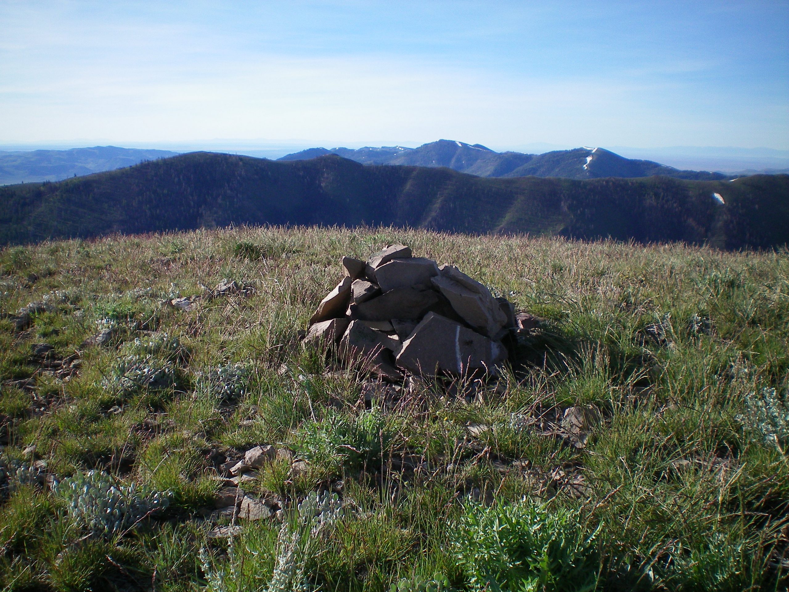
The newly-built cairn atop Peak 8301 with Peak 8074 in mid-ground (the summit is the leftmost of the two humps). Livingston Douglas Photo
Northeast Ridge, Class 2
Access
Same as for the north shoulder. This is the first leg of a ridge traverse from Peak 8301 to Vue Benchmark.
The Descent
From the summit, follow the ridge crest northeast almost 1-1/2 miles and descend over 900 vertical feet to reach the connecting saddle with Vue Benchmark. This sagebrush-covered saddle is at 7,380 feet. The northeast ridge is laborious and rocky. The scree rock base is loose and there are some areas of thick sagebrush. Thankfully, the terrain is not very steep.
Additional Resources
Regions: EASTERN IDAHO->Pioneer Mountains
Mountain Range: Pioneer Mountains
Longitude: -114.19039 Latitude: 43.50929