Elevation: 8,319 ft
Prominence: 379
This peak is not in the book. Published November 2020
Peak 8319 is the sister peak to nearby Appendicitis Hill (8,523 feet) and is probably overlooked by most climbers. It sits at the head of Rocky Canyon and is almost due south of Appendicitis Hill. Peak 8319 is just a ridge point on the massive south ridge of Appendicitis Hill. It sits on a narrow side ridge and is a most unimpressive summit. USGS Appendicitis Hill
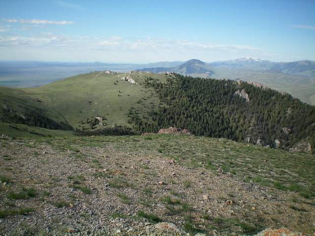
Peak 8319 (mid-ground) as viewed from the summit of Appendicitis Hill. Livingston Douglas Photo
Access
From US-93 in Moore, ID, drive west to [signed] 3400W. Turn left/south onto 3400W and drive south just over a mile to [signed] 3000N. Turn right/west onto 3000N. This road leads west up into Rocky Canyon. Drive 1.4 miles west on 3000N to a cattle guard/fence and a sign for “Appendicitis Hill Wilderness Study Area” and a large parking area at an unsigned road junction. Park here (5,693 feet). You can drive another 0.3 miles up 3000N to three blue cattle cisterns and park there if you wish. The road gets rougher after that point. It becomes a 2-track road and eventually just a cattle trail.
East Ridge, Class 2
The Climb
Hike west up the jeep road (then 2-track then cattle trail) to a fork in Rocky Canyon at 6,450 feet. Ascend west up the easier, shorter scrub on the ridge that separates the two forks of the canyon. The ridge heads southwest to a flat area at 7,180 feet. There is a 2-track jeep road heading southwest then west up the ridge from here. Hike up this 2-track all the way to where it skirts the south side of Point 8194.
Continue following the 2-track as it drops 65 vertical feet to a saddle that is southwest of Point 8194 and due east of the summit ridge of Peak 8319. Leave the 2-track here and scramble west directly at the summit ridge, aiming at its right/north end. Scramble up the rocky, blocky ridgeline northward to a corner point. From here, continue left/west along the summit ridge to reach the high point at the west end of this elbow in the ridge. This section of the summit ridge is choppy and rocky.
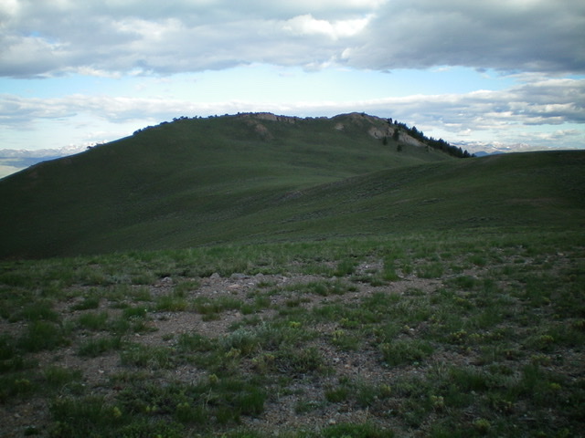
The summit ridge of Peak 8319 as viewed from the east. The right/north end of the ridge is a corner point. The summit high point is behind it (west of it) on a rocky connecting ridge. Livingston Douglas Photo
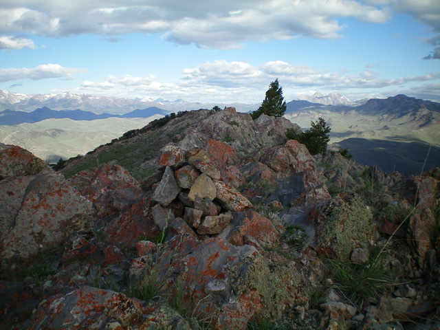
Looking west along the summit ridge of Peak 8319 from the corner point. The measured summit is at the west end of this short, rocky ridge section. Livingston Douglas Photo
East Ridge/North Shoulder, Class 2
The Descent
From the summit, return east to the saddle and the 2-track road at the base of the summit ridge, southwest of Point 8194. Leave the road and bushwhack northeast through sagebrush to the top of Point 8194. From Point 8194, descend northeast to just below a saddle at the base of Appendicitis Hill. Scramble east a short distance through sagebrush to reach the saddle and a 2-track road there. This is the connecting saddle with Appendicitis Hill and it concludes the first leg of today’s two-peak journey. Appendicitis Hill is up next.
Additional Resources
Regions: EASTERN IDAHO->Pioneer Mountains
Mountain Range: Pioneer Mountains
Longitude: -113.47959 Latitude: 43.71119