Elevation: 8,347 ft
Prominence: 484
This peak is not in the book. Updated September 2023
Black Pearl Peak is another Lick Creek Range peak scoped out by John Platt. This peak sits directly south of Pearl Peak. The mountain is typical of Lick Creek Range peaks with lots of exposed granite, slopes with burned trees both standing and fallen, and a vertical North Face. USGS Box Lake
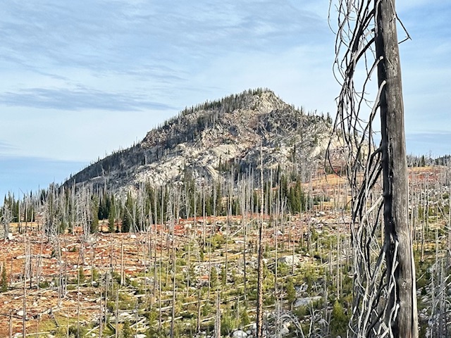
Black Pearl Peak viewed from the lower slopes of Paintbrush Peak.
Access
The easiest access is from the west. Follow Warren Wagon Road [(B)(2) on Page 135] north from its junction with ID-55 for 14.0 miles to a turnoff FS-432 (which is sometimes signed for the Crestline trailhead). This rough road is passable for Subaru type vehicles. Follow this road as it switchbacks up the mountain for 5.0 miles to its junction with FS-1525. FS-1525 leads to the starting point for an ascent of Pearl Benchmark. Keep right following FS-432 for another 1.6 miles to the large Crestline Trailhead parking lot at an elevation of 7,200 feet.
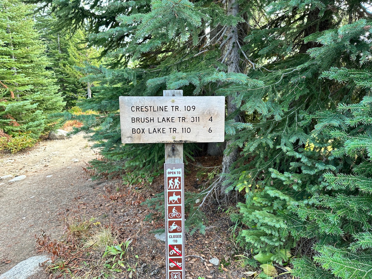
The start of FST-109.
From the trailhead, hike the Crestline Trail, FST-109 for one mile. This trail is in great shape, open to motorcycles and not where it is located on the most recent Forest Service Topo map. At this nondescript point (45.08228/-115.98446) you will leave the Crestline Trail to head northeast toward Black Peak and Paintbrush peaks. See the map below.
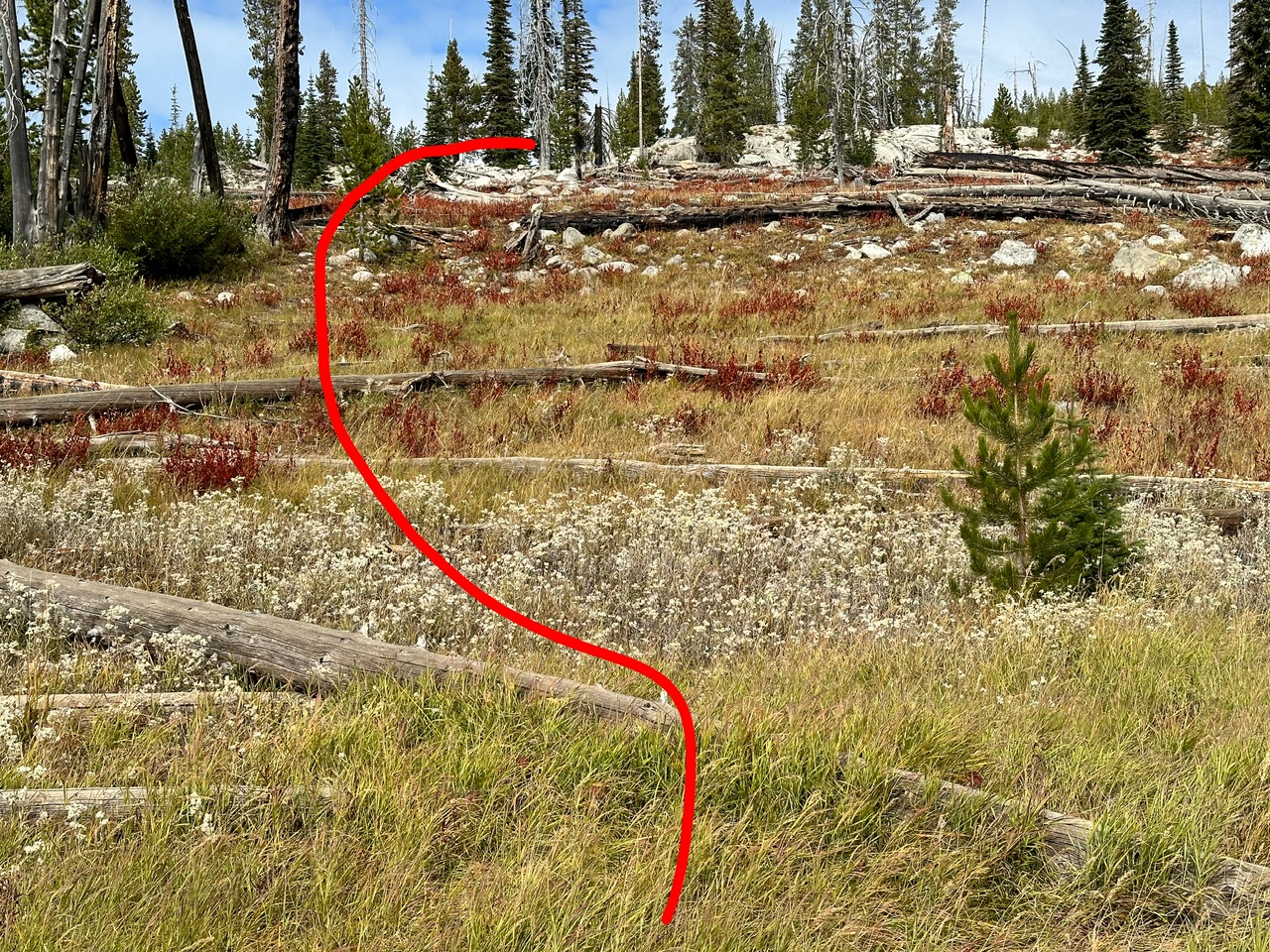
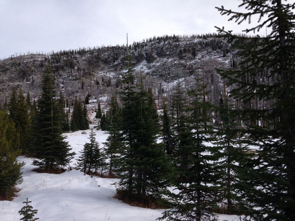
The view from waypoint 45.08228/-115.98446.
Head due north up a small rise and then look to the northeast. If you are lucky you will spot a rock cairn. From the first cairn you should be able to follow a faint tread and other cairns northeast until you reach roughly 7,600 feet of elevation. You will note on the map below that I missed this turn on my ascent and headed off to the east. This counter clockwise route is doable but not recommended because it encountered a lot of downfall.
South Ridge/Southwest Face, Class 2+
From the 7,600 contour continue north to the base of Black Pearl Peak’s south ridge. The peak’s West Face can be climbed via a number of different lines. In 2014 we climbed the a gully that cuts the west face. In general make a climbing ascent along the west side of the ridge to the summit. See John Platt’s trip report.
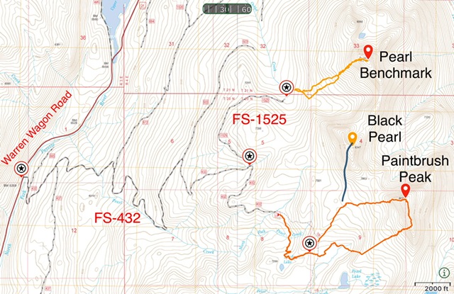
Access and routes for Pearl, BM/Black Pear and Paintbrush peaks.
Here are a few photos from my ascent with John Platt, John Fadgen and Art Troutner in 2014.
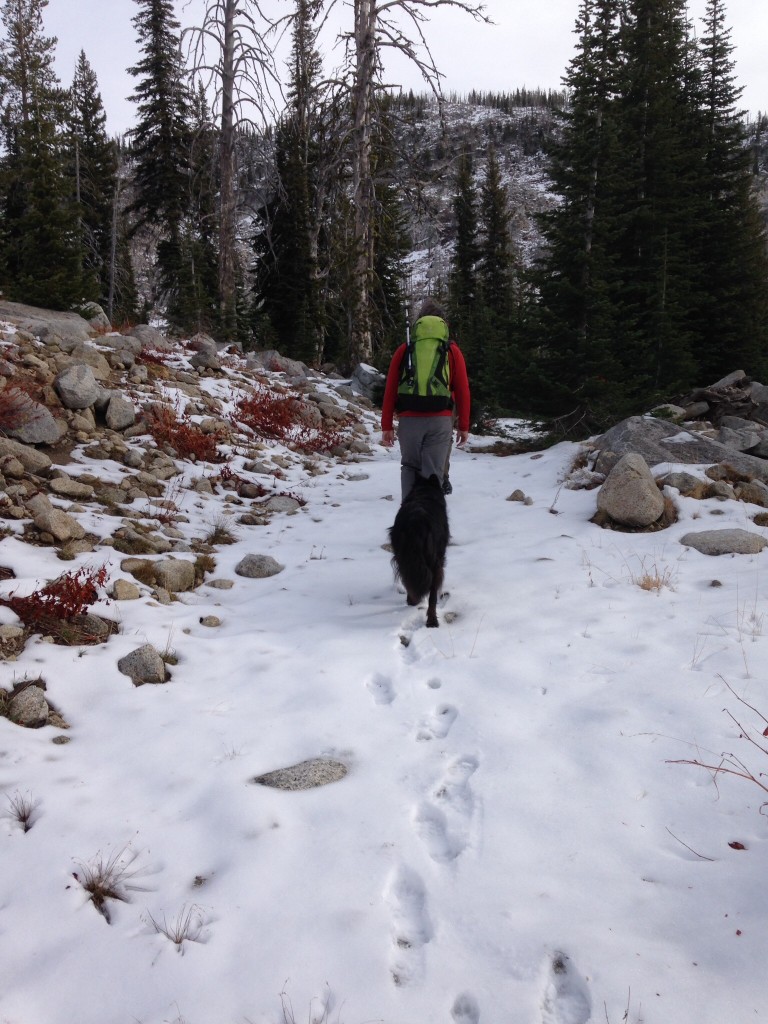
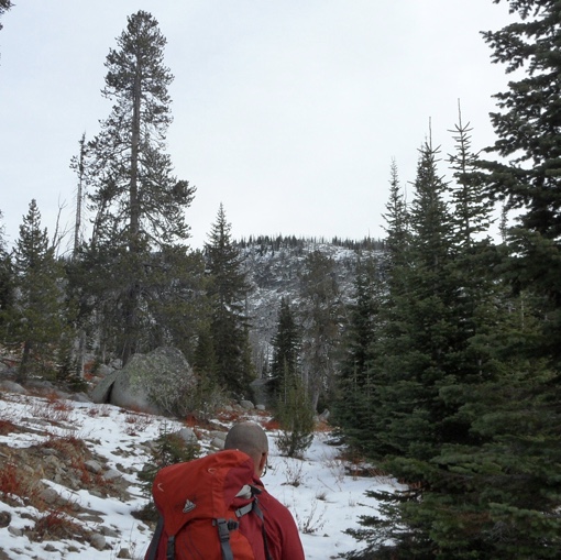
The approach to Black Pearl Peak.
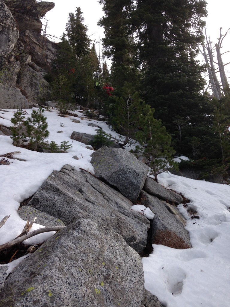
Midway up the West Face of Black Pearl Peak.
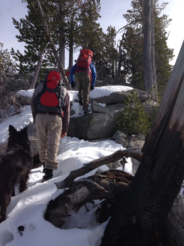
Moving up the summit ridge.
The West Face of Black Pearl Peak.
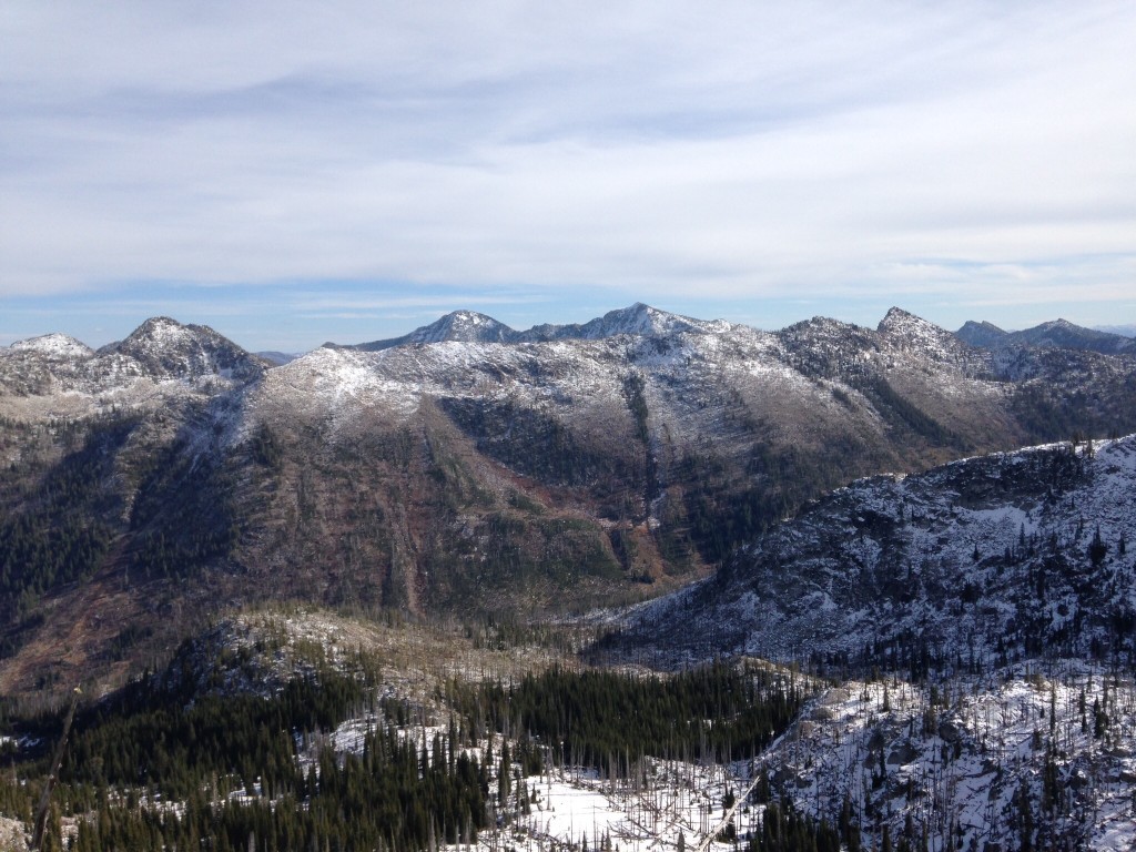
Looking west from the summit of Black Pearl Peak. Storm Peak is on the far left. North Loon Mountain and South Loon Mountain are in the center. Lost Art Peak is the sharp point on the right.
Additional Resources
Mountain Range: Western Salmon River Mountains
Year Climbed: 2014
Longitude: -115.97529 Latitude: 45.093829