Elevation: 8,329 ft
Prominence: 589
This peak is not in the book. Published November 2021
Peak 8329 is located north of the Bayhorse townsite on the east side of Beardsley Gulch. It is most easily climbed from the Beardsley Gulch Road/FSR-052 and its west face. USGS Bayhorse
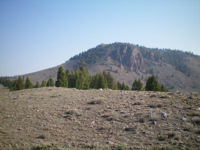
Peak 8329 as viewed from the south. Livingston Douglas Photo
Access
This is the first leg of a 2-peak adventure that includes Peak 8329 and Peak 7719. It covers 8.0 miles with 2,750 feet of elevation gain round trip.
Bayhorse Lake Road/FSR-051 is located along ID-75 exactly 7.9 miles south of the junction of US-93 and ID-75 just south of Challis. Turn right/west onto Bayhorse Lake Road and reset your odometer. At 3.1 miles, reach a pullout just below the “official use only” entrance to the Bayhorse townsite. Park here (6,100 feet).
West Face, Class 2
The Climb
From the parking pullout, walk up Bayhorse Lake Road for 0.2 miles to a signed junction with FSR-052 (“Welcome to Bayhorse” sign). There is not adequate room to park at this junction and it is at a sharp bend in the road. Please note that this is NOT the gated public entry into the Bayhorse townsite, which is 0.1 miles down the road. Leave Bayhorse Lake Road here and hike up FSR-052 (an ATV trail) as it skirts around the Bayhorse townsite, reaches a road junction (go right here), and ascends into Beardsley Gulch. Follow FSR-052 as it heads northeast then north then northwest up Beardsley Gulch to an unsigned road junction at about 7,250 feet.
This junction is just past a gully to the right and is a short distance past Point 7720+. The USGS topo map incorrectly shows this side road as heading up the gully from its base. However, the road is on the far/north side of the gully, so you must first pass the gully to reach it. Leave FSR-052 and hike northeast up this side road as it follows the left/north side of a gully. After about ½ mile, the road reaches an unsigned junction with a 2-track road (shown on the USGS topo map but not shown on the Challis National Forest Map) that heads right/southeast. Go right here and follow the 2-track road up to a semi-open saddle at the base of the west side of Peak 8329.
From the 7,660-foot saddle, scramble northeast straight up a sagebrush slope then bend right/east higher up on steep sagebrush slope with loose underlying scree/gravel. The upper 200-250 vertical feet of this face is brutal. In spite of the sagebrush, it is slow going on very loose terrain. The summit of Peak 8329 has a nice cairn and a triangulation post/wiring. It is at the west end of the summit cap, not the east end as the UGSS topo map suggests. The east end is 5-10 feet lower, according to my altimeter. The cairn and triangulation equipment are CORRECT and are on the high point.
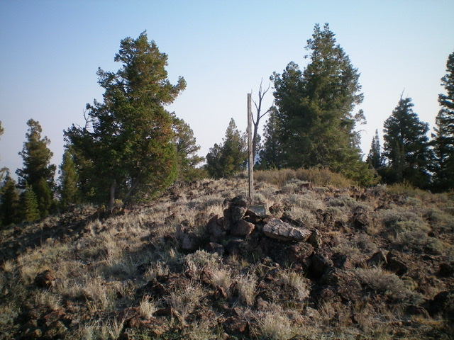
The summit of Peak 8329. Livingston Douglas Photo
The Descent
From the summit, return to the 7,660-foot saddle. Follow the 2-track ridge road as it heads south to a 7,420-foot saddle. This is the connecting saddle with Peak 7719 and concludes the first leg of today’s 2-peak adventure. Peak 7719 is up next.
Additional Resources
Regions: Eastern Salmon River Mountains->Salmon River Mountains->Southeast Corner Peaks->WESTERN IDAHO
Mountain Range: Eastern Salmon River Mountains
Longitude: -114.29709 Latitude: 44.42549