Elevation: 8,411 ft
Prominence: 551
This peak is not in the book. Published November 2022
Peak 8411 sits at the headwaters of both Blind Creek and American Creek in the Eastern Salmon River Mountains. It is most easily reached via Lower Harden Creek Road on its west side. USGS East Basin Creek
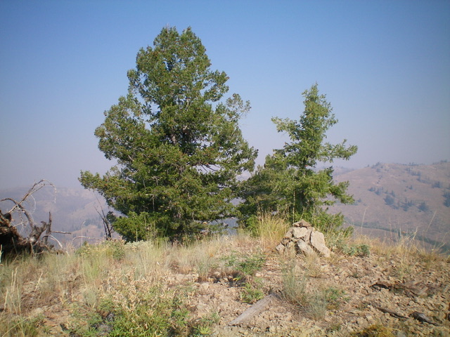
Peak 8411 (dead center) as viewed from Peak 7300 to its south on a very smoke-hazy day. Livingston Douglas Photo
Access
Lower Harden Creek Road/FSR-183 (poorly signed) is located along ID-75 about 3-1/2 miles west of Sunbeam. It is a narrow 4WD road with rocky sections and few pullouts. It is in a burn area and has fallen, charred trees that protrude into the road in spots. Bring a chainsaw and have good tires if you plan to drive up this one.
Map Errors
The USGS topo map shows a road heading up Lower Harden Creek well past where the road leaves the drainage and switchbacks west. The USGS topo map fails to show much of American Creek Road/FSR-150.
West Shoulder/South Ridge, Class 2
The Climb
From the large parking pullout at the base of Lower Harden Creek Road/FSR-183 along ID-75 (6,040 feet), hike about 1.5 miles up FSR-183 to its signed junction with American Creek Road/FSR-150 on the right. Continue another 0.5 miles up FSR-183 to just before a sharp left turn in the road where it leaves the Lower Harden Creek drainage. Leave the road here and bushwhack right/east down to Lower Harden Creek, a small stream. Cross the stream and bushwhack up a steep slope of scrub, loose gravel/dirt, burnt tree logs, and scattered pines to reach the crest of the west shoulder.
Follow the forested shoulder northeast then east through annoying brush and downed logs to reach a jeep road that crosses the shoulder just southwest of Point 7841. This decent road is American Creek Road/FSR-150. Follow FSR-150 for a short distance southeast then east to reach the crossing of a dry gully. Leave the road here and bushwhack northeast then east up the easy gully to reach the crest of the south ridge. This gully skirts the right/east side of Point 7841. Once on the ridge, follow it north-northeast over a minor hump, drop 35 feet to a saddle, then bushwhack northeast to Point 8294 in a live pine forest that blocks visibility.
From Point 8294, head north and drop 65 feet to a saddle. From the saddle, scramble north up over a final hump then climb northwest to the summit. This final push to the summit is in mostly open terrain (a mix of scrub and blowdown). The summit of Peak 8411 is burnt. It had no summit cairn so I built one. There were no signs of previous ascent.
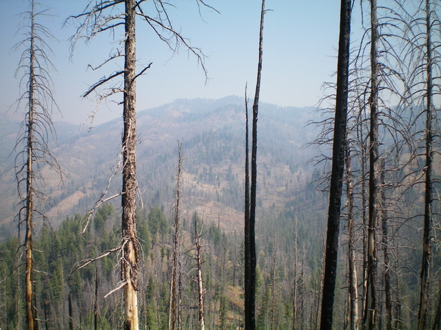
Looking up the south ridge (my ascent route) from Point 8294. The summit hump is not yet in view. Livingston Douglas Photo
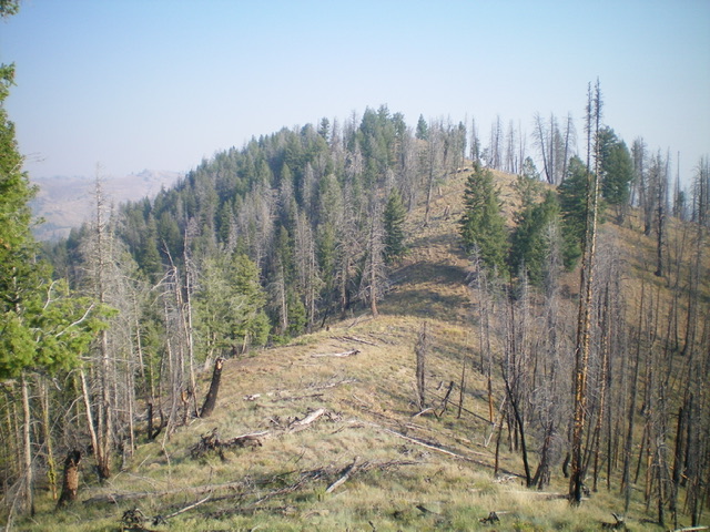
The summit of Peak 8411. Livingston Douglas Photo
South Ridge, Class 2
The Descent
From the summit, return to Point 8294 then southwest down to Point 7920+. Descend south on the forested ridge to a saddle and FSR-150. Follow FSR-150 south for a short distance to where it bends sharply left/east at the southwest end of Point 7760+. You have two choices here. Either leave the road and follow the forested ridge south-southwest to later rejoin FSR-150 much closer to Peak 7300 OR follow FSR-150 as it meanders its way to the east side of American Creek and onto a different ridge then crosses American Creek farther down to rejoin the south ridge of Peak 8411. The latter option is avoids bushwhacking but is much longer. Regrettably, this section of FSR-150 is not shown on the USGS topo map and can be confusing.
The south ridge is mostly forested and it meanders a bit as it makes its way down to the connecting saddle with Peak 7300 at a point where FSR-150 crosses the ridge to descend northwest to Lower Harden Creek Road. The south ridge is also narrow in spots. But it is a much shorter, more direct route to the connecting saddle than the road option. The terrain opens up enough to get a good look at Peak 7300 from the 6,900-foot saddle area. This saddle is the connecting saddle between Peak 8411 and Peak 7300. It concludes the first leg of today’s 2-peak adventure. Peak 7300 is up next.
Additional Resources
Regions: Eastern Salmon River Mountains->Salmon River Mountains->Southeast Corner Peaks->WESTERN IDAHO
Mountain Range: Eastern Salmon River Mountains
Longitude: -114.75479 Latitude: 44.30089