Elevation: 8,432 ft
Prominence: 372
This peak is not in the book. Published November 2020
Peak 8432 is located on the Continental Divide about two miles west-southwest of mighty Mount Jefferson (10,203 feet). It sits at the headwaters of Tin Cup Creek (ID) and above Hell Roaring Creek and Lillian Lake (MT). The easiest ascent route is via the east ridge from a saddle near the headwaters of Tin Cup Creek. The routes described are part of a 2-peak journey that includes Peak 8432 and Peak 8787 to its west. USGS Mount Jefferson
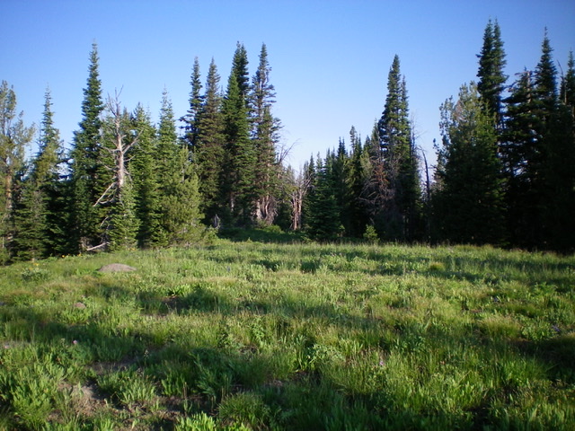
The semi-open summit area of Peak 8432. Livingston Douglas Photo
Access
Willow Creek Road/FSR-046 is located on the north side of Fremont County Road A-2 (the Yale-Kilgore Road) approximately 12 miles west of US-20 on the north side of Island Park, ID. Drive 2.9 miles north up Willow Creek Road to the road closure gate. Park here in a pullout area (7,040 feet).
East Ridge, Class 2
The Climb
From the road closure gate, follow a foot path (used mostly by horses) from the gated closure northeast to the Continental Divide. If you lose the weakening foot path as you approach the CD (as I did), scramble north up through grass/sagebrush to find the trail and/or to quickly reach the CD just above (and west of) a ridge saddle. There is a cairn and post on the CD where the foot path reaches it. The foot path/trail ends here (8,090 feet).
Scramble west up the ridge in semi-open terrain of pines and veg. Climb over a ridge hump then descend 45 vertical feet to a minor saddle. Continue west then northwest up through a pine forest to reach the semi-open summit of Peak 8432. There was no summit cairn. The nearby forested ridge area is 5-10 feet lower than the semi-open summit area.
Northwest Ridge, Class 2
The Descent
From the summit, descend northwest through a pine forest on the ridge crest until you reach a good point to descend west through the pine forest to an open meadow and ridge saddle below at 7,940 feet. This is the connecting saddle between Peak 8432 and Peak 8787. It concludes the first leg of today’s 2-peak journey. There is some blowdown to contend with in the forested descent to the saddle but it’s not too bad.
Additional Resources
Regions: Centennial Range->EASTERN IDAHO
Mountain Range: Centennial Range
Longitude: -111.54219 Latitude: 44.55319