Elevation: 8,440 ft
Prominence: 1,520
This peak is not in the book. Published January 2023
Peak 8440 is the highest of the forested humps that sit above Mike Spencer Canyon. It has a significant amount of prominence for a peak in this section of the Snake River Range. Peak 8440 is most easily reached by its east ridge via FSR-162 and FST-301. It still requires a difficult bushwhack up onto the east ridge. Bushwhacking in this area can be absolutely brutal, so minimize your off-trail activity. USGS Stouts Mountain
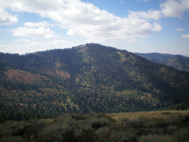
Peak 8440 as viewed from Spencer Peak to its northeast. Livingston Douglas Photo
Access
From the signed junction of US-26 and ID-31 in Swan Valley, drive east on ID-31 for 8.0 miles to a signed junction with Mike Spencer Canyon Road/FSR-250. Drive 1.9 miles east up FSR-250 to its end at a large trailhead parking area (6,255 feet), which is 0.1 miles past a signed junction with FSR-162 (a narrow, rocky, very rugged 4WD road). This is the second leg of a 3-peak adventure that includes Peak 8440, Peak 8116 and Spencer Peak (8,142 feet).
Map Errors
The USGS topo map fails to show the extent of the trails in this area. It is missing FST-065 and much of FST-301. In addition, the USGS topo map labels FST-301 as FST-201. These are critical oversights because the bushwhacking in this area is wicked and trails are helpful in mitigating that difficulty.
Northeast Shoulder, Class 3
The Climb
From the trailhead parking area, walk down FSR-250 to its junction with FSR-162. Hike east then southeast up FSR-162 for about 1.6 miles to reach a signed “T” junction with FST-301 and a bridge crossing. The elevation here is about 6,850 feet. From here, FST-301 is a foot trail heading left and an ATV trail heading right. Go right/south and follow the ATV trail across a good footbridge. Continue up the ATV trail until it is about to head left to cross a gully in a thickly forested area (7,275 feet).
Leave the trail and bushwhack right/west directly up through a dense forest with thick underbrush to reach the crest of the northeast shoulder. While this is the most direct route to the summit of Peak 8440, it is a VERY DIFFICULT bushwhack. The terrain is mostly thick brush, chest-high willows, and scattered pines. It is a battle to make any progress. In retrospect, it is probably better to stay on FST-301 to a higher level then bushwhack up onto the east ridge.
Once on the rounded, ill-defined northeast shoulder, bushwhack through thick brush and willows to finally reach easier terrain higher up. The terrain becomes a mix of easier scrub and semi-open pine forest. The summit of Peak 8440 is semi-open and has two potential high points. The summit area is a ridge crest. The west end seemed to be the highest point. I built a cairn there. But when I returned to the east end, the two pine trees there measured slightly higher on my altimeter. It’s anybody’s guess because the entire area lies above the final contour line.
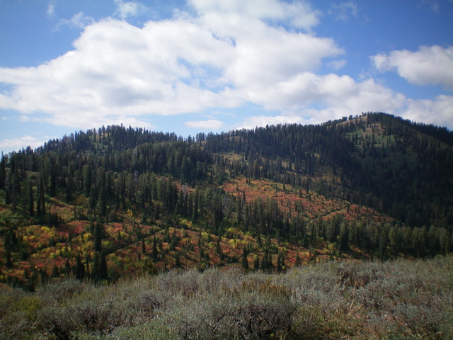
Peak 8440 (summit is at far left) and its forested northeast shoulder (skyline right of summit), my ascent route. Livingston Douglas Photo
East Ridge, Class 2
The Descent
From the east end of the summit area, follow the ridge east-southeast to Point 8136 in mostly open scrub initially. The ridge soon becomes a tedious mix of forest, blowdown, and tall scrub. From Point 8136, descend northeast then east through easy, open pine forest (with some open areas of scrub) to reach a flattish area at about 7,800 feet. Bushwhack east then southeast through this mess to reach a saddle at 7,690 feet and find FST-065 there. This flattish bushwhack is a miserable mix of ridge pines, deadfall, thick/tall scrub, and some sections of willows.
There are some minor ups and downs as well. The east ridge of Peak 8440 weaves all over the place and offers limited visibility due to the pine forest. There is no trail here, not even any game trails. Animals aren’t stupid enough to wander around up here. The 7,690-foot ridge saddle is in easy pine forest and is a JOY. This is the connecting saddle with Peak 8116 and concludes the first leg of today’s 3-peak adventure. Peak 8116 is up next.
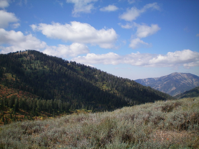
Peak 8440 (summit is at far right) and its semi-forested east ridge (skyline left of summit), my descent route. Livingston Douglas Photo
Additional Resources
Mountain Range: Big Hole and Snake River Mountains
Longitude: -111.25279 Latitude: 43.51179