Elevation: 8,142 ft
Prominence: 422
This peak is not in the book. LOJ calls this peak Spencer Benchmark. Peakbagger.com refers to this peak as Mike Spencer Peak. Published January 2023
Spencer Peak is a semi-open summit that, unlike other peaks in the area, is easy to reach via FST-301 and its south ridge/face. It offers beautiful views of the surrounding area. Spencer Peak is the high point on a ridgeline that sits on the north side of Mike Spencer Canyon. USGS Fourth of July Peak
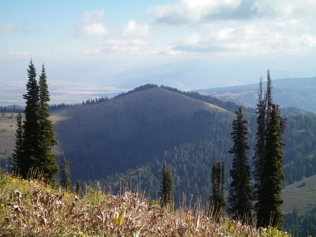
Spencer Peak (dead center) as viewed from Peak 8440 to its southwest. Livingston Douglas Photo
Access
Same as for Peak 8440. This is the third leg of a 3-peak adventure that includes Peak 8440, Peak 8116 and Spencer Peak (8,142 feet).
Map Errors
The USGS topo map fails to show the extent of the trails in this area. It is missing FST-065 and much of FST-301. In addition, the USGS topo map labels FST-301 as FST-201. These are critical oversights because the bushwhacking in this area is wicked and trails are helpful in mitigating that difficulty.
South Ridge/Face, Class 2
The Climb
From the 7,690-foot saddle at the base of the south face, leave FST-065 and bushwhack through a short, easy patch of pine forest to reach the open sagebrush face. Scramble up the steep sagebrush, weaving as necessary to make progress. The summit of Spencer Peak is a ridgeline summit and has a decent cairn. I rebuilt the cairn and stuck a triangulation post in it. There was no sign of a USGS benchmark.
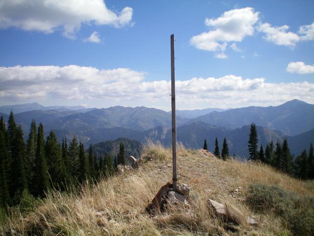
The summit of Spencer Peak. Livingston Douglas Photo
Northwest Ridge/West Gully, Class 2
The Descent
From the summit, descend the northwest ridge in open scrub to near a ridge hump. Leave the ridge here and descend west down the open scrub on the southwest face to reach a forested gully. Follow a game trail (of sorts) in the center of the dry gully in relatively easy terrain without much brush or blowdown. You will soon find FST-301 lower down in the gully. Follow FST-301 for a short distance to reach FSR-162. Hike down FSR-162 to its junction with FSR-250 then hike up FSR-250 for 0.1 miles to the trailhead parking area and your awaiting vehicle.
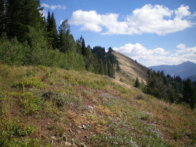
Looking up the northwest ridge of Spencer Peak (my descent route) at the summit hump. Livingston Douglas Photo
Additional Resources
Mountain Range: Big Hole and Snake River Mountains
Longitude: -111.2301 Latitude: 43.5245