Elevation: 8,445 ft
Prominence: 305
This peak is not in the book. Published November 2022
Peak 8445 sits at the southeast end of a ridgeline that separates the West Fork Warm Springs Creek from Moonlight Gulch. It is overshadowed by its more popular brother (Allen Mountain) to its east. It is best climbed in combination with nearby Allen Mountain. USGS Griffin Butte
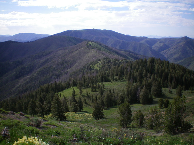
Peak 8445 is the semi-forested hump in mid-ground (dead center) as viewed from the northwest. Livingston Douglas Photo
Access
From ID-75 in Ketchum, turn diagonally left onto [signed] Warm Springs Road. Reset your odometer at this junction. At 2.7 miles, enter the Sawtooth National Forest. At 5.9 miles, reach a signed junction with FSR-049. Drive about 70 yards up FSR-049 and park in a shaded pullout area along the road (6,110 feet). GPS coordinates: 43⁰40’02”N, 114⁰27’10”W.
East Ridge, Class 2
The Climb
This is the second leg in a 2-peak adventure that includes Allen Mountain (8,580 feet) and Peak 8445. From the 7,860-foot connecting saddle with Allen Mountain, follow FST-146 briefly northwest as it heads uphill. It soon crests and turns left/southwest to skirt the south side of Peak 8445. Leave the trail here and bushwhack north across easy, open terrain (field grass) to reach the crest of the east ridge. Scramble west up through field grass then a pine forest to reach the summit ridge. Head right/north to reach the cairned high point.
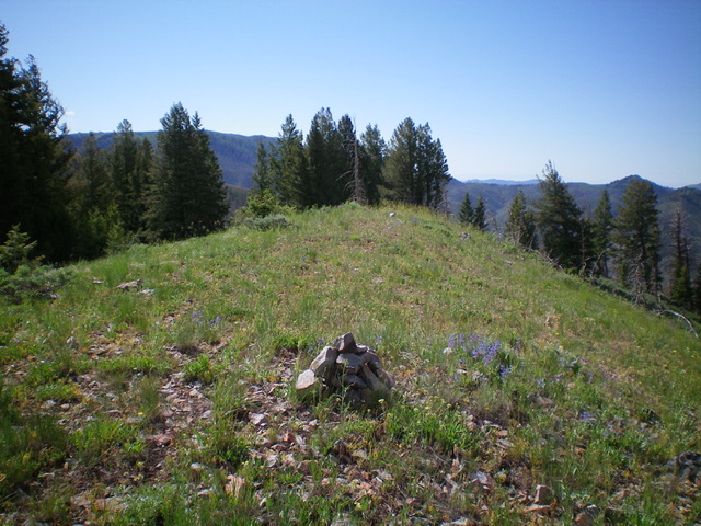
The summit of Peak 8445. Livingston Douglas Photo
South Ridge/Southwest Face, Class 2
The Descent
From the summit, descend southeast (briefly) then south on the vegetation-covered ridge, skirting blowdown (some charred) as necessary to reach a minor saddle just north of Point 7908. The south ridge is not a pleasant place. The sagebrush is thick and there are areas of dense willows. Once on the saddle, leave the ridge and descend southwest (staying left/south of a patch of thick aspens), staying just south of a dry gully. The sagebrush and willows on this descent are simply brutal. And there is blowdown thrown in just for good measure. Continue straight down the slope to intercept FSR-049. Once on FSR-049, follow it northwest then west through two switchbacks as it descends to a sharp left/south turn at a dry gully that heads north. Continue another 1.7 miles down FSR-049 to reach its junction with Warm Springs Road and your parked vehicle.
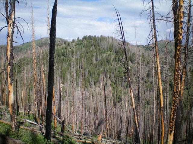
Peak 8445 (dead center) as viewed from the southeast. Livingston Douglas Photo
Additional Resources
Regions: Smoky Mountains->WESTERN IDAHO
Mountain Range: Smoky Mountains
Longitude: -114.46079 Latitude: 43.69201