Elevation: 8,455 ft
Prominence: 395
This peak is not in the book. Published August 2021
This peak is located south of Tyee Mountain. The peak offers impressive views of the Sawtooth Range. USGS Swanholm Peak
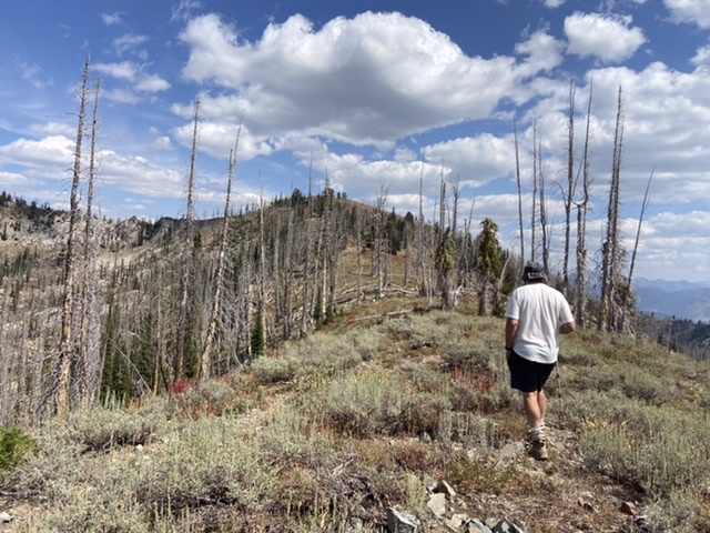
Hiking up the broad west ridge
Access
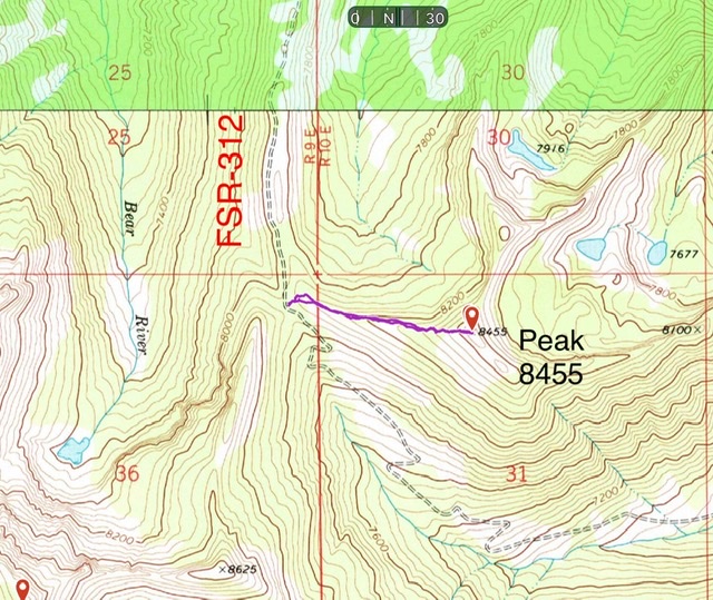
To access the peak via FSR-312/Graham Road [(B)(2.1) on Page 153], take ID-21 from Boise for 55 miles to the turn for FSR-384 at the [signed] Edna Creek Campground turn. Turn onto the excellent FSR-384 gravel road and follow it to FSR-312 in 4.0 miles. FSR-312 is a relatively good road but it has rough, steep spots. It is not recommended for passenger vehicles. The main intersections are signed for Graham Road. Note: Google Maps does not give good directions for this area.
The road crosses a pass between Archie Mountain and Peak 7561, continues to another pass and a junction with Jackson Peak Road, and then descends into the upper reaches of Crooked River. The road climbs out of the Crooked River drainage to yet another pass and then crosses the east face of Peak 8498 and then wiggles its way to yet another pass at the base of Peak 8455’s west ridge. There is good parking (and a campsite) on the north side of the road. Park here.
West Ridge, Class 2
From the parking area, climb up the steep slope to the top of the west ridge. Follow the broad ridge to the summit. My GPS track recorded 1.0 mile with 362 of elevation gain round trip.
Additional Resources
Regions: Boise Mountains->WESTERN IDAHO
Mountain Range: Boise Mountains
Year Climbed: 2021
Longitude: -115.32089 Latitude: 43.99179