Elevation: 8,460 ft
Prominence: 1,800
This peak is not in the book. Published July 2018
Marshall Fin is located due south of Marshall Mountain and north of California Lake. It is the highest point in the area and has 1,800 feet of prominence. USGS War Eagle Mountain
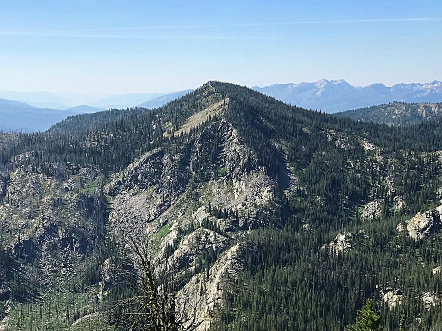
Marshall Fin as viewed from Marshall Mountain.
Access
This peak can be reached by road from the west or the south. Western access is via FS-318. Southern access is from Secesh via FS-325. The best route is from the west. Google Maps will give you directions if you search for Marshall Mountain.
Western Access and Routes
From Warren Wagon Road, turn north onto FS-246 which quickly leads past the Burgdorf Hot Springs Resort. Turn onto FS-318 at a road junction located 5 miles past the resort. Follow this road, reportedly suitable for high-clearance vehicles, for 6.7 miles where it junctions with FS-325. Follow FS-318 south to access the peak. The peak can be climbed from almost anywhere along FS-325, but the best route is from the saddle northwest of the summit. The forest varies in density but is not a difficult obstacle.
Alternate Access and California Lake Route, Class 2
Pat McGrane and I hiked to this summit from California Lake, which is located to the south along FS-325. Google Maps will not give you directions for reaching California Lake from the south. To reach the lake, take Warren Wagon Road north from McCall to its junction with the Burgdorf Road/FS-246 and reset your odometer. Continue east on Warren Wagon Road for 2.7 miles and turn north onto FS-325.
This road is shown as an improved road on the Payette National Forest map (there are bridges along the way) but the farther you go, the worse the road becomes. It is no longer an improved road. A 4WD vehicle with AT tires is recommended. The road reaches California Lake in 7.8 miles. From the lake, it is another 5.0 miles to the junction with FS-318 and FS-320 at the West End of Marshall Mountain’s summit ridge. This 5.0 miles definitely requires a real 4WD vehicle and good tires. There are 2 good camping sites at the lake.
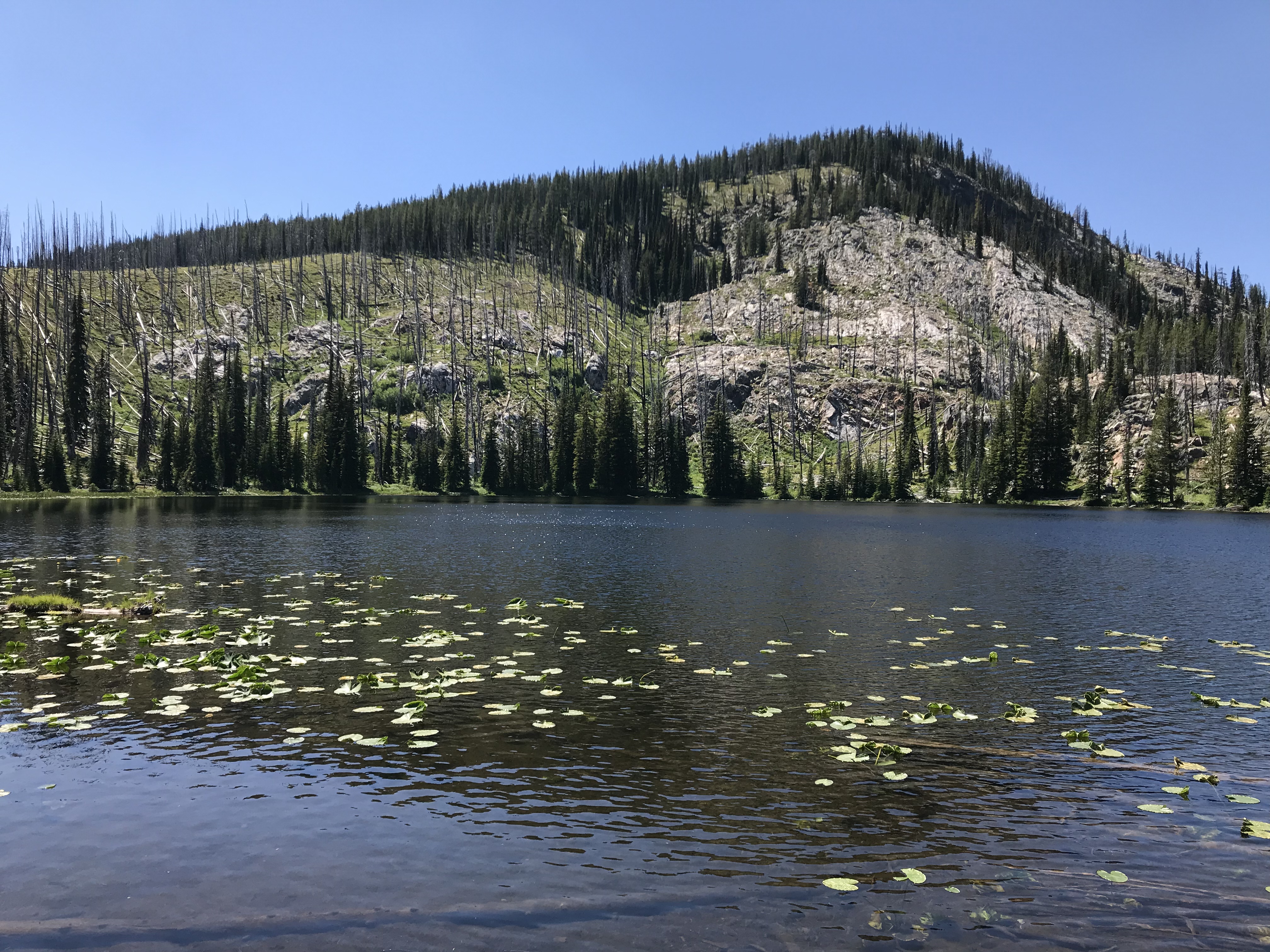
California Lake represents one of the many types of terrain found in the northwest corner of the Salmon River Mountains.
From the lake, the best route follows the road to the peak’s West Slopes. Ascend these slopes to the summit as shown on the map below which was part of a 3-peak trip. It is roughly 2.5 miles and 1,200 vertical feet to the summit.
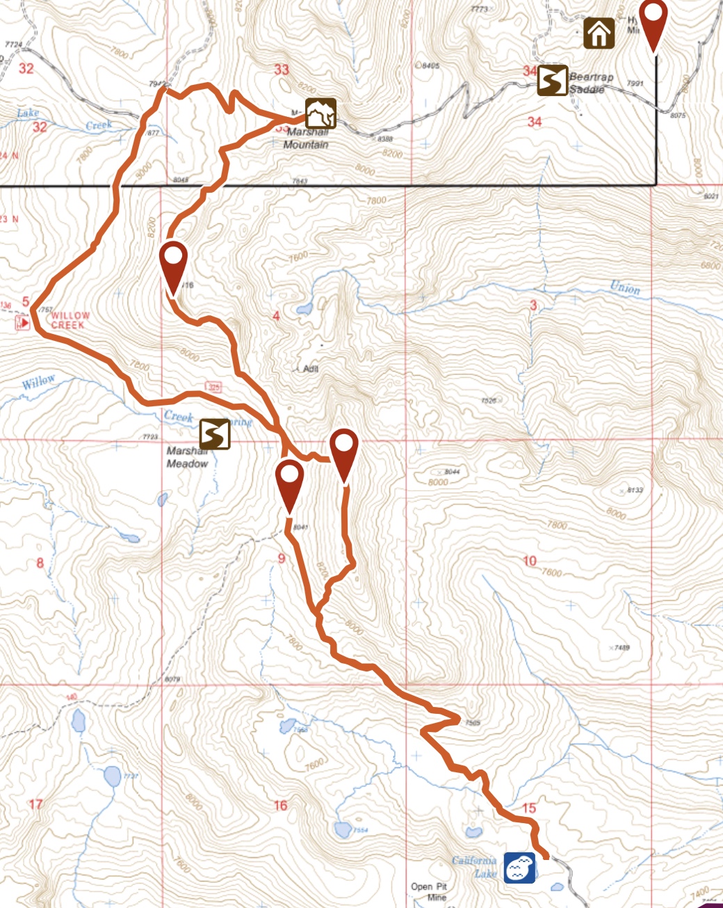
My GPS track for Marshall Mountain and the two peaks with an elevation of 8,460 feet. I highly recommend this scenic ridge walk.
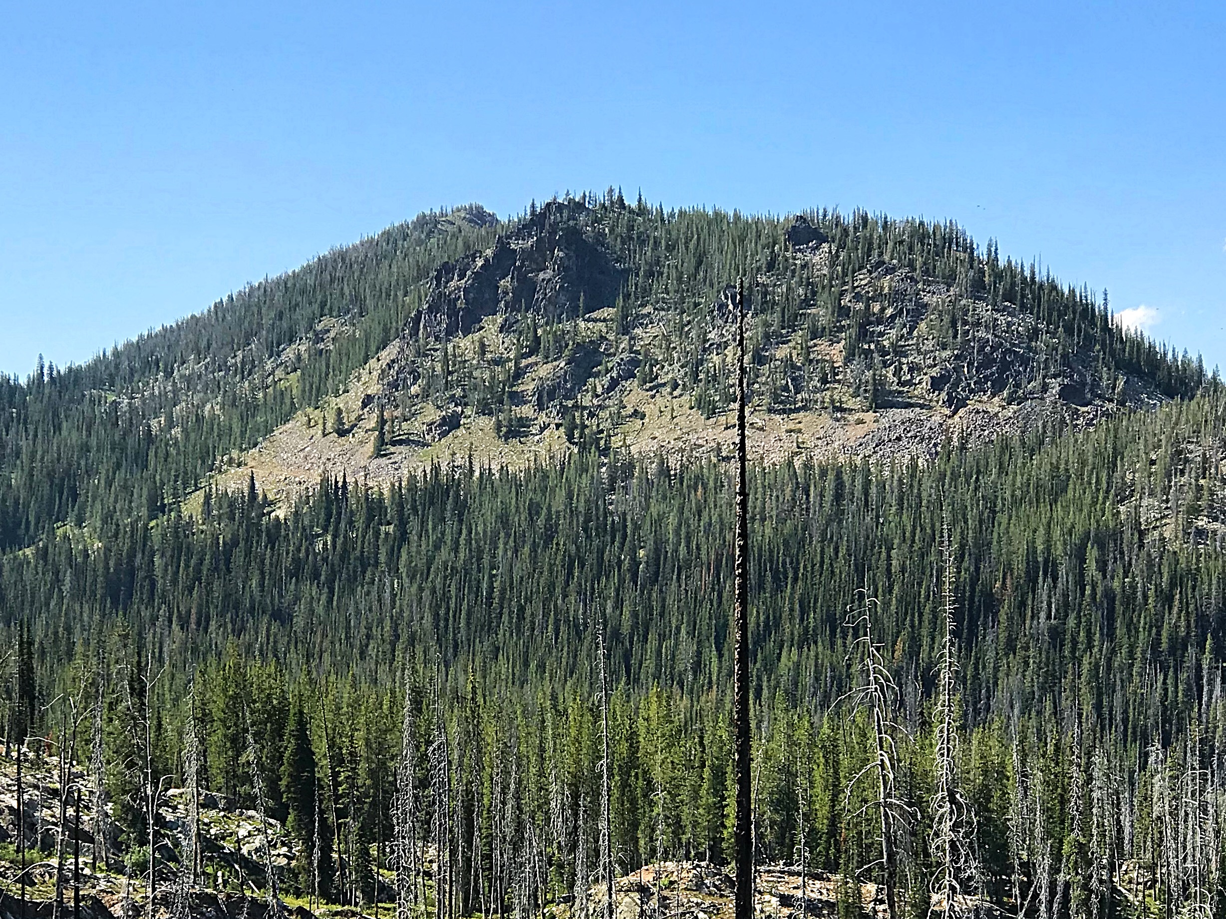
Marshall Fin as viewed from just above California Lake.
Additional Resources
Regions: Northwest Corner Peaks->Salmon River Mountains->WESTERN IDAHO->Western Salmon River Mountains
Mountain Range: Western Salmon River Mountains
Year Climbed: 2018
Longitude: -115.84449 Latitude: 45.35229