Elevation: 8,485 ft
Prominence: 465
This peak is not in the book. Published November 2022
West Fisher Creek Peak is located on an open ridgeline that sits above Fisher Creek in the White Cloud Peaks. While there are patches of forest in this area, it is mostly sagebrush and field grass and has ample signs of deer and elk. West Fisher Creek Peak is slightly lower than its ridgeline neighbor to the east, East Fisher Creek Peak (8,533 feet). USGS Obsidian
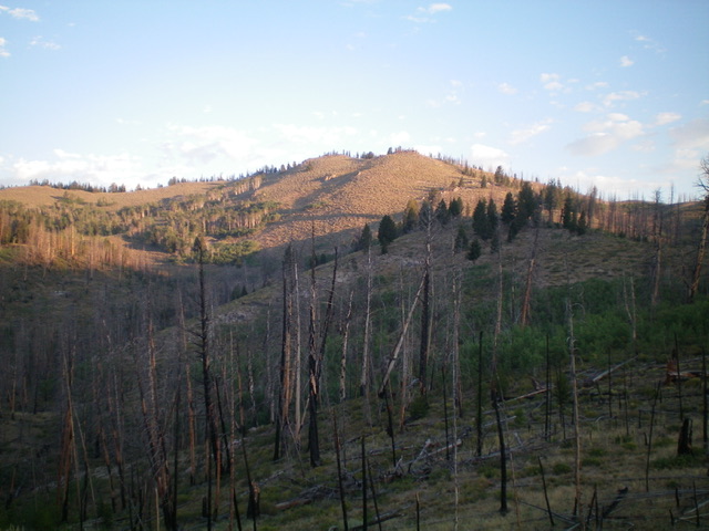
West Fisher Creek Peak as viewed from midway up the southeast ridge (my ascent route). Livingston Douglas Photo
Access
From ID-75 south of Stanley, turn right/east onto [signed] Fisher Creek Road/FSR-132. Drive 3.7 miles up FSR-132 to a small pullout on the left-hand side of the road. Park here (7,255 feet). GPS coordinates: 44⁰03’43”N, 114⁰46’26”W. This pullout is at the base of a ridge and is between two prominent gullies on the north side of the road.
Southeast Ridge, Class 2
The Climb
From the parking pullout, scramble north up onto the ridge. This is a burn area with areas of downed, charred timber and standing snags (though not many). Higher up, the terrain is a mix of aspen patches and scattered live pines. The southeast ridge is a combination of scrub, field grass, and scattered, downed logs and trees. The ridge weaves a bit but is easy to follow. There is no thick forest and only two minor ridge humps to navigate. The summit is a small rock/pine hump with some large boulders, ridge pines, and a tall post. I built a cairn atop the highest boulder.
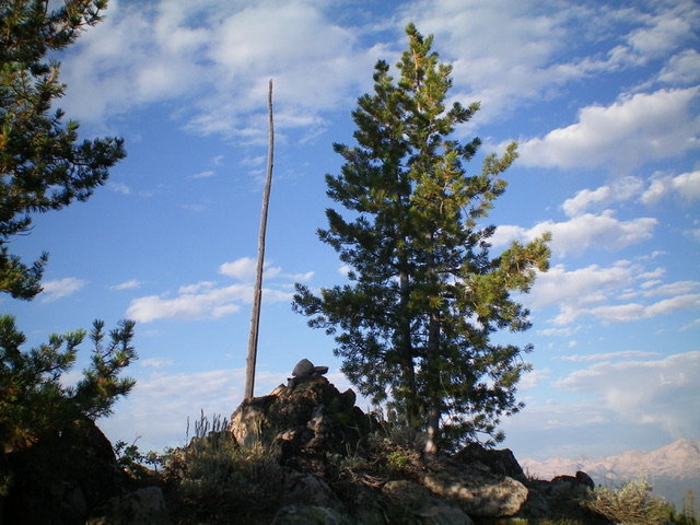
The summit cairn/post atop West Fisher Creek Peak. Livingston Douglas Photo
East Ridge, Class 2
The Descent
From the summit, descend north through a thick pine forest to find a ridge. Follow the forested ridge (with lots of blowdown) over a minor hump then up to a bigger, open ridge hump. This second hump gives visibility and the correct semi-open ridge which connects with East Fisher Creek Peak. Descend this ridge east then northeast through a patch of pine forest to reach open sagebrush terrain. Aim eastward at the obvious summit hump of East Fisher Creek Peak, which is on a north-south ridgeline. The ridge wiggles a bit and has some minor ups and downs before reaching the 8,020-foot connecting saddle with East Fisher Creek Peak. This saddle concludes the first leg of today’s 2-peak adventure. East Fisher Creek Peak (8,533 feet) is up next.
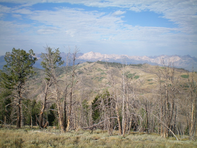
West Fisher Creek Peak (mid-ground) as viewed from the east. Livingston Douglas Photo
Additional Resources
Regions: EASTERN IDAHO->White Cloud Mountains
Mountain Range: Pioneer Mountains
Longitude: -114.78929 Latitude: 44.07509