Elevation: 8,620 ft
Prominence: 800
This peak is not in the book. Published October 2018
This peak is one of 6 peaks on the impressive East-West ridge line which parallels Lick Creek and the Lick Creek Road. Hum #4 is located between Hum #3 and Hum #5. John Platt and John Fadgen made the first ascent in September 2018. USGS Enos Lake

Hum #4 as viewed from Hum #5. John Platt states: “The highest point (right) looks lower but is just farther away.”
Access
Access this peak from Lick Creek Road [(B)(3) FH-48 Yellow Pine/Lick Creek Road on Page 136]. Park at roughly 5,300 feet. See the GPS track below.
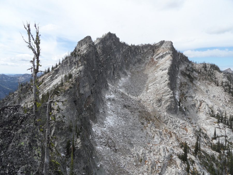
West Ridge, Class 3
See the map below for the Platt/Fadgen Route and read John’s trip report for additional details. Getting to the Hum #3/Hum #4 saddle is likely the crux of the climb. There route covered 4.3 miles with nearly 3,500 feet of elevation gain.
The West Ridge of Hum #4. John Platt Photo
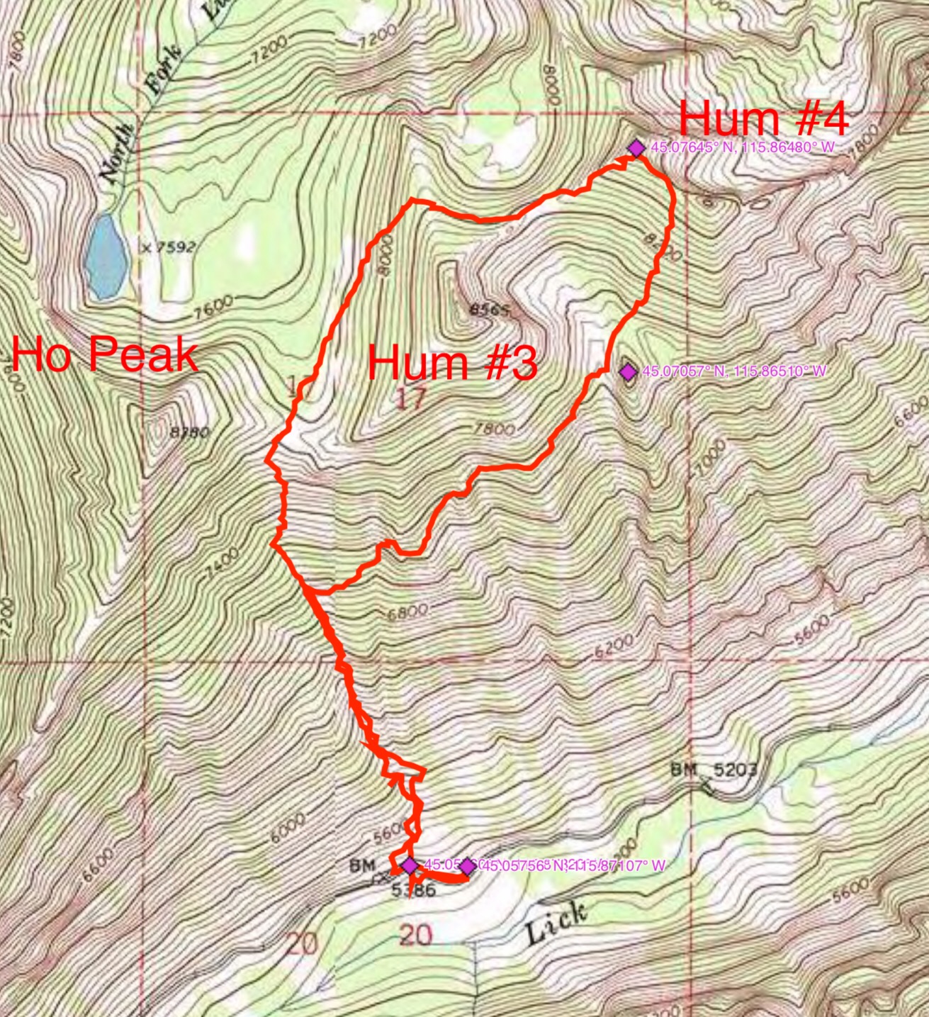
John Platt’s GPS track for the first ascent of Hum #4.
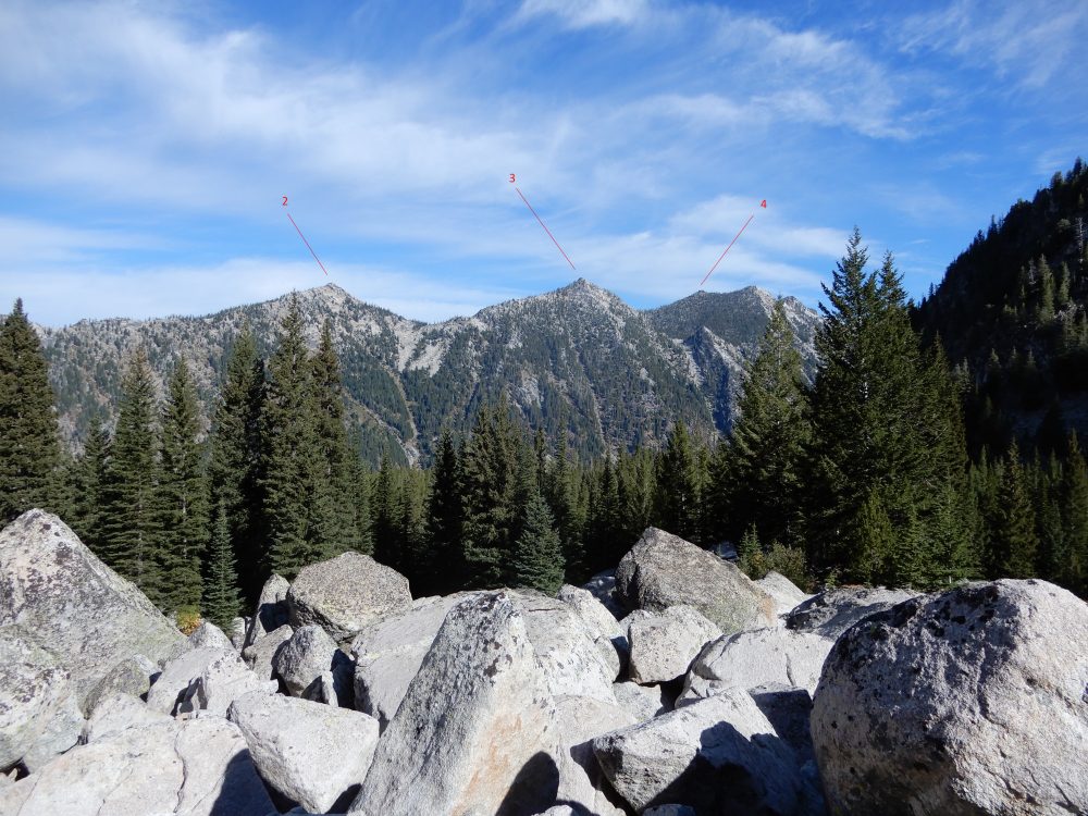
Hum Ridge as viewed from the southwest. John Platt Photo
Additional Resources
Mountain Range: Western Salmon River Mountains
First Ascent Information:
- First Ascent Year: 2018
- Season: Summer
- Route: West Ridge
- Party: John Platt and John Fadgen
Longitude: -115.86469 Latitude: 45.07659