Elevation: 8,409 ft
Prominence: 389

This peak is not in the book. Updated October 2018
Peak 8409 is the easternmost peak on the impressive East-West ridge line that parallels Lick Creek and Lick Creek Road. The ridge has 6 ranked summits and sufficient exposed granite to challenge the most ambitious mountaineers. The West End of the ridge is anchored by Humdinger Peak and the East End by Peak 8409 (Hum #5). The other peaks, from West to East, are Peak 8380 (Hum Peak), Peak 8380 (Ho Peak), Peak 8556 (Hum #3) and Peak 8620 (Hum #4). John Platt and John Fadgen climbed 4 of the 6 peaks in August 2015 in one long, difficult day. See their trip reports (which are linked on the pages for each peak) for additional details. They climbed Peak 8409 (which proved to be a difficult mountaineering problem and a first ascent) in September 2015. USGS Enos Lake
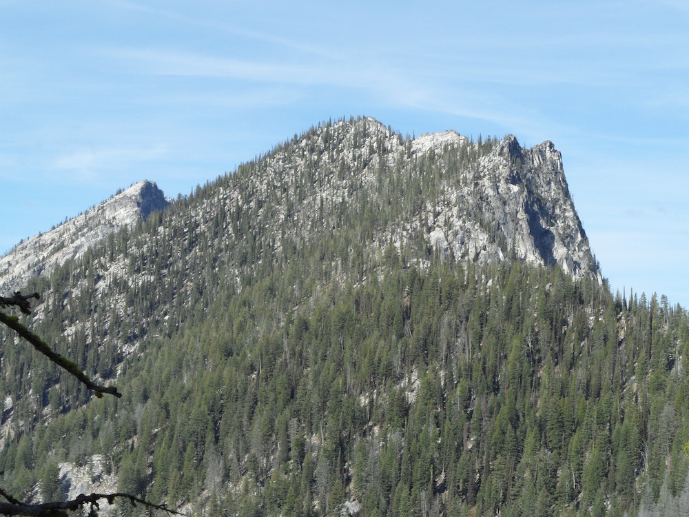
Hum #5 (right) and Hum #4 (left). John Platt Photo
Access
Access this peak from Lick Creek Road [(B)(3) FH-48 Yellow Pine/Lick Creek Road on Page 136]. Follow the road down and east from Lick Creek Summit to the Split Creek trailhead.
(B)(3) FH-48 Yellow Pine/Lick Creek Road
(d) FST-081, Split Creek/Loon Lake Trail
FST-082, North Fork Lick Creek Trail. This trail is in poor condition.
East Ridge, Class 3
Hike up FST-081 to its junction with FST-082. Turn west on FST-082 and ascend it to roughly 6,100 feet. Leave the trail and follow the ridge crest toward the summit. The ridge is decorated with granite, towers and arches which can be passed on the South Side of the ridge. Before reaching the summit, you must bypass an impressive false summit. John Platt measured the round trip at 9.7 miles with 5,185 feet of elevation gain.
Hum #5 as viewed from its East Ridge with Hum #4 behind to the left. John Platt Photo
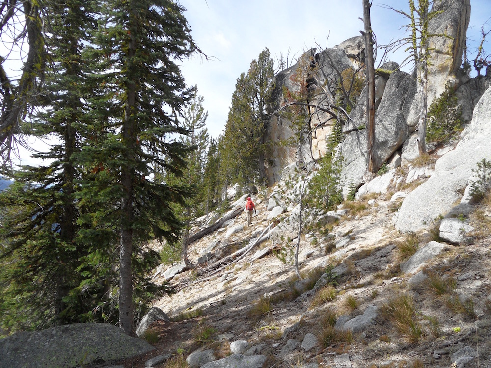
The false summit on the East Ridge of Hum #5. John Platt Photo
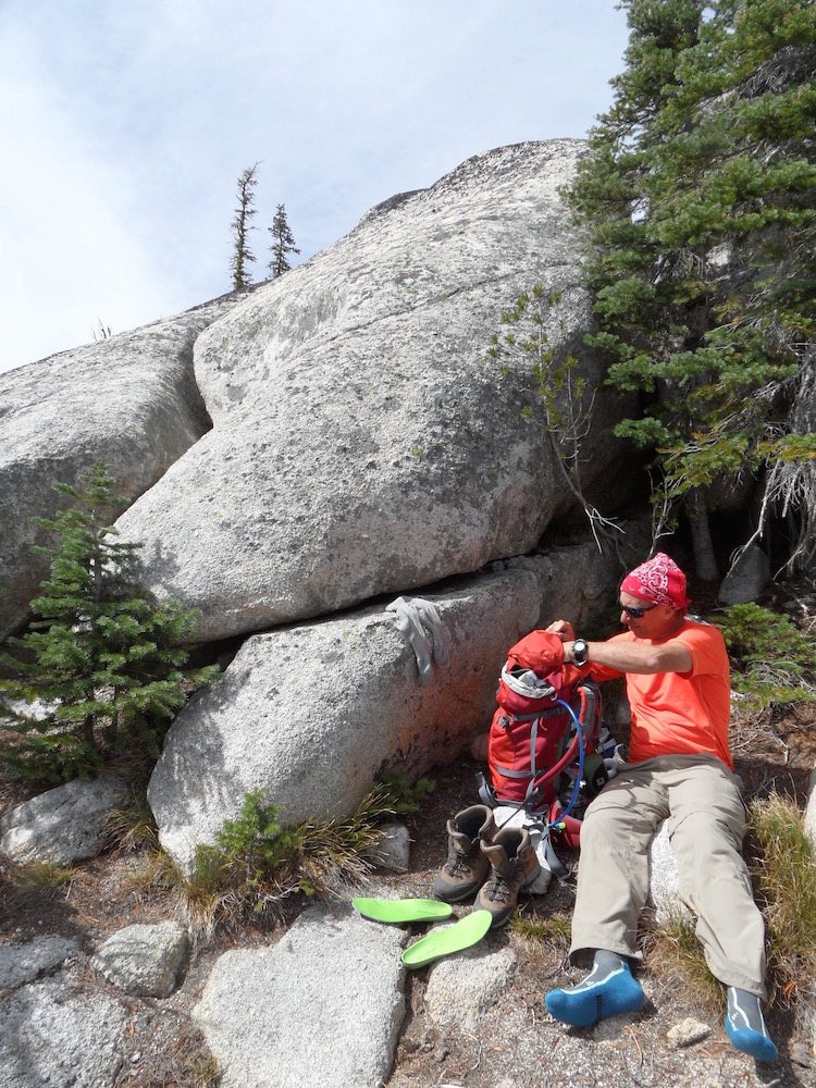
John Fadgen taking a break at the summit. John Platt Photo
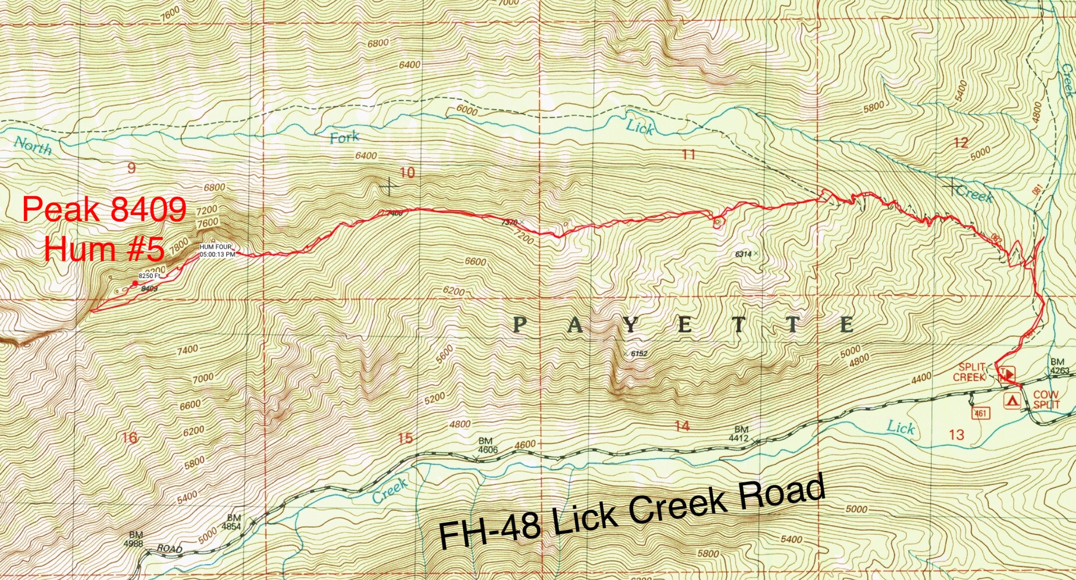
John Platt’s GPS track.
Additional Resources
Mountain Range: Western Salmon River Mountains
First Ascent Information:
- First Ascent Year: 2015
- Season: Summer
- Route: East Ridge
- Party: John Platt and John Fadgen
Longitude: -115.85209 Latitude: 45.07809