Elevation: 8,573 ft
Prominence: 593
This peak is not in the book. Updated October 2018
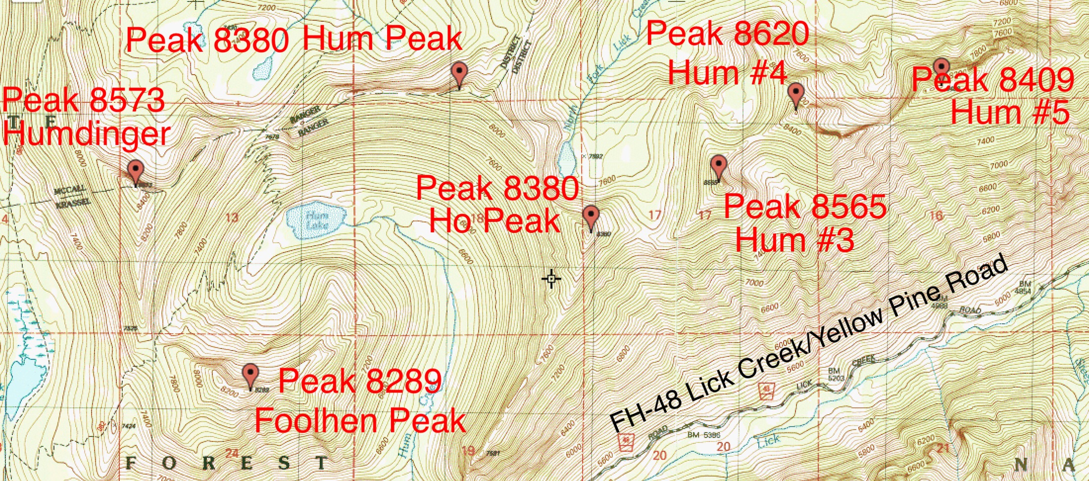
This peak sits on the main Lick Creek Range crest west of Hum Lake and north of Lick Creek Summit and Foolhen Peak. The peak serves as the anchor for an impressive East-West trending ridge that has 5 difficult, ranked summits: Peak 8380 (Hum Peak), Peak 8380 (Ho Peak), Peak 8565 (Hum #3), Peak 8620 (Hum #4) and Peak 8409 (Hum #5). See the map below. John Platt and John Fadgen are credited with the first ascents of these 5 ridge summits. John Platt’s trip report for Humdinger Peak is linked below. USGS Box Lake
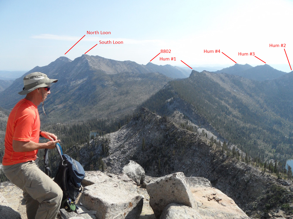
Humdinger Peak as viewed from the vicinity of South Loon Mountain. John Platt Photo
Access
Access this peak from just north of Lick Creek Summit. See Page 136 of the book.
(B)(3) FH-48 Yellow Pine/Lick Creek Road
(c) FST-084, Duck Lake/Loon Lake Trail
(c.1) FST-083/FST-082, Hum Lake/North Fork Lick Creek Trail
South Ridge, Class 3–4
Leave the Hum Lake Trail at the pass above Hum Lake and climb the South Ridge to the summit. It is roughly a mile with just over 700 feet of elevation gain to the top. You can avoid Class 4 climbing on the ridge crest by dropping down onto the East Side.
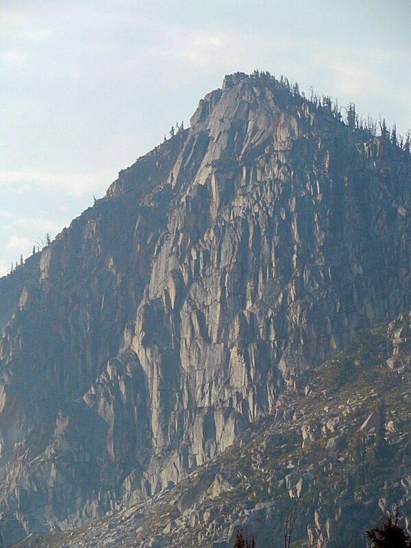
The South Ridge of Humdinger Peak as viewed from the slopes of Foolhen Peak. John Platt Photo
The Hum Ridge Peaks.
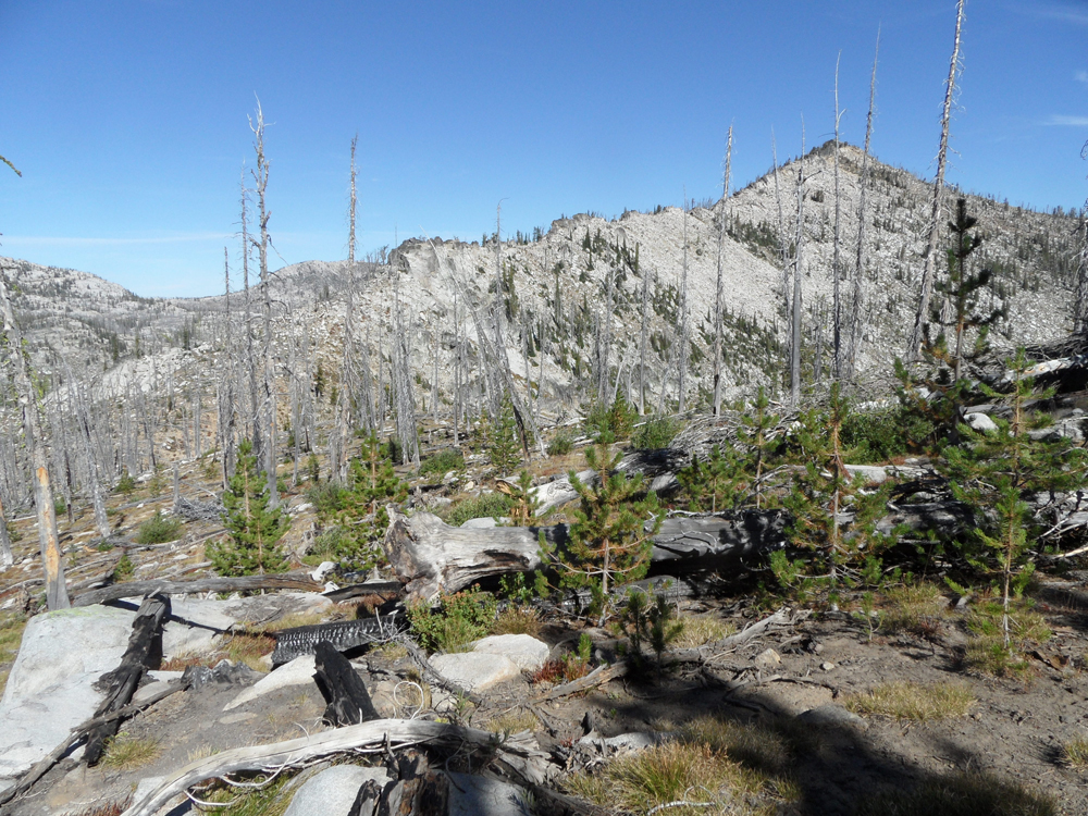
The view east from the summit of Humdinger Peak. John Platt Photo
Additional Resources
Mountain Range: Western Salmon River Mountains
Longitude: -115.92219 Latitude: 45.07189