Elevation: 8,624 ft
Prominence: 284

This peak is not in the book. Published November 2021
Peak 8624 is located on the northeast side of Horseheaven Pass in the Lost River Range. This is the second leg of a 2-peak journey that includes Peak 9315 and Peak 8624. It covers 5.5 miles with 2,125 feet of elevation gain round trip. USGS Burnt Creek
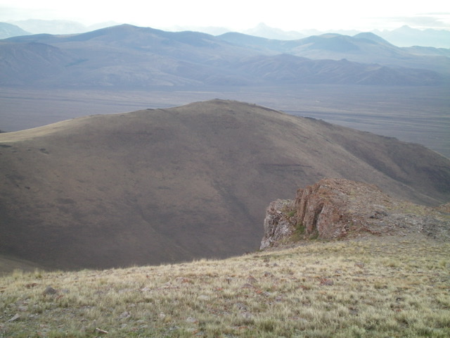
Peak 8624 as viewed from the southwest. The southwest face was my descent route. Livingston Douglas Photo
Access
Same as for Peak 9315. This is the second leg of a 2-peak adventure.
Northwest Ridge, Class 2
The Climb
From the 8,420-foot connecting saddle, scramble east on the undulating ridge following a fence row. Skirt the left/north side of a rocky ridge point early on in a forested patch and drop to a minor saddle. Continue eastward and skirt the right/south side of Point 8462 to reach the wide, gentle upper section of the ridge. Cruise southeast up the easy, short scrub/grass to the summit of Peak 8624. The summit is a rocky outcrop on the ridge crest. It had no cairn so I built a small one.
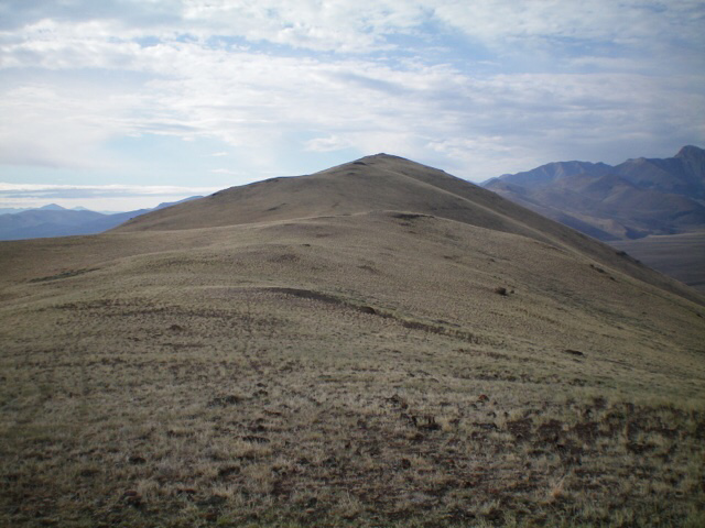
Peak 8624 (mid-ground) as viewed from Peak 9315 to its west. Livingston Douglas Photo
The summit of Peak 8624 as viewed from the northwest ridge. Livingston Douglas Photo
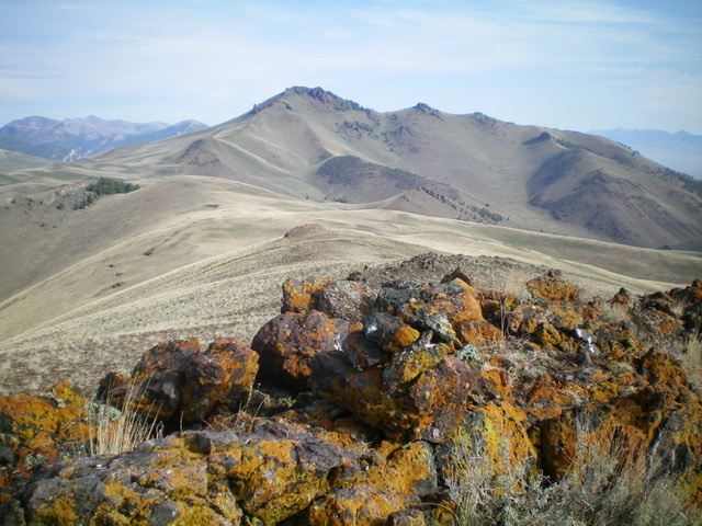
The summit rocks of Peak 8624 with Spring Hill in the distance. Livingston Douglas Photo
Southwest Face, Class 2
The Descent
From the summit, descend southwest straight down a steep face of short grass/scrub and loose scree/gravel to reach a cistern (not shown on maps) in the center of a dry gully. A 2-track road (not shown on maps) heads southwest from this cistern to the “water tank” (i.e., cistern) shown on the USGS topo map. Follow the [better] 2-track road (shown on maps) west from this cistern to FSR-117. Hike right/west up FSR-117 to Horseheaven Pass and your parked vehicle.
Additional Resources
Regions: EASTERN IDAHO->Lost River Range
Mountain Range: Lost River Range
Longitude: -113.72269 Latitude: 44.24239