Elevation: 8,634 ft
Prominence: 294
Peak 8634 is a soft-ranked summit that sits on the northwest ridge of nearby Cup Benchmark (9,147 feet). It is a worthy objective if you plan to also climb nearby Cup Benchmark. The easiest ascent route is via the southeast ridge, most of which has an old 2-track road on it. USGS Buttercup Mountain
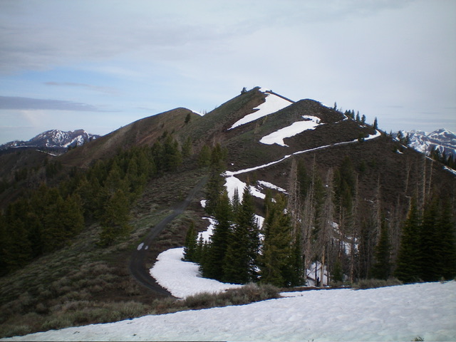
Peak 8634 (summit hump is left of center) and its multi-humped southeast ridge, my descent route. Livingston Douglas Photo
Access
Same as for Peak 8595. This climb begins at the end of Willow Creek Road, where the creek drainage has a major fork. For this climb, head up the right/main fork of Willow Creek rather than the West Fork as for Peak 8100 and Peak 8595. This is the first leg of a 2-peak adventure that includes Peak 8634 and Cup Benchmark (9,147 feet). It covers 10.0 miles with 3,500 feet of elevation gain round trip.
Southwest Ridge, Class 2
The Climb
From the parking/camping area at the fork in the Willow Creek drainage (6,110 feet), hike northeast up FST-223/Willow Creek ATV Trail. Early on, stay on the west side of [raging] Willow Creek on steep, angled terrain (sometimes with the aid of a cattle trail) to avoid two creek fords (not shown on maps) that occur over about a ½-mile section of the ATV trail along Willow Creek. The trail is not passable even for ATVs early on because of avalanche debris strewn across the trail and a large rutted gap with a feeder stream in it.
At just under 2-1/2 miles from the trailhead, the ATV trail fords a strong feeder creek coming in from the left/north. Jump across this creek just upstream from the trail. Willow Creek (and the ATV trail) heads right/east here. After another ½ mile, the ATV trail turns left/north up a narrow gully and then turns right/east to drop and cross a small feeder stream at about 7,300 feet.
After the gully crossing, the trail turns hard right/south and then bends left/southeast to cross the southwest ridge of Peak 8634. Leave the trail here and scramble northeast up the steep, open ridge in scattered scrub with a somewhat loose underlying base of scree/gravel/dirt. Higher up, there are a few ridge pines to skirt. The summit of Peak 8634 has a modest cairn which I built up.
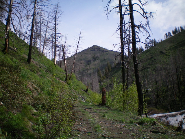
Peak 8634 (dead center) as viewed from the Willow Creek ATV trail to its southwest. The southwest ridge (my ascent route) is in dead center. Livingston Douglas Photo
Southeast Ridge, Class 2
The Descent
From the summit, descend east-southeast to a minor saddle. From there, scramble up over a minor ridge hump then continue southeast down steeper terrain to a visible ATV trail junction at a small saddle. The terrain on the southeast ridge is mostly sagebrush and presents no problems. The 8,340-foot saddle is the connecting saddle between Peak 8634 and Cup Benchmark. It concludes the first leg of today’s 2-peak adventure. Cup Benchmark is up next.
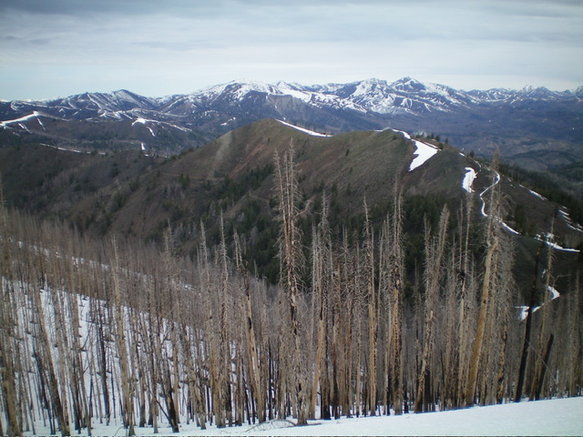
Peak 8634 (in mid-ground) as viewed from the southeast. Livingston Douglas Photo
Additional Resources
Regions: Smoky Mountains->WESTERN IDAHO
Mountain Range: Smoky Mountains
Longitude: -114.6001 Latitude: 43.5648