Elevation: 8,660 ft
Prominence: 320
This peak is not in the book. Published January 2023
Peak 8660 is the high point on a ridge that separates Webster Creek from Cow Creek in the Webster Range. It is overshadowed by its higher, more rugged, ridgeline neighbor to the northwest, Peak 8822. The bushwhacking in this area is difficult so be prepared. USGS Diamond Flat
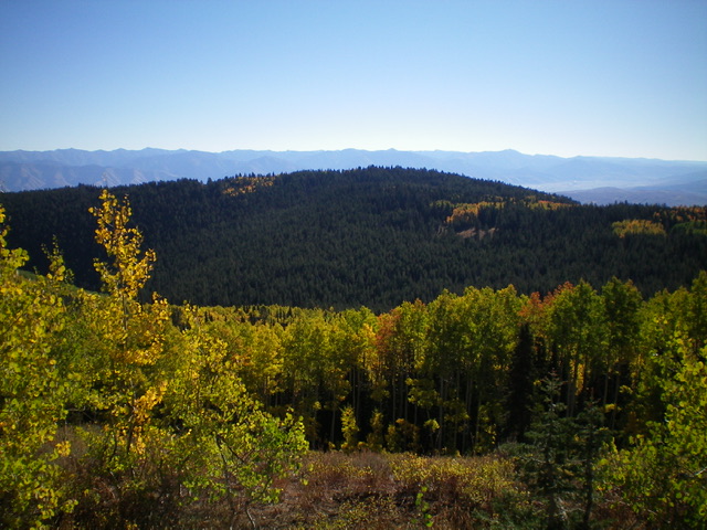
Peak 8660 (forested in mid-ground) as viewed from Peak 8822 to its northwest. Livingston Douglas Photo
Access
To reach Auburn, WY from US-89, leave the highway and drive south on CR-238 or leave the highway and drive west on CR-237 from Grover, WY. Drive south from Auburn, WY for ½ mile to a signed junction of CR-238 and CR-134/Auburn-TygeeRoad. Turn right/west onto CR-134 (which becomes FSR-110/Smoky Canyon Road) and drive 3.7 miles to a signed junction with FSR-886/Wyoming Fish Hatchery Road. Turn right/west onto FSR-886 and drive 1.9 miles southwest to a trailhead parking area for FST-112/Webster Creek Trail. Park here (6,385 feet). GPS coordinates: 42⁰45’58”N, 111⁰05’58”W.
Map Errors
The USGS topo map shows only a portion of FST-112. The USGS topo map shows much more open terrain than actually exists, especially on the routes discussed for this peak. Both aspens and pines have grown to fill in most of those open areas, including the “wide open” summit of Peak 8660. This makes reaching Peak 8660 and Peak 8822 a more difficult bushwhacking endeavor.
East Ridge, Class 2
The Climb
From the trailhead parking area, hike briefly on old road (gated) that heads west on the north side of the east ridge. Leave the road pretty quickly since it is not going up onto the ridge. Bushwhack left/south up onto the rounded, unforgiving ridge of thick pines, aspens, and underbrush in this initial section of the ridge. Contrary to the USGS topo map, there is no open terrain on the left/south side of the ridge early on. It is all thick aspens and brush now. Once on the ridge, bash your way up to Point 7132 through trees, blowdown, and thick brush. It is brutal. Point 7132 is a semi-forested hump. Descend west from Point 7132 to a minor saddle then continue west up a steep section to 7,200 feet where the ridge turns noticeably left/southwest and the slope eases.
Bash through more miserably thick forest (with no game trails) to reach open Point 7512 on the main ridge crest. From here, you have a magnificent view of [still far-away] Peak 8660. Continue along the ridge northwest then west then northwest with a few open scrub edges (very thick) on the left/south side of the ridge crest. It’s better to stay in the forest where the underbrush is much easier and, in some sections, there is a game trail to help. The upper section and summit of Peak 8660 is heavily forested and is in no way open terrain as the USGS topo map shows. This area is a somewhat tedious bushwhack with scattered blowdown and thick forest to avoid.
The summit of Peak 8660 is a semi-open area. There was no summit cairn so I built one with the few loose rocks that I could find in the scrub-and-forest terrain. Visibility is somewhat limited on the high point due to the nearby pine forest. I ran my GPS to make sure that this is the high point and it is. The high point of Peak 8660 is a flattish hump with nothing higher.
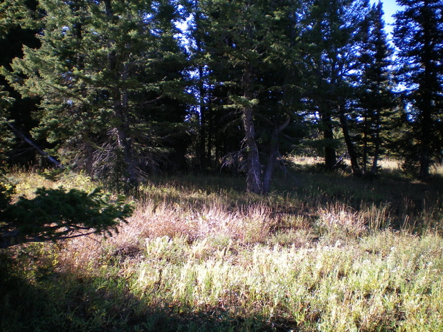
The semi-open summit of Peak 8660. Livingston Douglas Photo
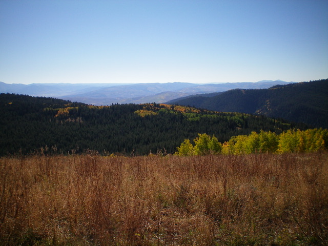
The thickly-forested west ridge of Peak 8660 (in mid-ground) as viewed from Peak 8822 to its northwest. The west ridge was my descent route. Contrary to the USGS topo map, the west ridge is not open terrain. Livingston Douglas Photo
West Ridge, Class 2
The Descent
From the summit, descend northwest then west through thick pine forest (offering no visibility) and a few areas of open grass. When in doubt, keep heading west to find the hidden, connecting saddle with Peak 8822. The 8,340-foot saddle is in reasonable pine forest. From here, you can see the open terrain on the east face of Peak 8822 higher up. This connecting saddle concludes the first leg of today’s 2-peak adventure. Peak 8822 is up next.
Additional Resources
Regions: Peale Mountains->SOUTHERN IDAHO->Webster Range
Mountain Range: Peale Mountains
Longitude: -111.1386 Latitude: 42.7648