Elevation: 8,660 ft
Prominence: 280
This peak is not in the book. Published November 2020
Peak 8660 is located on the Continental Divide in the Eastern Centennials. It is the second of two peaks in a challenging day that climbs Taylor Mountain on the way. Peak 8660 is a rather insignificant ridge that sits above the headwaters of Spring Creek (MT). But it takes some work to get to it because it is way back in and is not close to any roads. USGS Upper Red Rock Lake
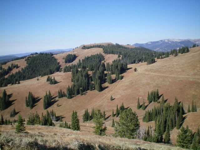
Peak 8660 (center) as viewed from the east. Livingston Douglas Photo
Access
Same as for Taylor Mountain (9,860 feet). This is the final leg of a 2-peak journey that begins on Taylor Creek Road.
Northeast Ridge, Class 1
The Climb
From the dry gully that is the low point between Taylor Mountain and Peak 8660, head west to intercept the remnants of a 2-track road (now just grass) and follow it west to a saddle that is signed for the “U.S. Sheep Experiment Station” and the CDT. Follow the CDT south-southwest then west to the summit of Peak 8660. The summit has a large cairn and is wide open with great views.
East Ridge, Class 2
The Descent
From the summit, follow the CDT back to a right/south turn in the ridge just after the CDT passes the head of a pronounced gully. Leave the CDT and follow the narrow ridge south then southeast to a saddle at 8,180 feet. There is a good use/game trail on the ridge to speed your descent. But this trail disappears before you reach the saddle. From the 8,180-foot saddle, bushwhack southeast up a thick sagebrush slope to reach Point 8386. From Point 8386, descend steeply east-northeast through a thick pine forest with plenty of brush to reach another saddle (7,980 feet).
Bash through more thick brush and sage to cross the saddle and bushwhack east up to Point 8182 through yet more thick brush/sage. From Point 8182, follow the ridge southeast up over Point 8002, navigating through scattered trees, deadfall, and thick sagebrush. Cattle/game trails will help you get through this mess, at least to some degree. Now you face a steep descent southeast down the ridge through a combination of scattered trees and thick brush/sage high up to a combination of thick forest, deadfall, and brush lower down.
When you reach the Taylor Creek drainage, cross the small stream to reach the foot path (formerly a road) on the east side of the creek. Follow the foot path down Taylor Creek to reach the gated road closure. Jump the gate and follow the jeep road a short distance to a sharp left turn uphill. Head uphill on the road and soon reach a cattle fence. Jump the cattle fence to reach an unsigned road junction and your parked vehicle near the other gated road closure where this adventure began.
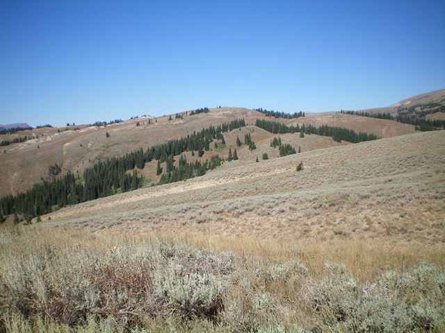
Peak 8660 (dead center) as viewed from high on the east ridge. Livingston Douglas Photo
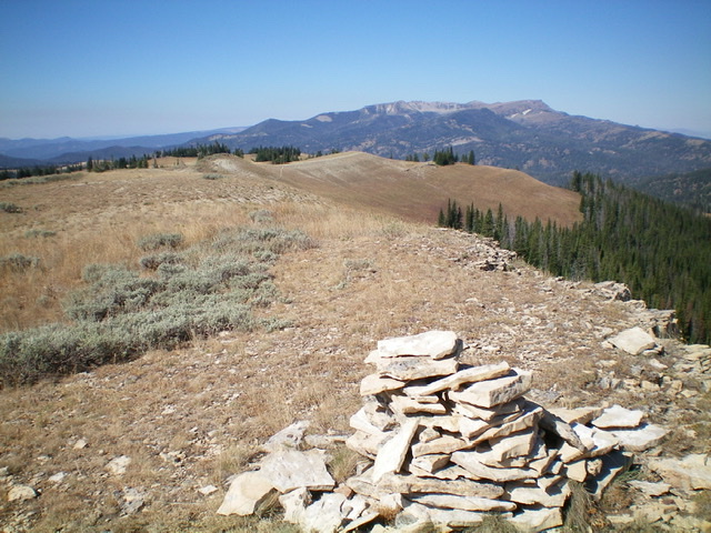
Looking west along the Continental Divide from the summit of Peak 8660. Livingston Douglas Photo
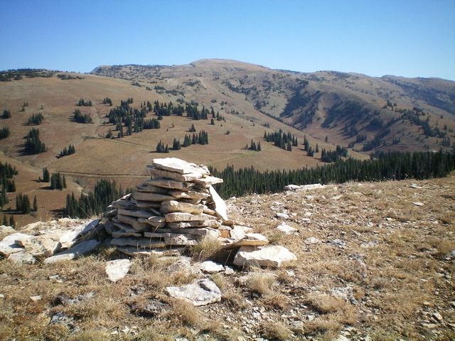
The summit cairn atop Peak 8660 with Taylor Mountain in the background. Livingston Douglas Photo
Additional Resources
Regions: Centennial Range->EASTERN IDAHO
Mountain Range: Centennial Range
Longitude: -111.71989 Latitude: 44.54419