Elevation: 8,712 ft
Prominence: 372
This peak is not in the book. Published November 2023
Peak 8712 is a somewhat-remote summit that sits at the head of Big Blind Canyon in the White Knob Mountains. It is most easily reach via an ATV trail that comes up Big Blind Canyon from Alder Creek Road. A serious off-trail climb is still required to reach the summit. USGS Big Blind Canyon
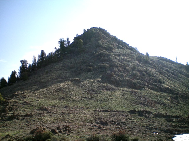
Peak 8712 (left of center) as viewed from the north spur to its west. Livingston Douglas Photo
Access
Same as for Peak 7642. This is the second leg of a 2-peak adventure that includes Peak 7642 and Peak 8712. It begins at Alder Creek Road and covers 8.0 miles with 3,150 feet of elevation gain round trip.
Map Errors
Most of the ATV trails in this area are not shown on the USGS topo map.
North Spur/Southwest Ridge, Class 3
The Climb
The bulk of this climb is Class 2. However, the final 100 vertical feet of the southwest ridge goes at Class 3. From the 7,340-foot connecting saddle with Peak 7642, either climb southeast up over Point 7480+ or skirt its left/northeast side in sagebrush to reach another saddle of sorts where an unmapped ATV trail ends after coming up a gully from an unsigned junction with BLM-4303. From this saddle, bushwhack east up through a mix of scrub and mountain mahogany to reach the narrow, mahogany-clad crest of the north spur of Peak 8712.
Follow the spur southward (steep in sections), staying close to the ridge crest and working around many snow patches and lots of mountain mahogany. In addition, higher up, there are some rocky ridge blocks/outcrops to navigate. Reach a flattish, open area (with a nearby rocky outcrop) at about 8,320 feet. From here, scramble south-southeast then southeast (avoiding some large snowfields) on easy, short scrub to reach the obvious, open, long saddle at the base of the southwest ridge.
The saddle terrain is a mix of scrub and minor rocky outcrops and goes quickly. The southwest ridge looks rather ominous (steep, rocky blocks). Is it even doable? Yes, it is. And it goes at Class 3. Scramble up the ridge crest (or just left/north of it) to reach a final gully climb to the small, brush-and-rock summit of Peak 8712. I rebuilt the small summit cairn. The southwest ridge is the most difficult line to the summit.
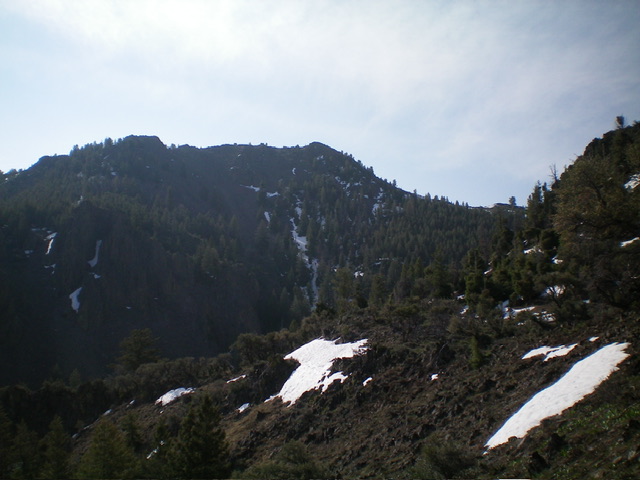
The rugged summit hump of Peak 8712 as viewed from its base to the southwest. Livingston Douglas Photo

Looking down the north spur (in mid-ground) from the summit. The north spur was my ascent route. Livingston Douglas Photo
Southwest Ridge/North Spur FULL, Class 3
The Descent
From the summit, return southwest down to the saddle area then to the north spur. Follow the north spur down to a minor saddle at 7,620 feet then descend an easy, dry gully west down to the visible (but unmapped) ATV trail. Follow this ATV trail north down the wide gully until it soon reaches a junction with BLM-4303 (signed here). Go left/west onto BLM-4303 and follow it as it undulates a bit but makes its way up and across the north ridge of Peak 7642. Continue hiking west then north down BLM-4303 all the way back to Alder Creek Road and your parked vehicle.
Additional Resources
Regions: EASTERN IDAHO->White Knob Mountains
Mountain Range: White Knob Mountains
Longitude: -113.5582 Latitude: 43.7978