Elevation: 8,726 ft
Prominence: 411
This peak is not a book. Published June 2021
This dome-shaped, northern Boulder Mountains peak towers over US-93. It sits south-southwest of its taller neighbor, Anderson Peak. Although a minor summit, the views of the Lost River Range and the Pahsimeroi Mountains are incredible. USGS Dickey Peak
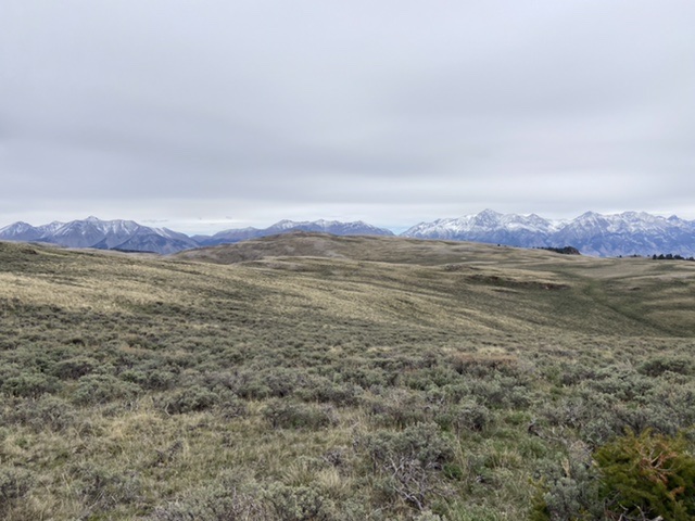
Peak 8726 as viewed from Peak 8686 with the Lost River Range in the distance.
Access
Primary access is via Walker Way Road. This occasionally-graded road cuts through this section of the Boulder Mountains from Trail Creek Road to the south to US-93 to the north. Walker Way Road is a well-engineered, narrow route that varies in quality but is, for the most part, in good condition. Nevertheless, a high-clearance vehicle is recommended.
If approaching from the south, Trail Creek Road leaves US-93 16.0 miles north of Mackay, Idaho. Follow it west for 4.7 miles. Turn right/north onto Peck Canyon/Walker Way Road. Follow this road north and then northeast for 11.7 miles. The unsigned and unmapped 4WD road begins at this spot.
If approaching from the north, follow US-93 south from the US-93/ID-75 junction for 18.2 miles and turn right/west onto [signed] Dry Gulch Road. See also [(D)(2) Page 243]. Follow this road (which soon becomes Walker Way Road) southwest and then west for 7.2 miles. The unsigned and unmapped 4WD road begins at this spot.
Southwest Face, Class 2
A 4WD road leads from Walker Way Road to the southwest face and the summit ridge. This road serves as a good trail. Once it ends southeast of the high point, it is a short, Class 2 stroll to the summit cairn. The distance from Walker Way Road is 1.1 miles with 430 feet of elevation gain.
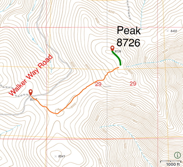
My GPS track. The orange shows the drivable section of the route. The green is the trail-less section.
Additional Resources
Regions: Boulder Mountains
Mountain Range: Boulder Mountains
Year Climbed: 2021
Longitude: -113.99901 Latitude: 44.17101