Elevation: 8,780 ft
Prominence: 400
This peak is not in the book. Published November 2020
Peak 8780 is located on the Continental Divide in the South Beaverheads. It sits above the headwaters of Poison Creek (MT) and is in a remote section of the Continental Divide. The CDT follows the crest of the Continental Divide in this area of easy, open scrub but it is faint (if not nonexistent) in sections. This climb is part of an adventure that covers 12 miles with 4,000 feet of elevation gain round trip. It includes Peak 8661 and Peak 8780, both of which are CD peaks. USGS Tepee Draw
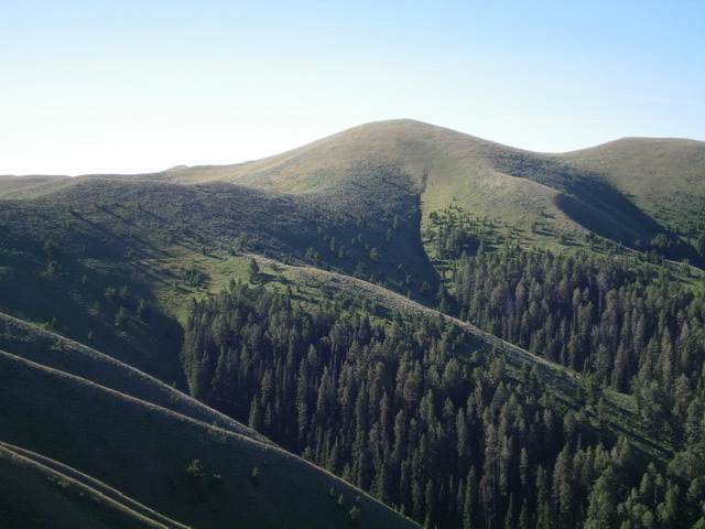
Peak 8780 (the hump right of center) and the undulating, weaving Continental Divide that leads southeast then south to it. Livingston Douglas Photo
Access
Same as for Peak 8661. This is the final leg of a two-peak journey.
Northwest Ridge, Class 2
The Climb
From the 8,250-foot connecting saddle with Peak 8661, follow the Continental Divide southeast to Point 8510. Descend south to a saddle and then bushwhack up the somewhat steep, sagebrush-clogged north face/ridge of Peak 8780 to reach the summit. The CDT does NOT ascend this final section of the climb. Instead, it skirts the northeast face of Peak 8780.
The summit of Peak 8780 had nothing on it, so I built a small cairn with the few loose rocks that I could find. The Continental Divide continues dead east from here. Return northwest back to Peak 8661 then northwest to Point 8806. Leave the Continental Divide there and descend the north ridge of Point 8806 to return to your parked vehicle at the end of FSR-1079/Shineberger Creek Road.
![The newly-built [albeit small] summit cairn atop Peak 8780, looking southwest. Livingston Douglas Photo](https://www.idahoaclimbingguide.com/wp-content/uploads/2EE505CA-7C31-4FA4-8120-DA86BE734370.jpeg)
The newly-built [albeit small] summit cairn atop Peak 8780, looking southwest. Livingston Douglas Photo
Additional Resources
Regions: Beaverhead Range->EASTERN IDAHO
Mountain Range: Beaverhead Range
Longitude: -112.43419 Latitude: 44.45439