Elevation: 8,802 ft
Prominence: 342
This peak is not in the book. Published February 2020
This peak is located due south of Enos Lake and east of South Loon Mountain. USGS Enos Lake
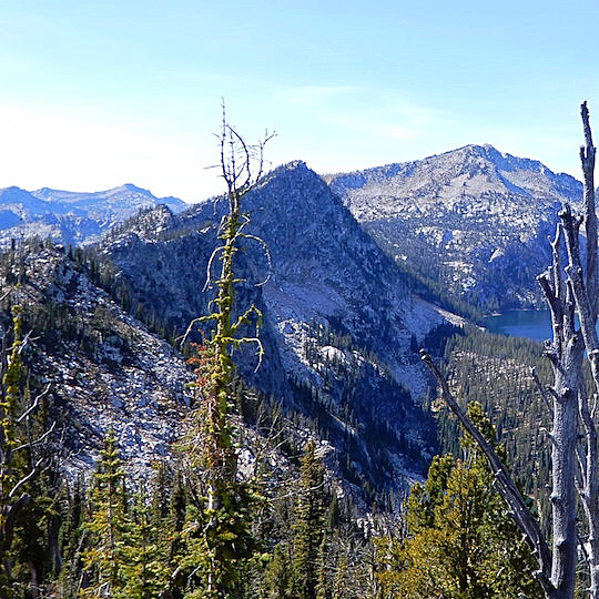
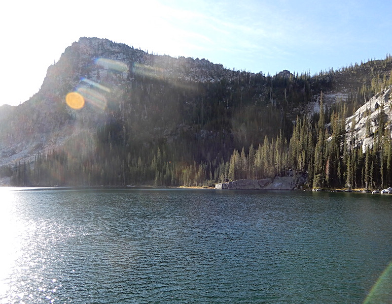
Enos Peak (left) as viewed from the east. South Loon Mountain and North Loon Mountain are on the horizon. John Platt Photo
Access
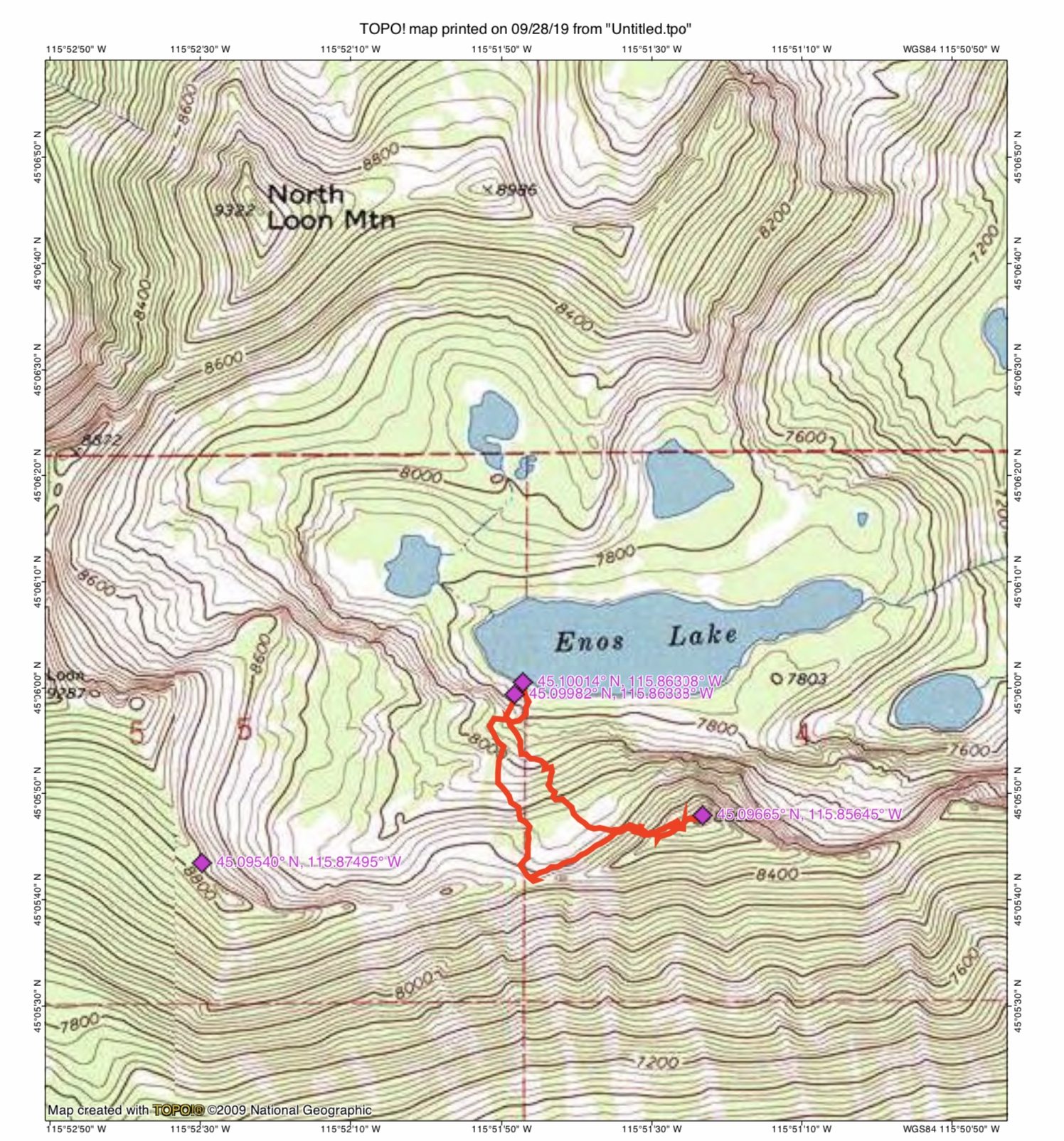
Take Lick Creek Road/FH-48 north from McCall to the Duck Lake trailhead. The trailhead is located just north of Lick Creek Summit [(B)(3) on Page 136]. The route from the Duck Lake trailhead to Enos Lake involves maintained and poorly maintained trails as well as a lot of difficult cross-country travel. Follow FST-085 north past Duck Lake to its junction with FST-084 [(B)(3)(c) on Page 136]. Hike up FST-084 to the top of the Lick Creek Crest. Descend down to the small lake at the headwaters of Loon Creek.
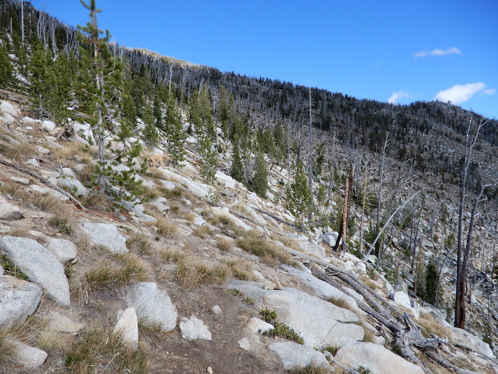
From the lake, traverse over to FST-082 [(B)(3)(d) on Page 136]. Follow FST-082 up to South Loon Saddle (8,056 feet). From the saddle, start up the South Ridge of South Loon Mountain. After gaining roughly 200 vertical feet, start a climbing traverse across the South Face of South Loon Mountain. Aim for a crossing of the peak’s Southeast Ridge at just over 8,800 feet. Cross the ridge and descend to Enos Lake. See the map below and use the link below to read John Platt’s trip report. This route covers 7.9 miles with 3,250 of elevation gain. Note: An alternative route to the upper Loon Creek drainage is to hike to Hum Lake and then from Hum Lake to Loon Creek [(B)(3)(d) on Page 136].
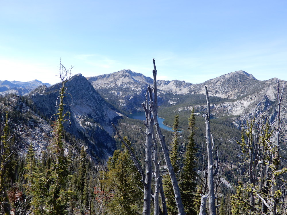
This photo shows the terrain on the South Face of South Loon Mountain from the South Ridge to the the Southeast Ridge. John Platt Photo
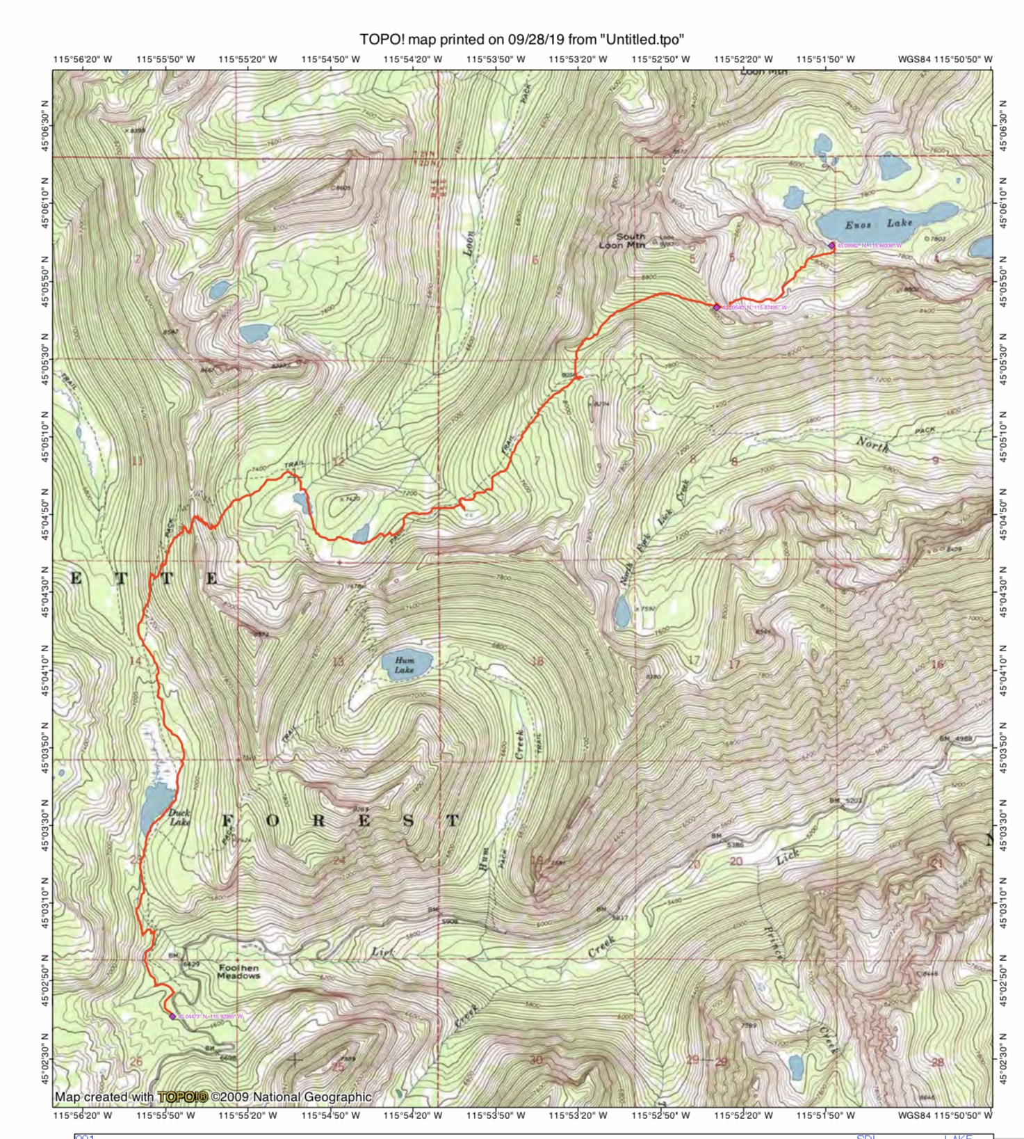
John Platt’s GPS track from the Duck Lake Trailhead to Enos Lake. The route covers 7.9 miles with 3,250 of elevation gain one way.
West Ridge, Class 4
As with the majority of Lick Creek Range summits, granite obstacles are encountered on this route. Depending on your climbing skill level, you may find an alternate way around the West Ridge obstacles. From Enos Lake, ascend to the saddle west of the summit. From the saddle, traverse east along the 8,200-foot contour until you can climb steep, grassy slopes and granite slabs to the top of the ridge. Continue east along the summit ridge. Platt and company encountered an obstacle along the last section of the summit ridge. They dropped off the ridge and then climbed up to the summit ridge via a Class 4 Wall (see photo).
Enos Peak and its West Ridge on the left. John Platt Photo
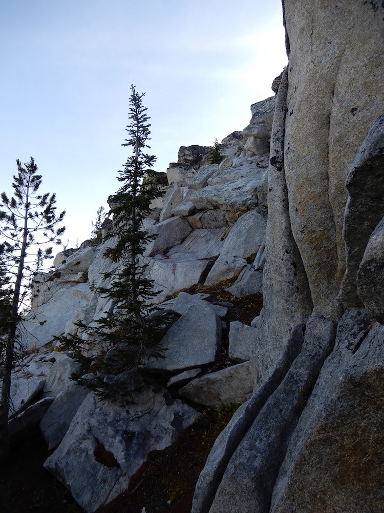
This Class 4 Wall was the final obstacle on the West Ridge Route. John Platt Photo
John Platt’s GPS track. His route covers 1.5 miles with 1,119 feet of elevation gain.
Additional Resources
Mountain Range: Western Salmon River Mountains
Longitude: -115.85639 Latitude: 45.09659