Elevation: 8,860 ft
Prominence: 320
This peak is not in the book. Published November 2020
Peak 8860 is one of two peaks that sit on a ridgeline at the head of West Modoc Creek and Middle Modoc Creek. The other peak is Peak 8871. There is an ATV trail/road on the ridge crest (FST-013) but the up-and-down terrain is easy, open scrub and is a cruise with the exception of a few loose, rocky sections. This climb is the final leg of a two-peak journey that reaches the summits of both of the aforementioned peaks. USGS Paul Reservoir
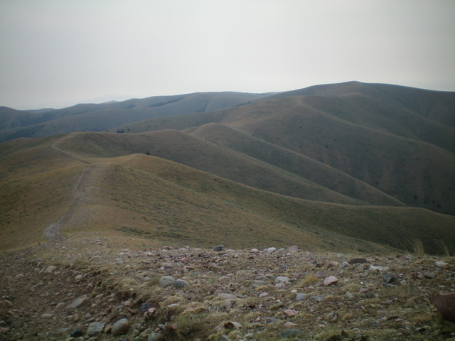
Peak 8860 (right of center) and the weaving, undulating ridgeline leading east then southeast to the summit. Livingston Douglas Photo
Access
Same as for Peak 8871. This is the final leg of a two-peak journey that begins at the base of West Modoc Road/FSR-001.
Northwest Ridge, Class 1
The Climb
From Point 8829, follow FST-013 along the undulating ridge crest east then southeast to reach the summit of Peak 8860. FST-013 (an old road) is quite rocky and loose in sections. The nearby terrain is often better for hiking than the road itself. The summit of Peak 8860 is just another ridge bump, albeit the highest one in the area. It lacked a summit cairn, so I built one with the rounded talus that was available.
North Ridge, Class 2
The Descent
From the summit, descend the open scrub/gravel of the north ridge directly into the easy forest above Middle Modoc Creek. Bushwhack north down through the somewhat-steep forest using diagonal cattle/game trails (to avoid the nearby blowdown) to reach Middle Modoc Creek at about 7,760 feet. The creek is a small stream most of the way back to FSR-001/West Modoc Road. The creek drainage is wide and has mostly dry grass and some weak cattle trails to expedite the hike downstream.
Farther down the creek drainage, move to the left/west side of the creek to find a good cattle trail that leads down to the split-rail fence closure that is just above the junction with FSR-001. An easy crossing of West Modoc Creek immediately precedes the fence closure. Once you reach FSR-001, walk 0.6 miles north then northeast on it to reach its junction with FSR-003 and your parked vehicle.
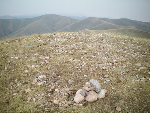
The summit area of Peak 8860, looking back at Peak 8871 to the west in the distance (left of center). Livingston Douglas Photo
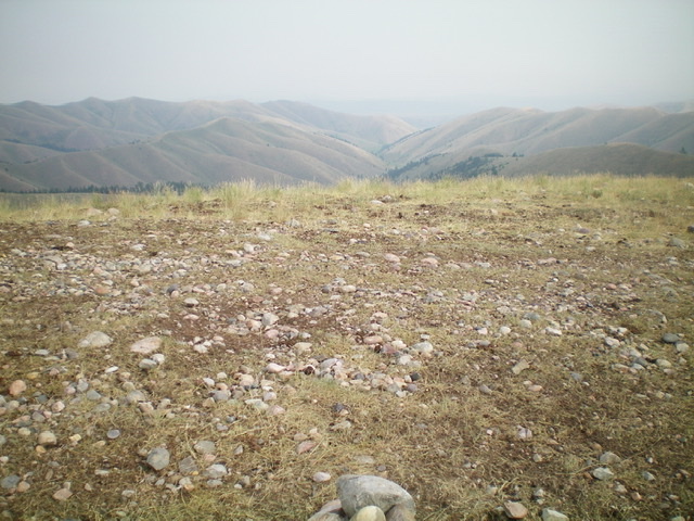
Looking north at the Middle Modoc Valley (descent route) from the summit of Peak 8860. Livingston Douglas Photo
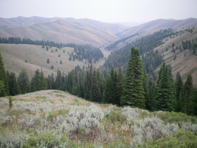
Looking down the north ridge of Peak 8860, with the Middle Modoc Valley in dead center. Livingston Douglas Photo
Additional Resources
Regions: Beaverhead Range->EASTERN IDAHO
Mountain Range: Beaverhead Range
Longitude: -112.36089 Latitude: 44.43049