Elevation: 8,871 ft
Prominence: 611
This peak is not in the book. Published November 2020
Peak 8871 is one of two peaks that sit on a ridgeline at the head of West Modoc Creek and Middle Modoc Creek. The other peak is Peak 8860. Peak 8871 sits just behind, and southwest, of the ridgeline proper. There is an ATV trail/road on the ridge crest (FST-013) but the terrain is easy, open scrub and is a cruise. This climb is the first leg of a two-peak journey that reaches the summits of both of the aforementioned peaks. USGS Tepee Draw
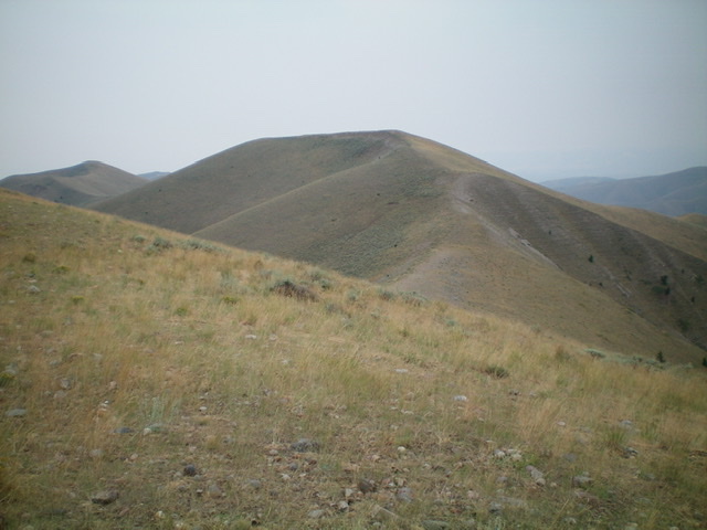
Peak 8871 (center) and its northeast ridge as viewed from the West Modoc/Middle Modoc ridge crest to its northeast. Livingston Douglas Photo
Access
From Exit 190/Humphrey on I-15, drive east to the frontage road on the east side of I-15. Reset your odometer. Drive north on the frontage road. At 2.6 miles, go left onto Modoc Road and through an underpass to reach the west side of I-15. After crossing underneath I-15, the roads bends sharply right/north. At 5.0 miles, the road turns left/west and moves away from I-15. At 6.4 miles, the road turns hard left/south and crosses a small stream. At 9.7 miles, reach the National Forest boundary. Modoc Road is now FSR-005. At 11.9 miles, reach a signed junction. Straight is FSR-001/West Modoc Road. Go left onto FSR-003/Paul Reservoir Road and park just past the junction in a large pullout/campsite area (7,505 feet).
Northeast Ridge, Class 2
The Climb
From the parking area, walk a short distance and cross Modoc Creek to reach the [signed] junction with FSR-001/West Modoc Road. Hike southwest up this rough, rutted jeep road for 0.6 miles to reach a signed junction at a fork in the drainage (7,590 feet). Go right onto West Modoc Road. Hike another mile up West Modoc Road to reach another junction at another fork in the valley (7,765 feet). The right fork is now a closed road and is only a foot path. The left fork is [signed] FST-136, an ATV trail/road. Go left onto steep, rocky FST-136 (not shown on the USGS topo map) and follow it up a shoulder on the west side of West Modoc Creek.
FST-136 goes all the way up to the ridge crest at a ridge hump (Point 8840+) where it reaches FST-013, an ATV trail/road on the ridge. Go left/south onto FST-013 and follow it a short distance to the next ridge hump (Point 8829). Leave the road here and descend a steep, scrub/gravel ridge southwest to a gentle saddle at 8,660 feet. Scramble southwest then south up the easy, open scrub of the ridge to reach the summit of Peak 8871. There was no summit cairn so I built one in the center of the flat north-south ridge crest line. The USGS map shows the high point in the middle of this flat area but I found the north end of it to be of equal height to the [measured] center point. Return back to FST-013 and Point 8829. This concludes the first leg of today’s two-peak journey. Peak 8860 is up next.
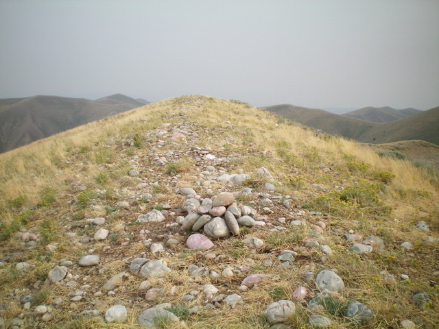
The summit area of Peak 8871 with its newly-built summit cairn, looking north. Livingston Douglas Photo
Additional Resources
Regions: Beaverhead Range->EASTERN IDAHO
Mountain Range: Beaverhead Range
Longitude: -112.39139 Latitude: 44.43559