Elevation: 9,044 ft
Prominence: 504

This peak is not in the book. Published December 2019
Peak 9044 is one of two obscure, forested peaks on the east side of South Creek, located near the mouth of South Creek Canyon. The easiest ascent route is from an ATV Trail (FST-4272) up Black Canyon then a steep bushwhack north to the connecting saddle between Peak 9044 and Peak 9151. Both peaks can be easily climbed from this saddle. There is a lot of difficult rock up here—ridge towers, steep face rock, etc. Do not take either of these peaks lightly. There is private property at the mouth of South Creek Canyon so be careful there. USGS Tyler Peak
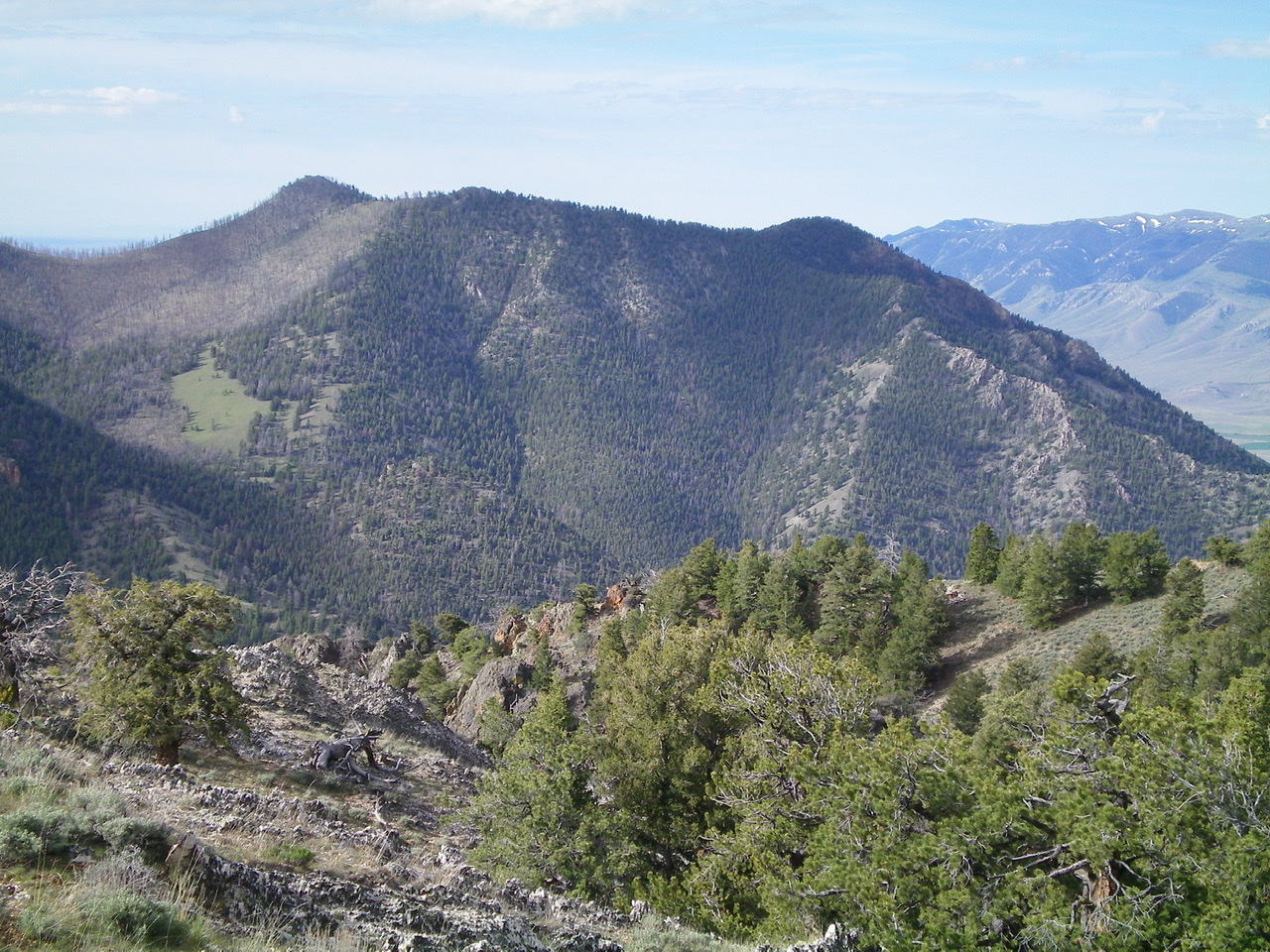
Peak 9044 as viewed from the summit of Peak 8923. The summit is the charred hump left of center. Point 8852 is the forested hump right of center. The rocky, knife-edged west ridge is right of center (in front of the skyline ridge) and leads up to a ridge finger just left of Point 8852. It is a challenging climb. Livingston Douglas Photo
West Ridge, Class 3
Access
South Creek Road is located 7.6 miles north of Howe on the [paved] Little Lost River Highway. It is unsigned. Turn right/east onto South Creek Road. At 1.9 miles, go left/north at an unsigned junction just before the road crosses a cattle gate. The road now becomes a rutted 2-track jeep road and follows the left/west side of a cattle fence.
The road turns sharply right/east at a fence corner to follow the left/north side of the fence toward the mouth of South Creek Canyon. At 3.7 miles, reach the end of the road and a large parking area at the mouth of South Creek Canyon. Park here (5,780 feet). The [signed] trailhead for the South Creek Trail/FST-4342 (an ATV trail) is nearby.
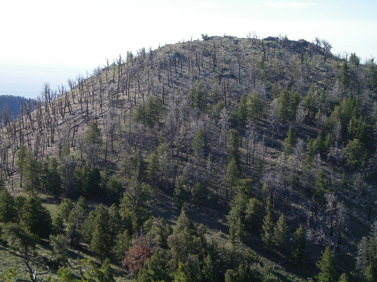
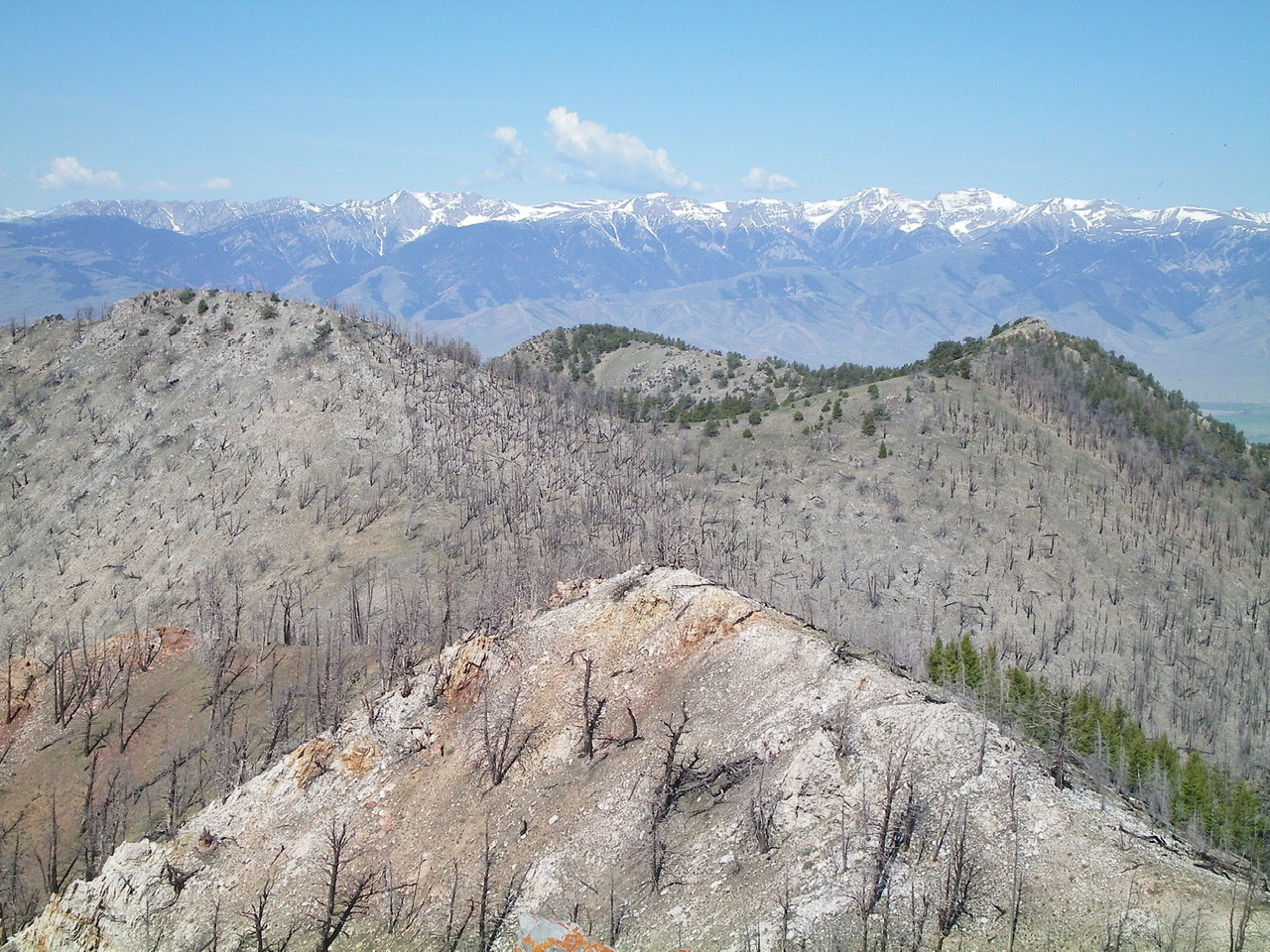
Looking south at burn-scarred Peak 9044 from Point 9004. Livingston Douglas Photo
The Climb
The South Creek Trail is overgrown, poorly maintained, and is not “hiker friendly.” It crosses South Creek numerous times in thick trees/brush with no footbridges. The creek crossings can be done without fording the creek, but it’s not always easy. At the least, this trail is tedious and time consuming. I don’t recommend it but, in this canyon, you have no choice. It is the ONLY trail here.
Hike up South Creek Trail and cross the creek three times. You are now on the right/east side of the creek. Between the 3rd and 4th creek crossings, there is a beautiful open slope on the right/east side of the trail. If you reach a trail section where the creek is literally flowing down the trail, you’ve gone a little too far upstream. Leave the pathetic “trail” here and climb east up the easy scrub/grass on a shoulder of sorts. This shoulder/face is just south of a prominent gully that has a wickedly-towered rock ridge on its far side. Your goal now is to climb east-southeast to reach Point 8852. Aim for a rocky prow at the top of the face. That prow is the start of the west ridge. Stay on the ridge’s left/north side most of the way to the ridge “finger” just past Point 8852 (to be discussed).
Higher up, the open terrain ends and the forest takes over. In addition, rocky outcrops/towers join the mix. Life gets difficult here. Just keep working your way uphill east and, occasionally, left/north to skirt a tower or steep face on the narrow ridge. The terrain here is challenging: trees, thick brush, blowdown, steep angled sides, and boulders/talus all mixed together. Stay close to the ridge crest but move off the crest proper as necessary. Reach a narrow finger of ridge just northeast of Point 8852. The terrain is much easier now—flat gravel and scrub initially. Continue northeast on the ridge through open forest to a saddle just west of Point 9004.
The ridge bends right/east here to reach rocky Point 9004. The terrain above the saddle is thick forest with some ridge rock mixed in. From the top of Point 9004, drop 170 vertical feet south-southeast to a charred saddle. Scramble south up through a burn area to reach the ridge crest summit of Peak 9044. From the trailhead, it takes over three hours of hard work to get up here. It is BRUTAL. The summit of Peak 9044 is small and rocky. There were remnants of a cairn hidden in a lower outcrop/boulder. I built a new cairn atop the highest boulder.
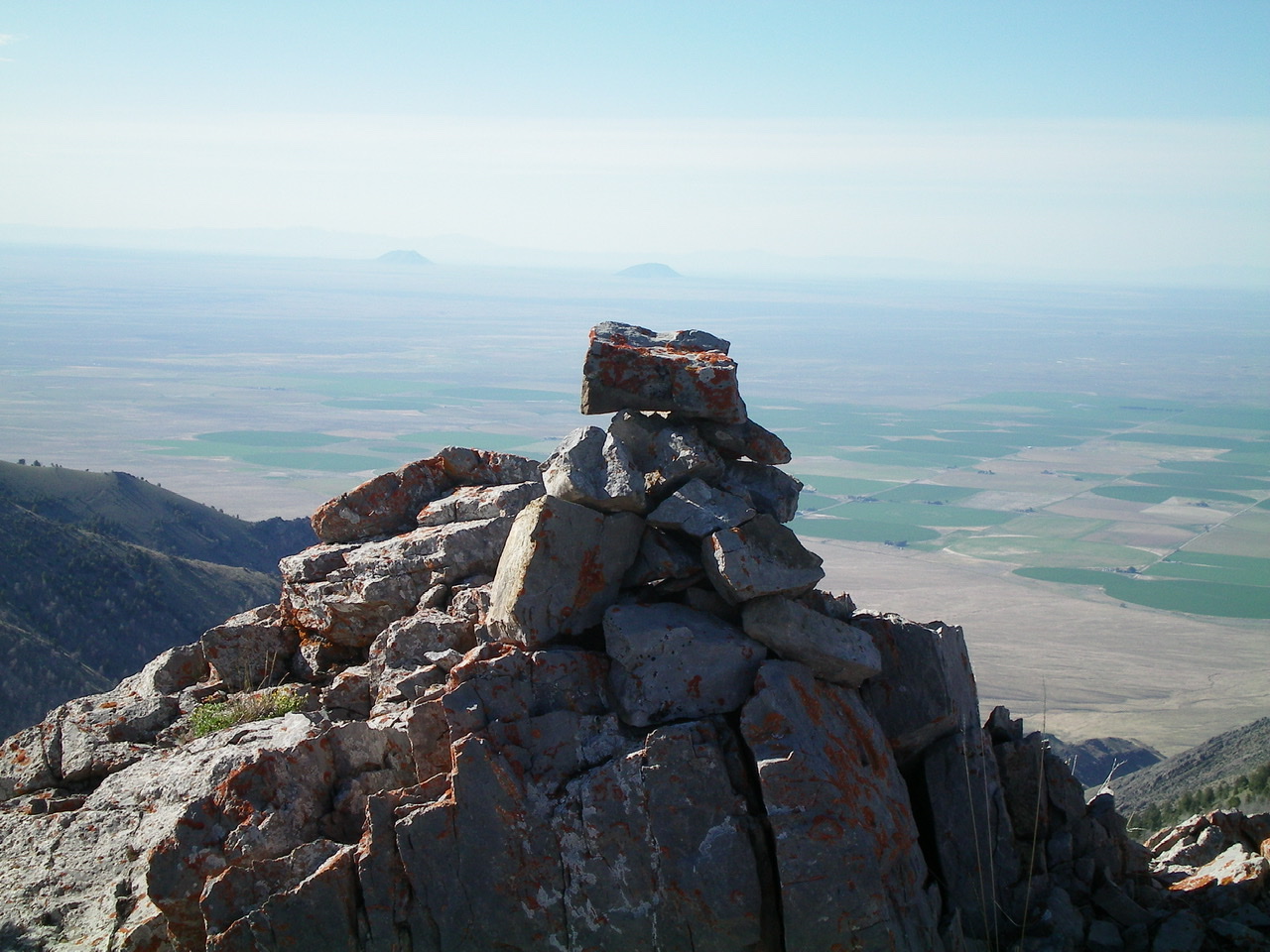
The newly-built summit cairn atop Peak 9044. Livingston Douglas Photo
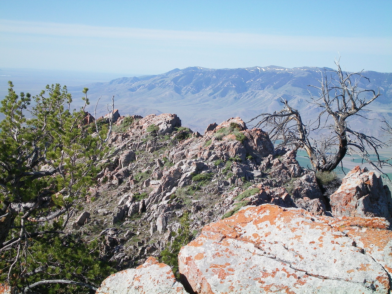
The rocky ridge crest summit area of Peak 9044. Livingston Douglas Photo
Burn-scarred Peak 9044 (the hump left of center) as viewed from Peak 9151 to the east. Livingston Douglas Photo
East Ridge, Class 2
Access
Same as for the west ridge. This is the first leg of a ridge traverse from Peak 9044 to Peak 9151.
The Descent
Descend the charred east ridge to a gentle saddle of scattered snags. The terrain on the east ridge is a combination of loose scree, charred logs, and blackened snags.
South Ridge/West Spur, Class 3
Access
Same as for the west ridge. This is the final leg of a loop route that begins and ends at the mouth of South Creek Canyon.
The Descent
After returning from the summit of Peak 9151, descend the narrow south ridge from the summit of Peak 9044. The ridge is choppy and has numerous rocky outcrops/towers with thick forest mixed in (not burned forest). Reach a tiny saddle at Point 8618 and bushwhack northwest to reach an indistinct west shoulder. Follow this shoulder down rough terrain—a dense mix of trees/brush, angled loose scree, and ridge rock/towers. Class 2+/3 down-climbing is required to skirt the ridge towers. There is one section of angled boulders on the right/north side of the ridge to scramble across.
The shoulder bends right/northwest as you descend lower, and eventually terminates in a large gully. Follow this gully as it bends left/southwest. Once you reach flatter terrain at the base of the gully, do a cross-country scramble right/northwest through sagebrush and over a few minor shoulders and gullies to reach the east side of a small patch of private property at the mouth of South Creek Canyon. Skirt the right/northeast side of the fence row to get back to the South Creek Trail, jumping across South Creek on the way. Follow the trail a short distance to the trailhead parking area.
Additional Resources
Regions: EASTERN IDAHO->Lemhi Range
Mountain Range: Lemhi Range
First Ascent Information:
- Other First Ascent: West Ridge
- Year: 2019
- Season: Summer
- Party: Livingston Douglas
- Other First Ascent: South Ridge/West Spur —Descent
- Year: 2019
- Season: Summer
- Party: Livingston Douglas
Longitude: -112.99519 Latitude: 43.91929