Elevation: 9,210 ft
Prominence: 510
This peak is not in the book. Published July 2023
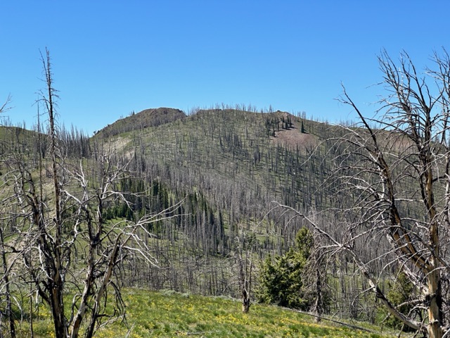
Peak 9210 sits just south-southwest of Fox Peak. This area was burned over and is slowly recovering from the event. The peak’s summit sits above the burned tree line and offers peakbaggers massive views of the Smoky, Boulder, and Pioneer mountains. USGS Boyle Mountain
Peak 9210 as viewed from Fox Peak
Access
Primary access is from ID-75 and Baker Creek Road/ FSR-162 [(A)(4) on Page 213]. Turn onto Baker Creek Road and follow it south for just over 3.0 miles. Just past the East Fork Campground, turn onto FSR-168/East Fork Baker Creek Road. Follow FSR-168 to the northwest side of Fox Peak and the trailhead for [signed] FST-143, which is 11.8 miles from ID-75. This road was in good condition in 2023 and suitable for high clearance vehicles. Alternatively, you can reach Peak 9120’s north ridge from Fox Peak.
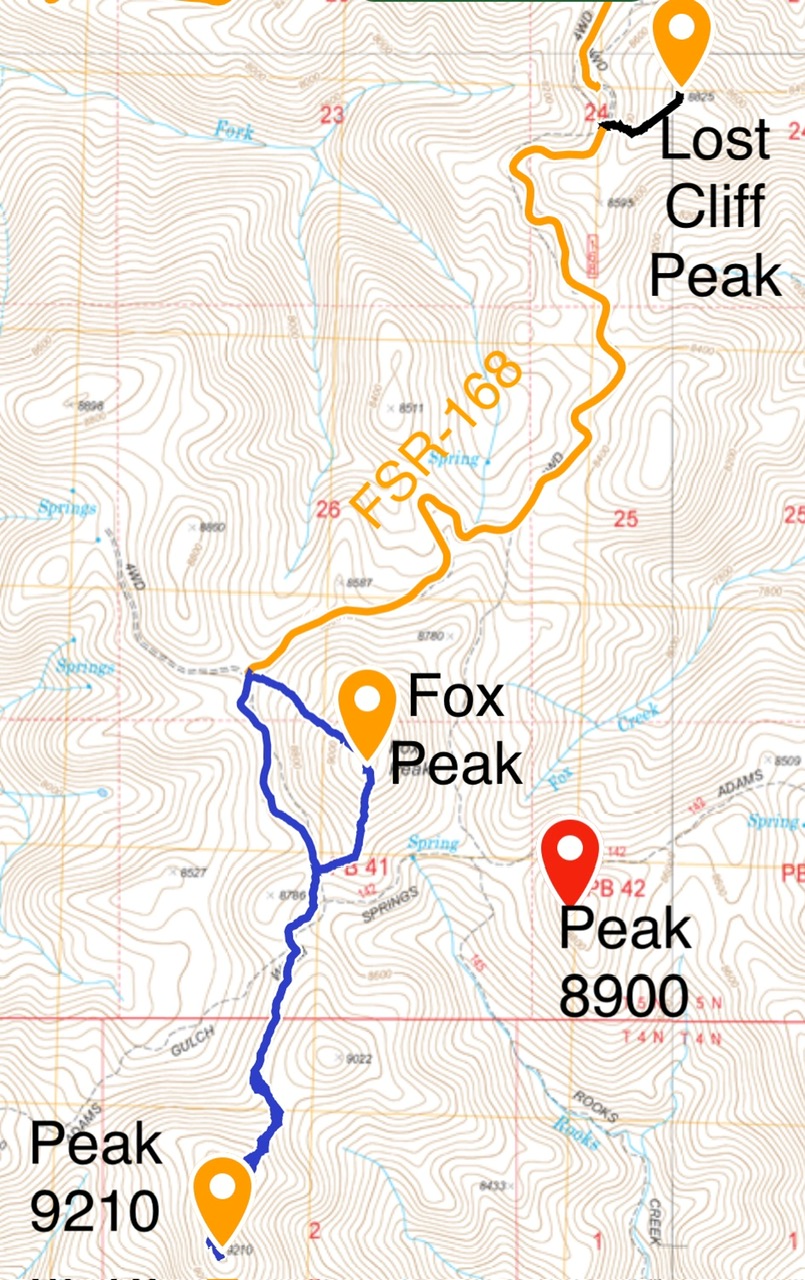
My GPS tracks for Fox Peak and Peak 9210.
North Ridge, Class 2
From the trailhead, hike FST-143 south along the base of Fox Peak to its junction with FST-142. Continue southwest on FST-142 until the trail reaches a point below the saddle between Peak 9210 and Point 9022. [Note that the trail is located higher than shown on the USGS and Forest Service maps. Instead of losing elevation south of the FST-143/142 junction, the trail maintains nearly the same elevation. Additionally, the trail numbers on the signs do not match the numbers on the map.] Climb to the saddle and then head up the peak’s broad north ridge, dodging the occasional deadfall.
Additional Resources
Regions: Smoky Mountains->WESTERN IDAHO
Mountain Range: Smoky Mountains
Year Climbed: 2023
Longitude: -114.5217 Latitude: 43.7081