Elevation: 9,285 ft
Prominence: 545
This peak is not in the book. Published November 2020
Peak 9285 is a ridgeline summit that is overshadowed by its bigger, taller neighbor to the northwest—Big Elk Mountain (9,476 feet). Some might even consider Peak 9285 to be a hump on the long southeast ridge of Big Elk Mountain. Peak 9285 sits at the head of Chicken Ridge and is most easily accessed via West Fork Road/FSR-863 (a rugged jeep/ATV road) and its northwest ridge. USGS Big Elk Mountain
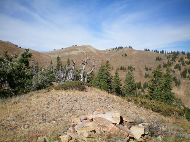
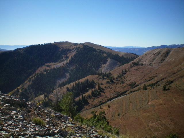
Peak 9285 as viewed from Point 9000+ on the east ridge. The summit is just left of center. The northeast ridge is the right skyline. Livingston Douglas Photo
Access
From the junction of US-26 and ID-31 in Swan Valley, drive about 10 miles southeast on US-26 to a [signed] turnoff for “Little Lemhi/Riverside Park” just north of Palisades Reservoir Dam. Turn right/south off US-26 and reset your odometer. Follow the paved road south briefly then right/west as it skirts the Riverside Park Campground and crosses the Snake River on a good bridge. Please note that the USGS topo map does NOT show this road or bridge crossing but the Caribou-Targhee National Forest Map does show it. Be advised that the Palisades Dam Road is closed and has been closed for years. Both the USGS topo map and the National Forest map make the dam road look open but it’s not.
At 2.1 miles, turn left onto [signed] Bear Creek Road. At 4.7 miles reach a [signed] “T” junction. Go right on FSR-058/Bear Creek Road. At 10.3 miles, reach the [signed] right turnoff for the Bear Creek trailhead. Continue straight on FSR-058. Cross a bridge over Bear Creek and reach a [signed] junction with West Fork Road/FSR-863 at 12.1 miles. Park at this junction (6,000 feet) or drive up rocky, rugged FSR-863 to shorten the mileage for this climb.
Northeast Ridge, Class 2
The Climb
Hike (or drive/ride) up FSR-863 for about 3.5 miles to a sharp right/west turn at 7,600 feet. This hairpin turn shows up well on the USGS topo map. This road turn is directly on the northeast ridge of Peak 9285. From here, you have two options. You can immediately bushwhack southwest up the steep, forested ridge OR you can go up FSR-863 for another 1/8 mile to a dry gully and bushwhack up brush and sage in open terrain to later move up onto the northeast ridge. I did the former route on the ascent and the latter route on the descent. I prefer the latter route because the forest bushwhack is steeper and more difficult. The good news is that the summit of Peak 9285 is just over a mile away so distance is not the issue here.
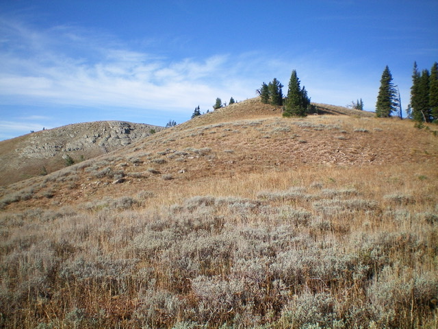
From the sharp turn in the road, bushwhack steeply up through the thick, brushy pine forest to reach open terrain after perhaps 350 vertical feet of bashing through the forest. The ridge becomes quite rounded now and appears to be more of a face climb. The terrain is now sagebrush and scrub with loose gravel/scree underneath. It is a GRIND. Higher up, the slope becomes very steep but it still is manageable. Reach an obvious ridgeline at 8,850 feet and follow the [now] well-defined ridge south then southwest on much easier terrain (tundra and broken rock). You soon reach a gentle hump that is a false summit (9240+).
The true summit of Peak 9285 is to the south, across a dry gully. Stay on the easy ridge crest and avoid the gully. Head west then southeast on the ridge crest to reach the summit. You must drop slightly to a minor saddle at the head of the gully. Contrary to what the USGS topo map indicates, the false summit is only five feet lower than the true summit. They certainly appear to be very close in elevation. The summit of Peak 9285 had a small cairn so I built it up.
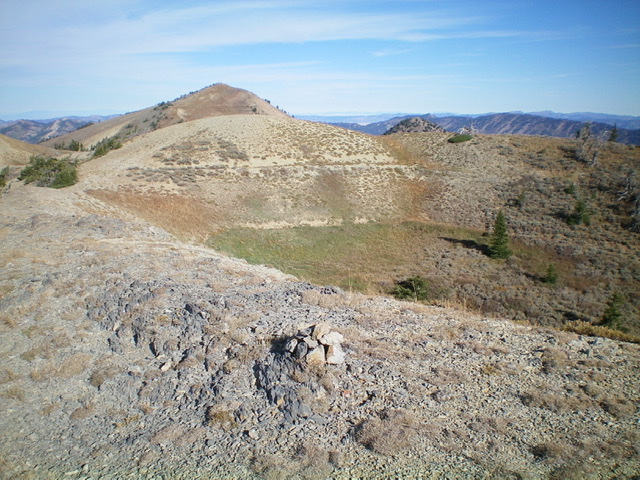
The final push to the top of the northeast ridge of Peak 9285. The summit is the hump on the left. Livingston Douglas Photo
The small summit cairn atop Peak 9285 with Big Elk Mountain in the distance (the large hump left of center). Livingston Douglas Photo
East Ridge, Class 2
The Descent
From the summit, follow the ridge crest southeast to a ridge corner (Point 9195) on easy, open terrain. From Point 9195, descend east on the ridge to a minor saddle then scramble up over semi-forested Point 9000+. From there, drop steeply northeast on the ridge crest on loose scree/gravel and brush/sagebrush to reach a final saddle. This saddle is the low point between Peak 9285 and the high point of Chicken Ridge. It concludes the first leg of today’s two-peak journey. Chicken Ridge is up next.
Looking down the east ridge of Peak 9285. Livingston Douglas Photo
Peak 9285 (center and left of center) as viewed from Peak 9142 to the northwest. Livingston Douglas Photo
Additional Resources
Regions: Caribou Range->SOUTHERN IDAHO
Mountain Range: Caribou Range
Longitude: -111.25819 Latitude: 43.21839