Elevation: 9,292 ft
Prominence: 512
This peak is not in the book. Updated October 2025
Peak 9292 is a rocky peak that sits west of Peak 9380 and north of Peak 9268 in the western section of the White Knob Mountains. It is most easily climbed in combination with nearby Peak 9380. USGS Harry Canyon
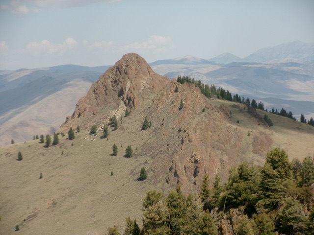
Peak 9292 as viewed from Peak 9268 to its south. Livingston Douglas Photo
Access
Same as for Peak 9380. This is the second leg of a 3-peak adventure that includes Peak 9380, Peak 9292, and Peak 9268. It covers 9.5 miles with 3,750 feet of elevation gain round trip.
East Face/Northeast Ridge, Class 3
The Climb
This climb is mostly Class 2 but has some Class 2+ boulder hopping as well as a final Class 3 chute to reach the summit. From the 8,780-foot connecting saddle with Peak 9380, cross the grass and short scrub of the saddle then head west up the east face. The east face is a mix of sagebrush, pines, downed trees, and increasing amounts of talus and boulders.
Move right-ish/northwest as you advance. The steep, cliff faces on the east face force you in that direction. Make a final push up scrub and talus to reach a boulder slope. Scramble right/north up this boulder patch to reach a ridge crest. This crest is the northeast ridge. Scramble southwest up this short ridge section in boulders and talus. Climb a final Class 3 chute to reach the small summit of Peak 9292. This summit has a large cairn.
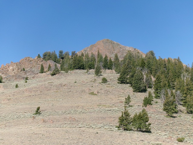
Looking up the east face of Peak 9292 from its connecting saddle with Peak 9380. This was the first leg of my ascent route. Livingston Douglas Photo
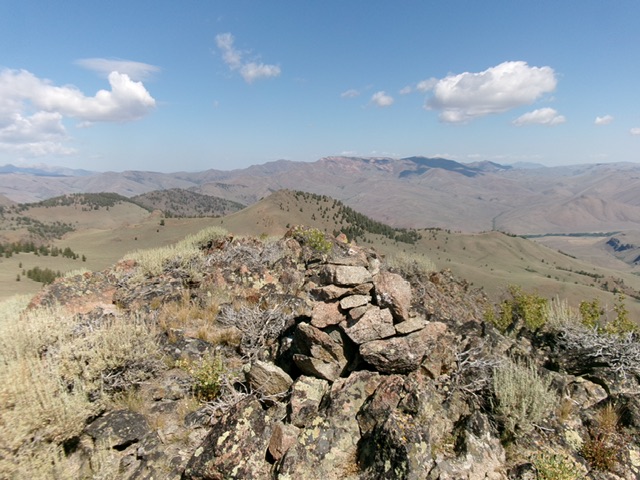
The large summit cairn atop Peak 9292. Livingston Douglas Photo
Traverse to the North Ridge of Peak 9268, Class 2
From the summit, return down the northeast ridge then east face to the wide area of the 8,780-foot connecting saddle with Peak 9380. Head south then southeast across open scrub and a gully to intercept the ridge that heads south to the north ridge of Peak 9268. Once on the ridge, follow it south (with the help of cattle trails) to reach the 8,740-foot connecting saddle. The ridge terrain is a mix of short scrub, scree/gravel, and rocky outcrops. The ridge has a few ups and downs on its way south to the connecting saddle. The 8,740-foot connecting saddle sits at the base of the forested north ridge of Peak 9268. This concludes the second leg of today’s 3-peak journey. Peak 9268 is up next.
Additional Resources
Regions: EASTERN IDAHO->White Knob Mountains
Mountain Range: White Knob Mountains
Longitude: -114.03229 Latitude: 43.93229