Elevation: 9,579 ft
Prominence: 319
This peak is not in the book. Published November 2020
Peak 9579 is one of four summits on a long ridgeline extending north from Antelope Pass: Peak 9579, Lupine Mountain (9,554 feet), Peak 9699, and Peak 9781. This climb is part of a four-peak adventure that covers 10.0 miles with 3,150 feet of elevation gain round trip. Do not attempt this ridge traverse on a windy day. USGS Copper Basin Knob
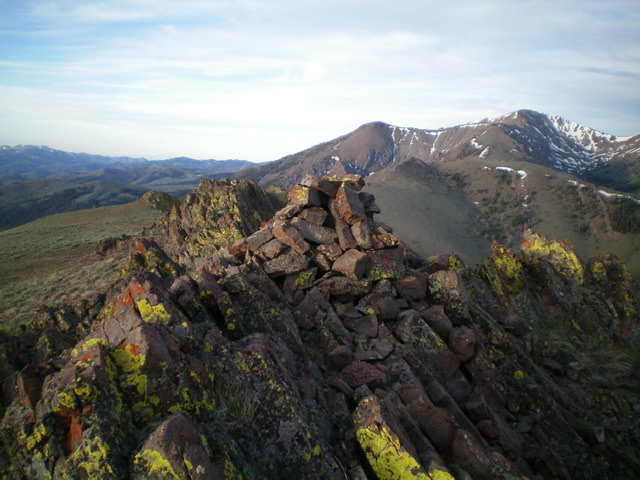
Peak 9579 (right of center in mid-ground) as viewed from the summit of Lupine Mountain to the north. Livingston Douglas Photo
Access
From the Copper Basin Guard Station along Copper Basin Road, drive southeast on narrow, rocky FSR-135 as it climbs for 4.9 miles to reach Antelope Pass (8,934 feet). Park in a pullout area on the pass. Antelope Pass is at the base of the south ridge of Peak 9579.
South Ridge, Class 3
The Climb
From Antelope Pass, hike north-northeast up an old 2-track road that follows the ridge crest. Regrettably, it soon ends and your work begins. At the road’s end, follow a game/use trail diagonally up and right/east to skirt the right/east side of a large ridge buttress. If you climb the buttress from its east side (as I did), you will find Ante Benchmark in a large ground boulder. Once past the buttress, move back onto the ridge crest and scramble north up the rocky ridge, skirting the right/east side of some rocky outcrops, to reach the final ridge crest rocky outcrop that is the high point of Peak 9579. There is a modest cairn on top. If you stay on the ridge crest and climb the ridge outcrops, the south ridge goes at Class 3. If you skirt the ridge outcrops, you can keep the climb at Class 2.
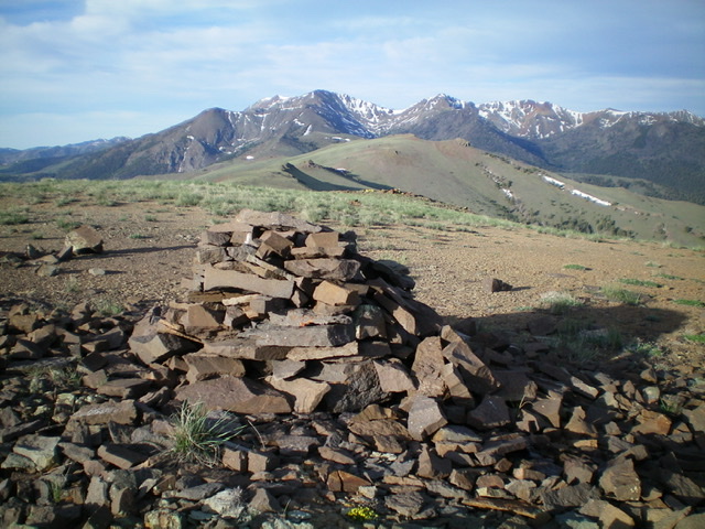
The summit cairn atop Peak 9579. Livingston Douglas Photo
Northeast Ridge, Class 3
The Descent
Follow the rocky ridge crest in a tedious endeavor to reach the connecting saddle with Lupine Mountain. There are numerous ridge outcrops that must either be climbed over (Class 3) or skirted by side-hilling on loose scree on the right/east side of the ridge crest (Class 2). There are several ups and downs on this ridge traverse as well. Not a whole lot of fun and a bit time-consuming. The descent to the 9,260-foot connecting saddle with Lupine Mountain is about a mile in length. This concludes the first leg of today’s four-peak adventure. Lupine Mountain is up next.
Additional Resources
Regions: EASTERN IDAHO->White Knob Mountains
Mountain Range: White Knob Mountains
Longitude: -113.76309 Latitude: 43.78219