Elevation: 9,634 ft
Prominence: 374
This peak is not in the book. Published December 2019
Peak 9634 is the high point on a narrow ridge that begins at Mud Spring and follows the west side of Cedar Run Canyon. The southwest ridge is an enjoyable scramble and is the easiest ascent route. The summit area is narrow and rocky. It is the only difficult part of the ascent. Peak 9634 is a ranked summit but is rarely visited. It can be combined with Peak 10681 and Foss Mountain for a three-peak day from the meadow at the end of Mud Spring Road. USGS Bell Mountain

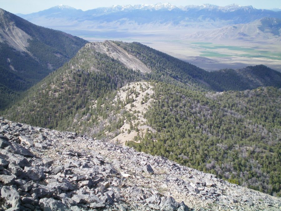
Peak 9634 (the rocky ridge line hump left of center) as viewed from the west ridge of Peak 10681. Livingston Douglas Photo
Southwest Ridge, Class 3
Access
The access road for Mud Spring/Cedar Run Creek is located on the Little Lost River Highway, exactly 0.3 miles north of the [signed] Pass Creek Road junction in Clyde and 28.0 miles north of Howe. Turn right/east onto the [unsigned] access road and reset your odometer. At 0.3 miles, turn right/south after crossing the Little Lost River on a bridge. Cross a cattle guard. At 1.0 miles, turn left/northeast at an unsigned road junction. This is Mud Spring Road. At 1.2 miles, go left at an unsigned junction. At 4.1 miles, reach the end of Mud Spring Road in a meadow/cow pasture. Park here (6,900 feet).
The Climb
From the meadow at the mouth of Cedar Run Canyon, hike up an old 2-track jeep road on the left/north side of Cedar Run Creek. Soon after entering the forest, the road becomes a cattle trail but a good one. After about ½ mile of road/trail hiking, reach the base of the southwest ridge of Peak 9634 in a small meadow where Mud Spring is located.
Leave the canyon here and climb northeast up the ridge crest. The ridge follows Cedar Run Canyon and is well-defined. There are no navigational challenges here. The terrain on the ridge is easy scrub initially, then a pine forest with some blowdown. Shale scree joins the mix higher up, but the ridge is still an easy climb. Near the summit, the ridge narrows and becomes a series of ridge points/pinnacles. If you climb over them, it is Class 3 work. The side-hilling here is probably just as difficult.
The summit area is an open, rocky ridge crest that is somewhat lengthy. The high point is at the north end of this mess of rocky outcrops and humps. There are four rocky ridge points to climb (or circumvent) before reaching the true summit (ridge point #5). There were remnants of a small cairn so I built a new cairn atop this final point. The summit offers a magnificent view of Cedar Run Canyon as well as the connecting ridge to Peak 10681 to the north.
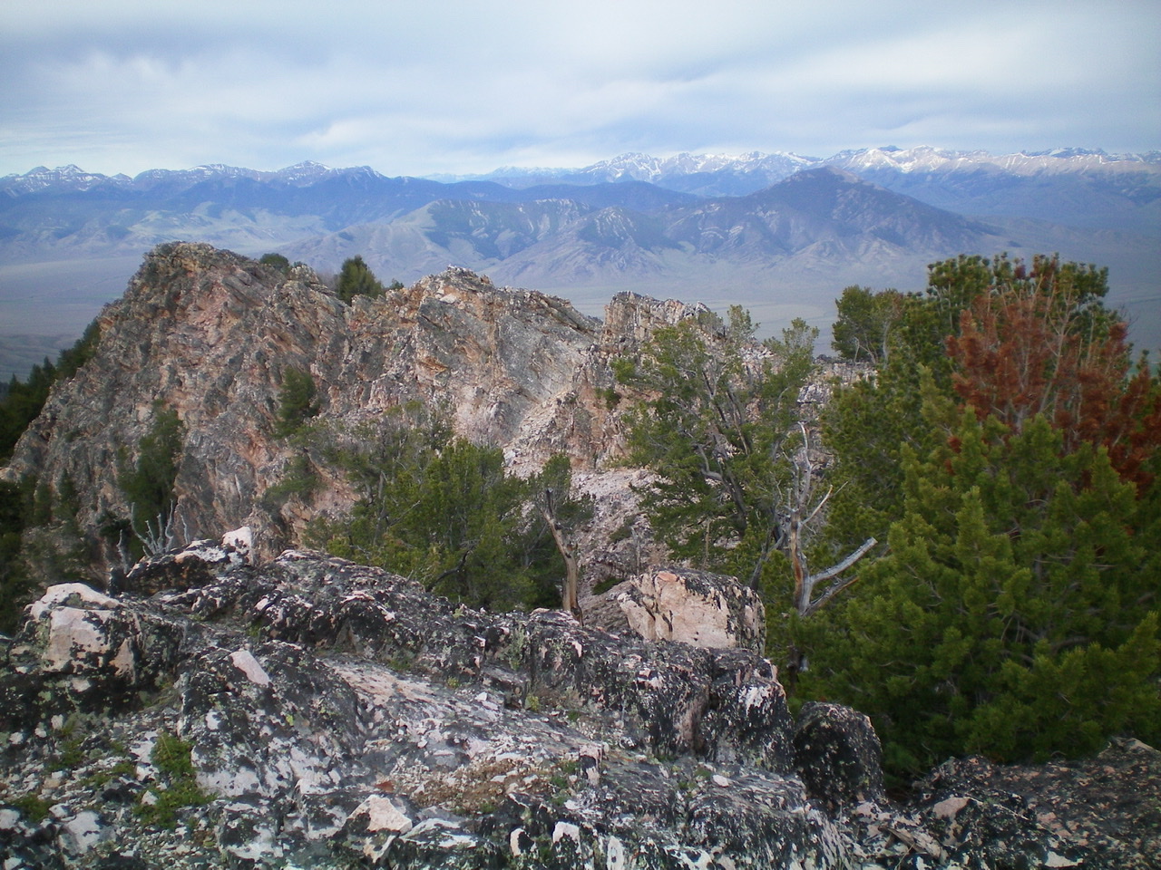
The rugged Class 3 ridge points on the southwest ridge as viewed from the true summit. Livingston Douglas Photo
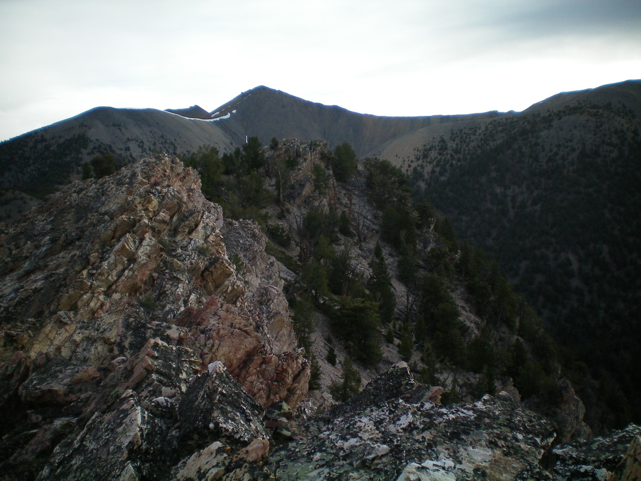
The upper southwest ridge of Peak 9634 as viewed from the summit. Livingston Douglas Photo
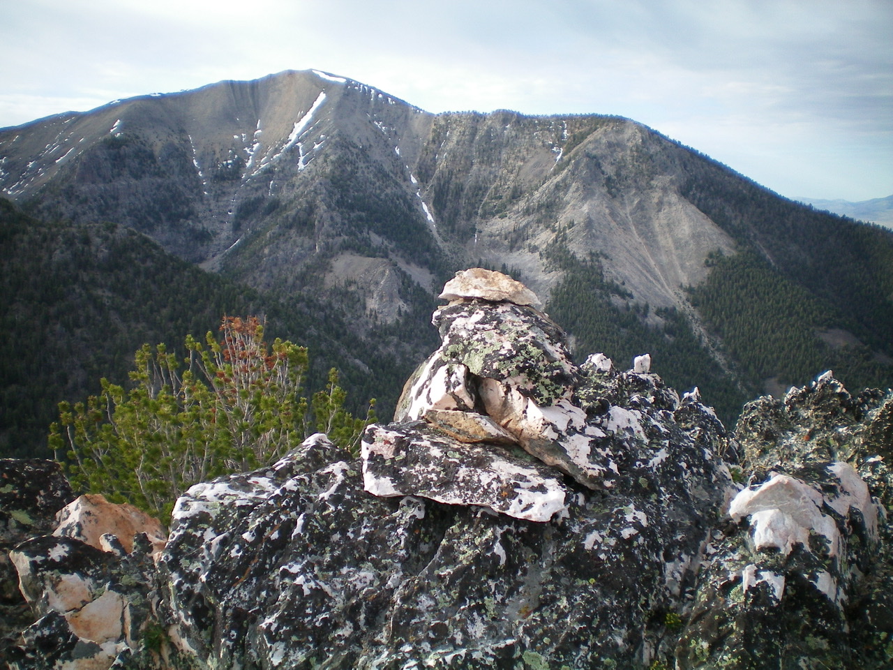
The summit cairn atop the highest rocky outcrop atop Peak 9634. Peak 10954 is in the background. Livingston Douglas Photo
North Ridge, Class 2
Access
Same as for the southwest ridge. This route is the first leg of a ridge traverse from Peak 9634 to Peak 10681.
The Descent
From the summit, follow the forested ridge north then northeast then north to reach a small saddle below Point 9523. This ridge saddle (9,260 feet) is the low point between Peak 9634 and Peak 10681. Skirt the left/west side of a few minor ridge humps on the way to the saddle. This is mostly a forest descent and is not overly rocky.
Additional Resources
Regions: EASTERN IDAHO->Lemhi Range
Mountain Range: Lemhi Range
Longitude: -113.16379 Latitude: 44.18379