Elevation: 9,642 ft
Prominence: 302
This peak is not in the book. Published November 2022
Peak 9642 is the high point on a ridge that separates Wilson Creek from Long Gulch in the Pioneer Mountains. It is located southwest of Devils Bedstead West. It is most easily climbed from the Long Gulch Trail/FST-123. USGS Phi Kappa Mountain
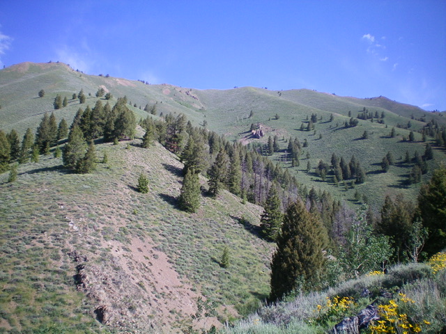
Peak 9642 and its magnificent, long southwest ridge (skyline) as viewed from the Long Gulch Trail to its southeast. The summit is right of center on the high ridge. Livingston Douglas Photo
Access
From the junction of Sun Valley Road and Dollar Road in Sun Valley, drive northeast on Sun Valley Road (which becomes Trail Creek Road) for 3.8 miles to an unsigned junction with Corral Creek Road/FSR-137. Turn right/east onto Corral Creek Road and drive 3.7 miles to its end at a large trailhead parking lot. There are two trailheads here: Pioneer Cabin Trail/FST-122 and Long Gulch Trail/FST-123. This is a popular trailhead and has parking for 15-20 vehicles. The trailhead elevation is 6,970 feet.
Southeast Rib/Southwest Ridge, Class 2
The Climb
From trailhead parking area, hike up the Long Gulch Trail/FST-123 for about 1.5 miles to a forested area. Leave the trail and bushwhack diagonally left/north (then straight down) through a pine forest to cross a dry gulch, dropping 100 vertical feet in so doing. Cross the gulch and climb a minor ridge to escape the dense vegetation and blowdown in the gulch. From the ridge, angle diagonally up and right to cross a dry gully and reach the southeast rib. Climb the steep southeast rib north-northwest through easy veg and scattered pines to reach tree line.
Once above tree line, the rib bends northwest to reach the summit ridge (i.e., southwest ridge) of Peak 9642 at a prominent, rocky ridge point that is just northeast of Point 9495. While it is possible to contour diagonally right/northeast to skirt the ridge point and head directly to a ridge saddle, that would be a tedious endeavor of side-hilling on loose scree/gravel. From the rocky ridge point, descend 100 feet through rock and ridge pines to reach 9,340-foot saddle.
This is the final ridge saddle before reaching the summit of Peak 9642. If you reach the southwest ridge at a lower point, you may have a lot of ridge points and ups and downs to contend with on your way to this saddle. From the 9,340-foot saddle, scramble northeast up the narrow ridge crest over a final ridge point and on to the summit of Peak 9642. The summit is a ridge crest hump and had no summit cairn, so I built one on the high point.
In retrospect, it is better to leave the Long Gulch Trail before reaching the forested area in order to have an easier, open drop to the gulch. There are multiple good ribs to climb to reach the southwest ridge and the entry point onto the southwest ridge should not present too many issues except for one or two ridge points to climb over or otherwise skirt.
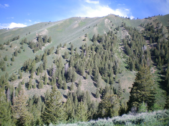
Looking up the south shoulder (my ascent route) from near its base. The ridge point at the top of the shoulder is just right of center. The summit is to the right and is not in view. Livingston Douglas Photo
East Ridge/South Rib, Class 2
The Descent
From the summit, follow the ridge east to a ridge corner at the head of the magnificent, steep, open south rib. Descend southeast then south on this ridge of scrub and loose shale scree/gravel to reach a forested section lower down. Bushwhack down through the easy forest to a dry, rocky gulch. Cross the gulch and angle diagonally up and left/south to reach the ridge crest and the Long Gulch Trail. The bushwhack up to the ridge crest is scrub/grass with some scattered pines. Once on the trail, follow it southwest for about 2.5 miles to the trailhead.
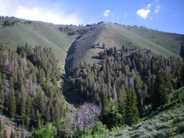
Looking up the south rib (my descent route) from near its base. The summit of Peak 9642 is left of center. Livingston Douglas Photo
Additional Resources
Regions: EASTERN IDAHO->Pioneer Mountains
Mountain Range: Pioneer Mountains
Longitude: -114.21931 Latitude: 43.76949