Elevation: 9,737 ft
Prominence: 567
This peak is not in the book. Published November 2020
Peak 9737 is one of two peaks that sit on the Continental Divide above Slag-a-Melt Lakes (MT). This two-peak journey includes Peak 9737 (a gentle summit) and Peak 9641 (a rocky, blocky summit with fierce exposure). The adventure begins at the Slag-a-Melt Lakes trailhead. USGS Homer Youngs Peak
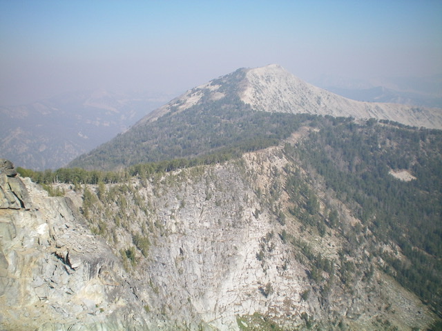
Peak 9737 as viewed from the south. Livingston Douglas Photo
Access
From Wisdom, MT, drive south on MT-278 for 6.6 miles to a [signed] right/west turn for “Twin Lakes Campground.” Reset your odometer here. At 4.1 miles, bear left/south at a signed junction. At 8.1 miles, turn left/south at a signed junction. At 12.9 miles, go straight at a signed junction. At 13.0 miles, reach the NF boundary. The road is now FSR-945. At 16.6 miles, reach a “T” junction. Go right/west onto FSR-625/Big Swamp Creek Road. Reset your odometer here.
At 2.3 miles, reach a signed road junction. Go right onto FSR-3944/Slag-a-Melt Road. At 3.6 miles, reach a signed road junction. Go left onto FSR-3967 and drive 0.1 mile to a pullout/campsite on the left side of the road at the base of a rocky, steep section of the road. Park here (7,395 feet). If road conditions and your vehicle permit, drive another two miles to the Slag-a-Melt Lakes trailhead. Otherwise, hike up the road as I did.
Southeast Ridge, Class 2
The Climb
From the [well-signed] Slag-a-Melt Lakes trailhead (7,610 feet),hike about two miles up FST-3186 (an ATV trail) to reach a trail junction. Go straight on the CDT/FST-009. Follow the CDT up to upper Slag-a-Melt Lake, where the trail makes a sharp right/north turn. The CDT soon bends left/west then bends right/north. Leave the CDT soon after this north turn to bushwhack through a dry meadow to the left/west. Your objective is to reach the Continental Divide to the west-northwest of this meadow.
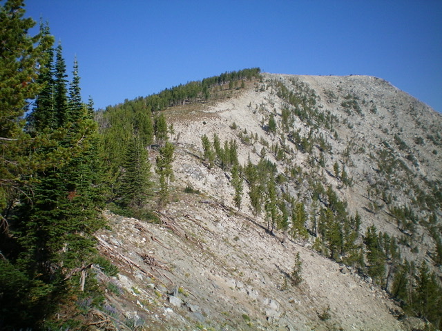
Once across the meadow, bushwhack northwest then west through a pine forest then follow a diagonal game trail leftward to get up onto the crest of the Continental Divide. You must thread this needle correctly because there are cliff faces all along the east side of the Continental Divide in the Slag-a-Melt Lakes area (see USGS topo map). Once on the ridge crest, follow the ridge north then briefly west then northwest in semi-open forest (easy) to approach the summit of Peak 9737.
A final rocky push north gets you on top. The summit high point area is small and is located at the north end of the summit ridge area. There is a small cairn (of sorts) in a collection of summit boulders. Return down the southeast ridge all the way to the 9,300-foot connecting saddle with Peak 9641. This concludes the first leg of today’s two-peak journey. Rugged Peak 9641 is up next.
Peak 9737 and its curving southeast ridge. The summit is at far right. Livingston Douglas Photo
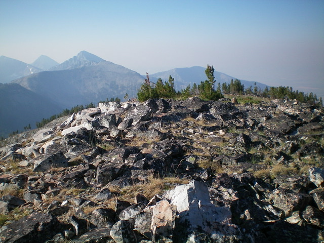
The open, rocky summit area of Peak 9737, looking south. Livingston Douglas Photo
Additional Resources
Regions: Beaverhead Range->EASTERN IDAHO
Mountain Range: Beaverhead Range
Longitude: -113.73859 Latitude: 45.36889