Elevation: 9,846 ft
Prominence: 466
This peak is not in the book. Published November 2022
Peak 9846 is the high point on a ridgeline that parallels Murdoch Creek for a few miles. It is most easily climbed from the Murdoch Creek Trail and can be combined with a ridge traverse from Peak 9620 to its southwest. The 2-mile ridge traverse between Peak 9620 and Peak 9846 is a worthwhile endeavor and covers two ranked summits in the Boulder Mountains. USGS Rock Roll Canyon
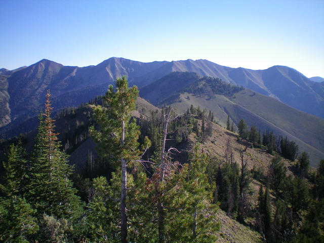
Peak 9846 is high point on the semi-forested ridge in mid-ground (dead center) as viewed from Peak 9620 to its southwest. Livingston Douglas Photo
Access
Same as for Peak 9620. This is the second leg of a 2-peak adventure that includes Peak 9620 and Peak 9846.
Map Errors
The 2nd footbridge crossing of Murdoch Creek is much earlier than the USGS topo map indicates. It is at the ¾-mile point at about 6,600 feet. Contrary to what the USGS topo map shows, Murdoch Creek Trail ends at about 7,200 feet where it fords Murdoch Creek, crossing to the right/east side of the creek.
Southwest Ridge, Class 2
The Climb
From the 9,260-foot connecting saddle with Peak 9620, follow the ridge northeast to Point 9719 then drop to a minor saddle. Continue northeast then north to the semi-open summit of Peak 9846. The ridge terrain is mostly scrub/sagebrush with nearby ridge pines. There are some good elk trails on the ridge to speed up the ridge traverse. The ridge has some narrow, rocky sections with some rocky outcrops, but nothing too serious. The summit of Peak 9846 is semi-open. It is a ridgeline summit with a modest cairn. The 2-mile ridge traverse from Peak 9620 takes about an hour.
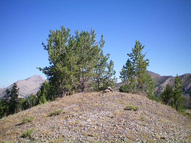
The summit of Peak 9846. Livingston Douglas Photo
West Face/West Gully, Class 2
The Descent
From the summit, descend due west down a shoulder which is initially forested and then becomes open terrain. Unfortunately, the shoulder becomes a face which leads steeply west down into a gully through a thick pine forest. Stay in the pine forest and avoid the larger gully ahead by staying right/north of it. Find an excellent side gully (to the right/north) that leads steeply down in open terrain (no blowdown) to join the larger/main gully. Follow the main gully west toward Murdoch Creek, which is now visible. Find a game trail in the gully. Cruise down it as it becomes a good use trail. Regrettably, the trail eventually disappears and an aspen forest takes over the middle of the gully.
Stay right/north of the aspens and move onto an angled pine forest face. Farther down, descend back into the gully and follow it to a final drop to Murdoch Creek. As you approach the creek, move right/north into a pine forest and descend steeply through it then through a section of open scrub to reach Murdoch Creek in a flat, wide, braided area. Walk across the shallow braids of the creek to reach the [obvious] footpath on the far side of the creek that is the top end of the Murdoch Creek Trail. Follow the overgrown, narrow, up-and-down trail back to the two footbridges and the well-beaten, excellent final ¾ mile of the trail to reach the trailhead.
Additional Resources
Regions: Boulder Mountains->EASTERN IDAHO
Mountain Range: Boulder Mountains
Longitude: -114.35939 Latitude: 43.82929