Elevation: 9,863 ft
Prominence: 700
This peak is not in the book. Published November 2020
Peak 9865 is an overlooked hump that is located west of the White Knob Crest. It is connected to Cabin Mountain by a 9,163-foot saddle. One might contend that Peak 9865 is really just a bump (albeit a significant one) on the west ridge of Cabin Mountain. It is a fun scramble from Corral Creek and the Burma Road. USGS Copper Basin Knob
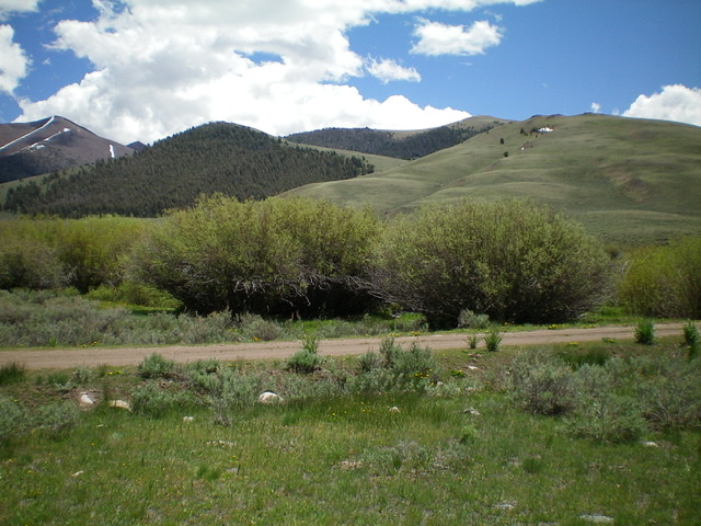
Peak 9863 as viewed from Burma Road at Corral Creek. The summit is the highest hump just right of center. The north ridge route comes up from just left of the photo and climbs over the forested hump (just left of center) and continues rightward to the summit. Livingston Douglas Photo
Access
Burma Road/FSR-142 is located along Copper Basin Road/FSR-135 exactly 3.9 miles southeast of the junction of FSR-135 and FSR-138/Copper Basin Loop Road. Drive 3.8 miles on Burma Road to FSR-519 at Corral Creek. Park here (7,920 feet). FSR-519 heads right/east up the right/south side of Corral Creek but only goes for 0.1 mile then turns into [rugged] FST-4070, an old 2-track that is only suitable for foot or horse travel and is blocked to vehicular traffic by a split-rail barrier.
North Ridge, Class 2
The Climb
Hike up FSR-519 then FST-4070 for about 0.8 miles to reach a sagebrush shoulder that is right/south of a prominent gully. Leave the old 2-track here and bushwhack east-southeast up through the sagebrush to reach the base of the north ridge. Stay just left/north of the forest line for the easiest going. Climb south up the ridge in open scrub then bushwhack through a brief forested section (with elk trails to assist you) to reach open terrain at about 9,300 feet. You will find an old 2-track jeep road here. Follow it in open terrain on the ridge crest all the way up to a ridge corner (9,800+). From that corner, scramble southwest then west to the open, rocky summit of Peak 9863. The summit had a small cairn which I rebuilt.
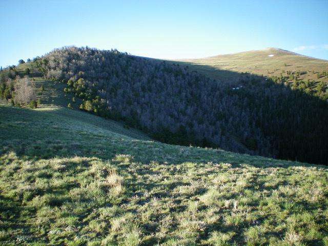
Looking up the north ridge of Peak 9863 from the 9,300-foot level. The summit is the open hump well right of center. Livingston Douglas Photo
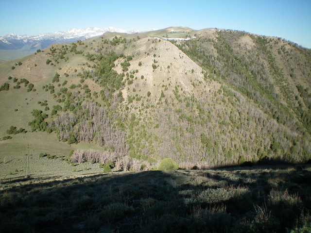
Looking back at Peak 9863 from the southwest ridge of North Cabin Mountain. The connecting saddle is on the far left of the photo. Livingston Douglas Photo
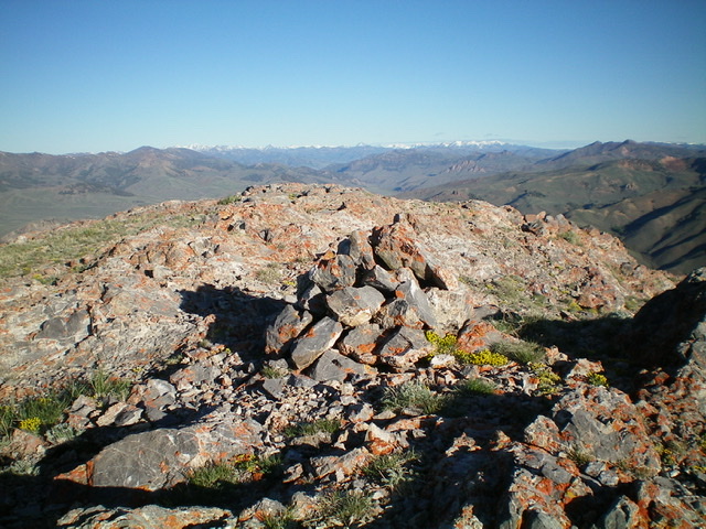
The summit of Peak 9863, looking northwest on an early June morning. Livingston Douglas Photo
East Ridge, Class 2
The Descent
From the summit, return east then northeast to the ridge corner (9,800+). From the corner, descend southeast then east on easy open scrub and broken rock to a saddle at 9,163 feet. The final section of the descent to the saddle is steep, with thicker/taller sagebrush to bash through. This concludes the first leg of today’s two-peak journey. North Cabin Mountain is up next and sits directly northeast above the saddle.
Additional Resources
Regions: EASTERN IDAHO->White Knob Mountains
Mountain Range: White Knob Mountains
Longitude: -113.84919 Latitude: 43.84919